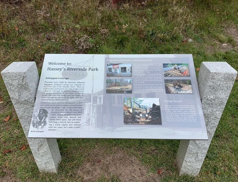
On Harrington Road (U.S. 1) south of Whitney Road, on the left when traveling north.
Schoppee's Garage Founded circa 1928 by Harrison (Hassey) Schoppee, Schoppee's Garage was originally on the south side of the Chandler River. When he learned that construction of a new bridge would realign Rt. 1 through his business, Hassey . . . — — Map (db m183739) HM
On Main Street (Maine Route 189) south of South Street, on the left when traveling north.
The Columbian Packing Company
Founded in 1891, the Columbian Packing Company
became one of the largest herring canneries in the
world. The cannery employed hundreds of workers
and shipped tons of canned herring to U.S. troops in both World . . . — — Map (db m258241) HM
On Main Street east of Oak Street, on the right when traveling east.
A rail line to Ellsworth was completed in 1884 for the Shore Line Railroad passenger trains. Soon, the line was extended to McNeil Point in Hancock, where train passengers boarded a ferry for the short trip to Bar Harbor. The rail line was later . . . — — Map (db m260024) HM
On Maine Route 190 0.1 miles east of Kendall’s Head Road, on the right when traveling east.
Cobscook Bay is one of Maine’s special places. Its huge tides (averaging 28 feet but sometimes surging to 30 feet) its cold nutrient rich waters, convoluted and largely undeveloped shoreline, vast intertidal areas provide habitat for a wide array . . . — — Map (db m183678) HM
[English version]
Built in 1885, the Mulholland Point Lighthouse guided many small coasters and freighters taking the shorter and foul weather-protected route through the narrow passage between Campobello and Lubec. Steamships, carrying freight . . . — — Map (db m54894) HM
Built in 1885, the Mulholland Point Lighthouse (photo 1) served as a guide for the many small coasters and freighters taking the shorter and more foul weather-protected route through the Lubec Narrows. Steamships, such as the . . . — — Map (db m63593) HM
[right side:]
Mowry Beach Preserve offers 48-acres of convenient public access to one of the easternmost sandy
beaches in the country. Situated along the edge of the village of Lubec, this property protects 1,800 feet of shoreline along a . . . — — Map (db m258278) HM
Maryland's Appalachian Region Offers Visitors Natural Splendor And Outdoor Adventure, Plus Countless Opportunities To Explore The Region's Rich Heritage—all Just A Few Miles Off Interstate 70.
Maryland Byways, like the Historic National . . . — — Map (db m196240) HM
Near Dwight D. Eisenhower Highway (Interstate 70) south of Baltimore National Pike (U.S. 40), on the right when traveling east.
Maryland's Appalachian Region Offers Visitors Natural Splendor And Outdoor Adventure, Plus Countless Opportunities To Explore The Region's Rich Heritage—all Just A Few Miles Off Interstate 70.
Maryland Byways, like the Historic National . . . — — Map (db m116525) HM
On West Memorial Boulevard 0.1 miles west of South Potomac Street (Maryland Route 65), on the right when traveling east.
1896
The Hagerstown Railway trolley system begins operation. Service is expanded in 1904 to Frederick and into Pennsylvania, becoming the first inter-urban rural rail system in the country. The last car runs in 1947.
1898
America . . . — — Map (db m145993) HM
On North Water Street at School Street, on the right when traveling north on North Water Street.
The last operating commercial herring smokehouse in the USA
Beginning in the 1890s and until 1991, herring were smoked here in smokehouses on the Lubec Narrows using a traditional process with European roots.
During the peak of the . . . — — Map (db m258183) HM
On New York State Route 67 0.1 miles west of River Road, on the right when traveling west.
Located in the northeast corner of the town of Hoosick, the Hoosic River divides the towns of Hoosick and White Creek at the hamlet of Eagle Bridge. In the early 1800s the area was called Kingsmills because of a large grain mill run by John King. . . . — — Map (db m290171) HM
On Pine Street West at Third Street South (County Highway 23), on the left when traveling west on Pine Street West.
Dedicated to the
Soldiers and Sailors of the
United States
Enlisting or Residing in
Washington County
———
Erected by the Citizens of
Washington County
1916
center panel
Minnesota
Alcorn James 2nd Cav. •
Barrisford . . . — — Map (db m72153) WM
Thin black lines indicate changes in relevance. Between each pair of lines entries are ordered geographically but all have the same relevance.
* Inflectional forms of words are their plurals, singulars, and possessives as well as gramatical tenses and similar variations.