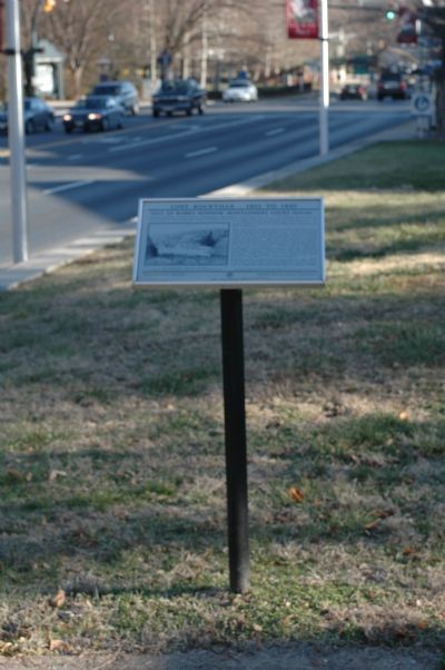
On West Jefferson Street (Maryland Route 28) east of South Washington Street, on the right when traveling east.
Architect Benjamin Latrobe came to “Montgomery Court House” in 1811 hoping that the fresh air would help his ailing young son recover his health. He stayed at Adam Robb’s tavern that may have been located on Lot 4 on Jefferson Street . . . — — Map (db m92) HM
On Vinson Street at Maryland Avenue, on the right when traveling west on Vinson Street. Reported permanently removed.
Rockville began when Owen's Ordinary, an inn and tavern, was established in this area around 1750. It functioned as the seat of lower Frederick County and in 1776 became the seat of Montgomery County when it was created. In 1784, William P. Williams . . . — — Map (db m117874) HM
On North Adam Street near West Montgomery Avenue, on the right when traveling south. Reported missing.
The Beall-Dawson property originally extended from Montgomery Avenue west to Forest Avenue and north to Martins Lane. The house was built in 1815 by Upton Beall, Clerk of the Montgomery County Court. It is a 2 1/2 story brick Federal-style home . . . — — Map (db m137624) HM
On South Washington Street near Vinson Street, on the right when traveling south. Reported permanently removed.
The first Episcopal church in or near Rockville was built in 1739 on a two-acre parcel of land, part of which is now the Rockville Cemetery. It was constructed of clapboards and logs and was called both the "Chapel of Ease" and Rock Creek Chapel. . . . — — Map (db m91) HM
On Washington Street north of E. Montgomery Avenue (Courthouse Square), on the right when traveling north. Reported permanently removed.
Rockville grew from a convenient crossroads meeting place in the 1750s to become the legal and market center of the county. The tiny village was selected as the seat of local government in 1776 for its central location and the presence of taverns . . . — — Map (db m138805) HM
On Courthouse Squre near Washington Street and West Montgomery Avenue, on the right when traveling east. Reported permanently removed.
There have been four court houses in Rockville since it was established as the County seat in 1776. Court was originally held at Hungerford Tavern. A frame court house existed in the late 18th century but was sufficiently outgrown by 1810 to . . . — — Map (db m101964) HM
On Maryland Avenue at Fleet Street, on the right when traveling north on Maryland Avenue. Reported permanently removed.
In 1777, seven commissioners were appointed to purchase a plot of land not exceeding four acres, for building a court house and prison for Montgomery County. In 1777, both court and jail were located in the former Hungerford Tavern on South . . . — — Map (db m330) HM
On West Middle Lane at North Adams Street, on the right when traveling west on West Middle Lane. Reported permanently removed.
The area at North Adams Street and Middle Lane has four of the oldest surviving Rockville homes: 101, 106, and 5 North Adams, and the Beall-Dawson House.
The 1793 portion of the house at 5 North Adams is probably the oldest structure in . . . — — Map (db m137953) HM
Near South Adams Street at West Jefferson Street (Maryland Route 28). Reported permanently removed.
In 1805, the Maryland General Assembly appointed a commission to raise money for a school lot and a fire engine for Rockville. The Rockville Academy was chartered and authorized to hire teachers in 1809. In 1812 and 1813, a number of lots were . . . — — Map (db m94) HM
On West Jefferson Street (Maryland Route 28) at West Montgomery Avenue, on the left when traveling east on West Jefferson Street. Reported permanently removed.
In 1823, the deacons of the Bethel Baptist Church church acquired a half-acre lot at this site to erect a church and provide a burial ground. The original church was replaced in 1864, but a half century later, the Baptists demolished it and built a . . . — — Map (db m37576) HM
On Wood Lane near North Washington Street, on the right when traveling west. Reported permanently removed.
Rockville was an early center of Methodism in Montgomery County. Methodists first met in private homes with occasional visits from a "circuit rider" minister. In 1835, the trustees of the Methodist Episcopal Church purchased lot 82 of the Original . . . — — Map (db m43555) HM
On Viers Mill Road (Maryland Route 28) at Rockville Pike (Maryland Route 355), on the right when traveling west on Viers Mill Road. Reported permanently removed.
St. Mary’s Church, built in 1817, is the oldest church still in use in Rockville. Rockville was chosen for the church location for its relatively large concentration of Catholics, it central location, and its prominence as the County seat. St. . . . — — Map (db m61) HM
On Great Falls Road (Maryland Route 189) at Potomac Street, on the right when traveling west on Great Falls Road.
This two-story Federal structure is significant for its architecture and for its personal associations. The house is one of only two pre-1830 brick structures still intact in Rockville.
The front section is 24-feet high and 24-feet wide. It . . . — — Map (db m226) HM
On West Jefferson Street (Maryland Route 28) at South Van Buren Street, on the right when traveling east on West Jefferson Street. Reported permanently removed.
This house was built on a 13.5-acre lot on the outskirts of Rockville in 1842. A stone marking the southwest corner of the original 1803 Rockville Plan is between this house and the adjacent Rockville Academy grounds. Matilda Holland, widow of . . . — — Map (db m74) HM