Lassen Trail and Burnett Cutoff Historical Markers
Peter Lassen, leading a group of 12 wagons, pioneered this trail in 1848 from the Applegate Emigrant Trail at Goose Lake. It was a popular route with 49ers on their way to the gold fields of the Sacramento Valley. 63 official T-markers by Trails West Inc. document its route along with 13 Burnett Cutoff markers.
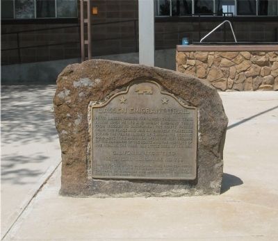
Peter Lassen opened the Lassen Emigrant Trail in 1848 when he led a 12-wagon emigrant train from Missouri to California. The route, which passed near this place, was extensively traveled during the years 1848-53 by emigrants seeking gold, adventure, . . . — — Map (db m10264) HM
Through this draw passed many covered wagons and gold seekers enroute to California over the Lassen Trail during 1848-1851. Approaching this location from the north, the trail passed what is now Bogard Ranger Station. Proceeding southward to Big . . . — — Map (db m22027) HM
“Striking the river this morning I noticed a cluster of
singular shaped rocks sticking up in spires of a conical
shape 20 to 30 feet high” - Andrew Lopp Murphy, Sep 26, 1849 — — Map (db m113025) HM
“We crossed the creek here running between high banks,
and drove a short distance down the north west side
and encamped” — Elijah Preston Howell, Sep 6, 1849 — — Map (db m113037)
“My shoes are giving out and I have no others. Left one of
them and the other is barely on...At our noon camp I made
some moccasins of cloth” — Joseph Stuart, Sep. 28, 1849 — — Map (db m113024) HM
"We now call this cr. a river, but we do not know what it is. We begin to hear ... that we are near the Sacramento Valley" - Elijah Preston Howell, Sep 8, 1849 — — Map (db m147426) HM
"We were obliged to cross the stream quite a number of times, in consequence of the canons of rock which confine it to a narrow bed." - Amos Batchelder, Sep 29, 1849
Guidebook available
Trails West Inc., P.O. Box 12045, Reno, NV 89510 . . . — — Map (db m113659) HM
"A few hundred yards N. W. of our camp, a tall, symetrical [sic] butte, or isolated mountain, rises from the level plain, like a tent." - J. Goldsborough Bruff, Oct 6, 1849 — — Map (db m147884) HM
This spot marks the convergence of two pioneer trails widely used by emigrants during the years 1846-1850. The Applegate Trail, established in 1846, led from the Humbolt River in Nevada to the Willamette Valley in Oregon. The Lassen Cut-Off, . . . — — Map (db m10174) HM
This trail was blazed by Peter Burnett in 1848 from Oregon City, Oregon Territory to the California gold fields. The route followed the Applegate Trail south and eastward to Tule Lake. It then struck southward probably following an earlier trail . . . — — Map (db m147839) HM
"We followed the Applegate Route to Klamath Lake [Tule Lake], where we left that road and took a southern direction. Thomas McKay, myself, and five others ... Went on in advance of the wagons to discover the best route" - Peter Burnett, Oct 1848 — — Map (db m147564) HM
"The water [at Copic Bay] being so bad, we drank very little, and left early next morning [over a prairie]." - Peter Burnett, Oct 1848 — — Map (db m147841) HM
Burnett's Road - Hunters skirted the lava fields to the west as they headed southerly. They crossed dry lake, which had only scattered ponds of water, and entered an area of scattered brush and rocky ridges. — — Map (db m147844) HM
"We passed over ... smooth prairie for some distance. One evening we encamped at what was then called Goose Lake (at Copic Bay). It being late in the season, the water in the lake was very low, muddy, and almost putrid." Peter Burnett, Oct 1848 . . . — — Map (db m87851) HM
J.G. Buff, leader of the Washington City Mining Co., camped on this site from Oct. 21, 1849 to Dec. 31, 1849. While here guarding company goods, at what he called "his mt. lodge in prosperity", he aided, fed, and cheered many weary, hungry, and sick . . . — — Map (db m87733) HM
The Lassen Trail was named for Peter Lassen, a native of Denmark who obtained a Mexican land grant, n 1844, for 22,000 acres of land near Vina, where Deer Creek enters the Sacramento River.
Lassen was an inveterate trail blazer and inspired by . . . — — Map (db m88074) HM
"The top of this hill is a narrow flat surface -... the hill is covered with tent wagons, oxen, mules, horses, men women, and children; some camps are on either side of the road, for several miles back." - J. Goldbrough Bruff, Oct 21, 1849 . . . — — Map (db m87731) HM
"The view below and before us truly grand - - the lofty mountains the stupendous rocks with the deep but magnificent vale below ... renders this one of the finest and most picturesque views I ever beheld" - Henry Austin, Oct 21 1849 . . . — — Map (db m87743) HM
"We gained the summit of greatest elevation. ... here we found 8 dead oxen, 2 discarded wagons, pieces of others, clothing, & c, scattered around" - J. Goldborough Bruff, Oct 21, 1849
Guidebook available
Trails West Inc., P.O. Box . . . — — Map (db m87741) HM
"There is an immense abyss on either side, we could look down thousands of feet. The side of the ridge seeming almost perpendicular" - Charles Glass Gray, Sep 29, 1849
Guidebook available
Trails West Inc., P.O. Box 12045, Reno, NV 89510 . . . — — Map (db m87734) HM
"Could you see me I would not be recognized, dirty, filthy & ragged are fully equal in appearance (to) the natives excepting being in an entire state of nudity" - Wm. Steuben, Sep 20, 1849
Guidebook available
Trails West Inc., P.O. . . . — — Map (db m87729) HM
Peter Lassen passed this way when he blazed 'The Lassen Trail' as he led a party of emigrants from Missouri to California by way of Deer Creek Pass. — — Map (db m58112) HM
"At Lassens ... saw many of the emigrants arriving here. They are broken down with the fatigue. Young men made old & stiff. Many dying with dysentary, fever, scurvey" - Pardon Tiffany, Oct 10, 1849
Guidebook available Tails West Inc. P.O. . . . — — Map (db m89185) HM
Jesse and Lindsay Applegate headed south from Williamette Valley, Oregon, June 29, 1846, seeking a less hazardous route to that region from the east. On July 21, they came to a large meadow on the Humboldt River, what is now the nearby Rye Patch . . . — — Map (db m67379) HM