Arlington Mill in Arlington County, Virginia — The American South (Mid-Atlantic)
Flow Of Time
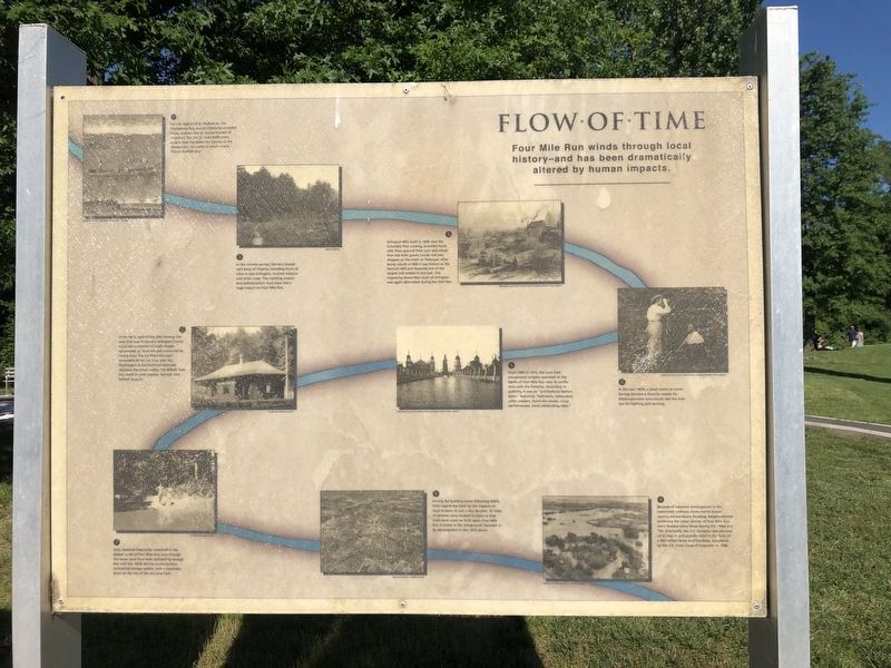
Four Mile Run winds through local history–and has been dramatically altered by human impacts.
1. For the region's first inhabitants, the Chesapeake Bay and its tributaries provided transportation and an annual harvest of migratory fish. For at least 8,000 years, people have harvested the bounty of the Chesapeake, the name of which means "Great Shellfish Bay."
2. In the colonial period, farmers cleared vast areas of Virginia, including much of what is now Arlington, to plant tobacco and other crops. The resulting erosion and sedimentation must have had a huge impact on Four Mile Run.
3. Arlington Mill, built in 1836 near the Columbia Pike crossing, provided locals with flour ground from corn and wheat that was both grown locally and also shipped up the creek on flatboats. After being rebuilt in 1890 it was known as the Barcroft Mill and featured one of the largest mill wheels in the East. This engraving shows that much of Arlington was again deforested during the Civil War.
4. In the late 1800s, a small resort at Carlin Springs became a favorite respite for Washingtonians who would ride the train out for
this page online
5. From 1906 to 1915, the Luna Park amusement complex operated on the banks of Four Mile Run near its confluence with the Potomac. According to publicity, it was an "architectural fashion plate," featuring "ballrooms, restaurants, roller coasters, shoot-the-chutes, circus performances, (and) exhilarating rides."
6. In the early years of the 20th century, the area that was to become Arlington County contained a number of small villages surrounded by farmland and connected by trolley lines. The Southern Railway's Alexandria-Bluemont Line, later the Washington & Old Dominion Railroad, followed the stream valley. The W&OD Trail, the country's most popular rail trail, now follows its path.
7. Early residents frequently cooled off in the deeper pools of Four Mile Run, even though the water must have been polluted by sewage. Not until the 1930s did the county build a centralized sewage treatment, with a treatment plant on the site of the old Luna Park.
8. During the building boom following WWII, little regard was held for the impacts on local streams. In just a few decades, 35 miles of streams were encased
9. Because of intensive development in the watershed, ordinary storm events began causing extraordinary flooding. Neighborhoods bordering the lower section of Four Mile Run were flooded many times during the 1960s and '70s. Eventually, the U.S. Congress was persuaded to step in and provided relief in the form of $63 million levee and floodway, completed by the U.S. Army Corps of Engineers in 1980.
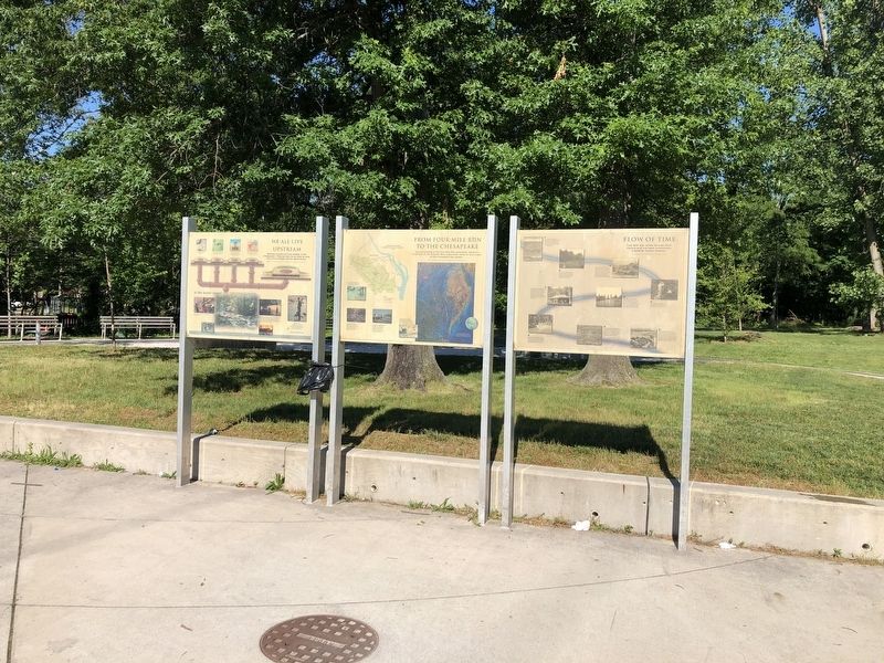
Topics and series. This historical marker is listed in these topic lists: Animals • Anthropology & Archaeology • Colonial Era • Environment • Indigenous Peoples and Communities • Industry & Commerce • Railroads & Streetcars • Waterways & Vessels. In addition, it is included in the Washington and Old Dominion (W&OD) Railroad series list. A significant historical year for this entry is 1836.
Location. 38° 51.397′ N, 77° 6.618′ W. Marker is in Arlington, Virginia, in Arlington County. It is in Arlington Mill. It is on Columbia Pike (Virginia Route 244) just east of South Four
Photographed by Devry Becker Jones (CC0), June 7, 2020
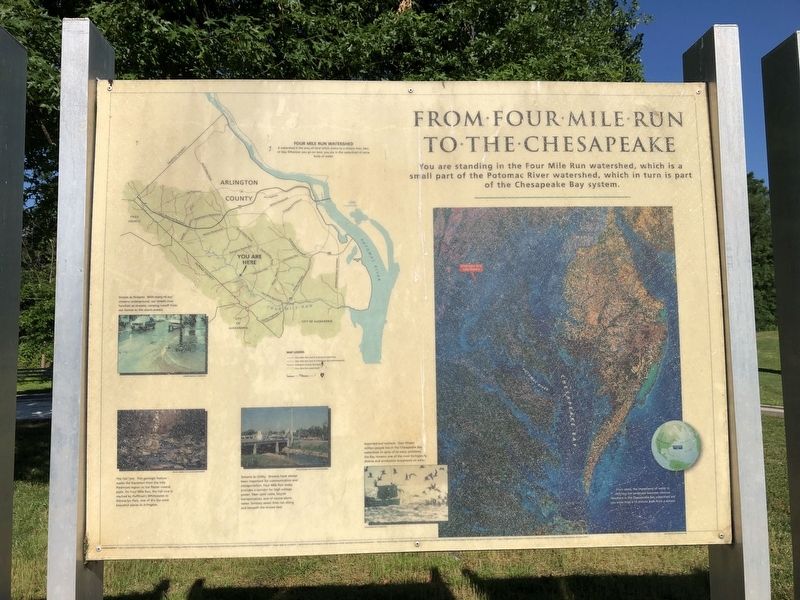
3. From Four Mile Run To The Chesapeake
This is a nature marker near to the marker.

Regionally, this marker is in the Washington Metropolitan Area and in Northern Virginia. It is also in the American South, specifically in the Upper South, in the Mid-Atlantic, and on the Eastern Seaboard. Globally, it is in the North Atlantic Region, North America, the Western Hemisphere, the Western World, and the Anglosphere. Historically, it finds itself in what was once the territory of the Mississippian Culture, one of the original Thirteen Colonies, one of the Confederate States of America, and the Antebellum South.
Other nearby markers. At least 8 other markers are within walking distance of this marker: Barcroft (within shouting distance of this marker); The Arlington Mill (within shouting distance of this marker); Early Engagement (about 400 feet away, measured in a direct line); Barcroft Community House (approx. 0.2 miles away); Original Federal Boundary Stone, District of Columbia, Southwest 6 (approx. 0.6 miles away); Dr. Lilli Vincenz (approx.
Photographed by Devry Becker Jones (CC0), June 7, 2020
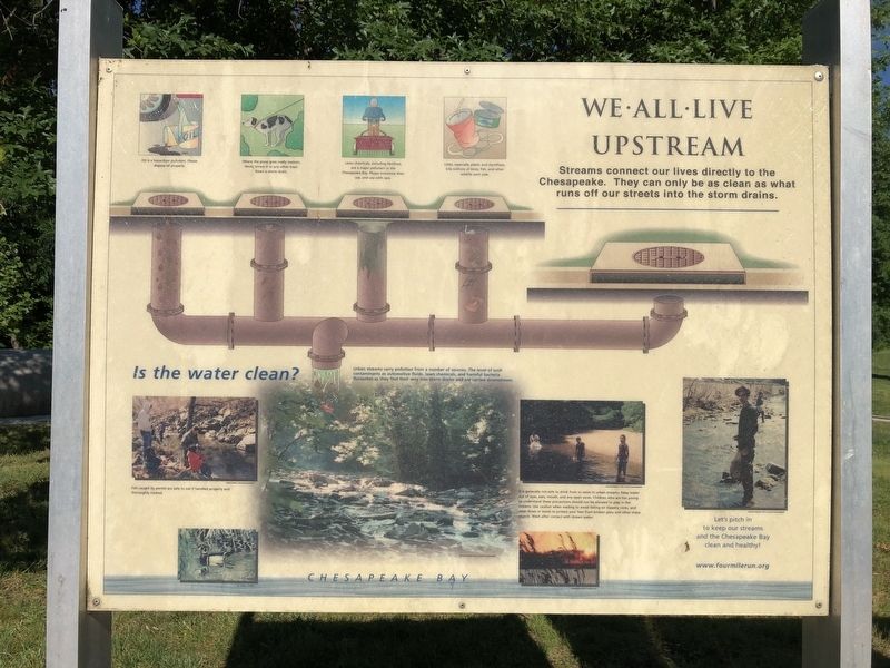
4. We All Live Upstream Marker
This is an environmental marker adjacent to the Flow of Time marker.
Another marker is no longer nearby. Washington's Survey Marker (was approx. half a mile away but has been confirmed missing).
Credits. This page was last revised on February 1, 2023. It was originally submitted on June 7, 2020, by Devry Becker Jones of Washington, District of Columbia. This page has been viewed 670 times since then and 32 times this year. Photos: 1, 2, 3, 4. submitted on June 7, 2020, by Devry Becker Jones of Washington, District of Columbia.
