Chuckatuck in Suffolk, Virginia — The American South (Mid-Atlantic)
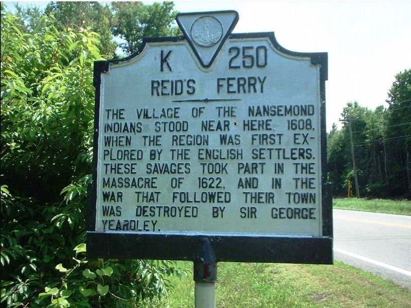
Reid's Ferry
Erected by Conservation and Development Commission. (Marker Number K-250.)
Topics and series. This historical marker is listed in these topic lists: Colonial Era • Native Americans • Settlements & Settlers • Wars, US Indian. In addition, it is included in the Virginia Department of Historic Resources (DHR) series list. A significant historical year for this entry is 1608.
Location. Marker has been permanently removed. It was located near 36° 48.133′ N, 76° 34.675′ W. Marker was in Suffolk, Virginia. It was in Chuckatuck. Marker could be reached from Godwin Boulevard (Virginia Route 10). Location is an estimate (5.5 mi NW of Suffolk proper). Touch for map. Marker was in this post office area: Suffolk VA 23434, United States of America.
We have been informed that this sign or monument is no longer there and will not be replaced. This page is an archival view of what was.
Other nearby markers. At least 8 other markers are within 4 miles of this location, measured as the crow flies. Dumpling Island (approx. 1.2 miles away); Siege of Suffolk (approx. 3 miles away); James Bowser Plantation (approx. 3.1 miles away); Revolutionary Camp (approx. 3.3 miles away); Civil War Cavalry Skirmish (approx. 3.3 miles away); Nansemond Indian Villages (approx. 3Ĺ miles away); a different marker also named Siege of Suffolk (approx. 3.6 miles away); St. John's Church (approx. 3.9 miles away). Touch for a list and map of all markers in Suffolk.
More about this marker. A landmark named K-250 Reidís Ferry was among the initial ones created when the Virginia Conservation and Development Commission began the historical marker program in 1927. The commission, a predecessor of the Department of Historic Resources (DHR), used designation symbols of “letter-and-number” and a title to name its landmarks.
Most likely erected between 1927 and 1928, K-250 Reidís Ferry stood several decades before it was retired. But the symbol “K-250” was not. In 1998 it was assigned the title Nansemond Indian Villages (see nearby markers).
The background of K-250 Reidís Ferry is hazy. For example, its original location and subsequent whereabouts are difficult to pinpoint. The marker was probably moved around,

Courtesy of The Sun.
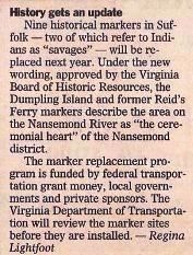
2. History gets an update
Nine historical markers in Suffolk—two of which refer to Indians as “savages”—will be replaced next year. Under the new wording, approved by the Virginia Board of Historic Resources, the Dumpling Island and former Reidís Ferry markers describe the area on the Nansemond River as “the ceremonial heart” of the Nansemond district. The marker replacement program is funded by federal transportation grant money, local governments and private sponsors. The Virginia Department of Transportation will review the marker sites before they are installed. —Regina Lightfoot” Dec 27, 1998 in The Sun, a part of The Virginian-Pilot newspaper.
Additionally, the marker and the “pre-updated” K-249 Dumpling Island had similar inscribed terminology. Both contained reference to “savages,” “1608,” and “the English”.

Courtesy of Shenandoah Publishing House, Inc.
3. K-250 Reidís Ferry, 1931.
The town of the Nansemond Indians stood near here when the region was first explored by the English, 1608. The savages took part in the massacre of 1622 and their town was destroyed by Governor Sir George Yeardley. Eight miles north of Suffolk —Virginia Highway Historical Markers, Fourth Edition (1931)

Courtesy of Virginia Department of Conservation and Development.
4. K-250 Reidís Ferry, 1948.
The village of the Nansemond Indians stood near here, 1608, when the region was first explored by the English settlers. These savages took part in the massacre of 1622, and in the war that followed their town was destroyed by Sir George Yeardley. Nansemond County: 5.5 miles northwest of Suffolk —State Historical Markers of Virginia, Sixth Edition (1948)

Courtesy of Virginia Historic Landmarks Commission.
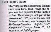
5. K-250 Reidís Ferry, 1985.
The village of the Nansemond Indians stood near here, 1608, when the region was first explored by the English settlers. These savages took part in the massacre of 1622, and in the war that followed their town was destroyed by Sir George Yeardley. Suffolk (“old” Nansemond County): Route 10, 5.5 miles n.w. of Suffolk proper. —A Guidebook to Virginiaís Historical Markers, compiled by Margaret T. Peters (1985)
Credits. This page was last revised on February 1, 2023. It was originally submitted on December 20, 2020, by Cynthia L. Clark of Suffolk, Virginia. This page has been viewed 506 times since then and 73 times this year. Photos: 1, 2, 3, 4, 5. submitted on December 20, 2020, by Cynthia L. Clark of Suffolk, Virginia. • Bernard Fisher was the editor who published this page.
