Near Leesburg in Loudoun County, Virginia — The American South (Mid-Atlantic)
The Enslaved Community
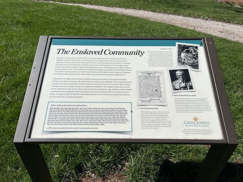
During the time of slavery, more than 130 men, women and children were held in bondage at Oatlands and Bellefield, a smaller Carter plantation located to the west. The enslaved dug the clay and made hundreds of thousands of bricks to construct the mansion, grist mill, barns and other buildings on the plantation. The beauty of Oatlands must be contrasted with the ugliness of slavery that made it possible. In the early 1800s, George Carter bought enslaved people from agents and nearby landowners. As the plantation grew, so did the number of enslaved people to work it. Three enslaved communities came together when George married Elizabeth Osborne Lewis in 1835. Families were torn apart and friends left behind when Elizabeth moved to Oatlands, bringing with her enslaved people inherited from her father, Benjamin Grayson, and her first husband, Joseph Lewis Jr.
Although their marriages were not recognized legally, enslaved men and women married and had children. Families, such as Bryant, Buchanan, Day, Howard, Murray, and Russ, were established. They survived harsh living conditions, hard labor and had little control over their own lives. By the start of the Civil War in 1861, the largest enslaved community in Loudoun County was at Oatlands and Bellefield. When freedom finally came, men and women worked hard to save and buy land, and the communities of Gleedsville (near Oatlands) and Howardsville (near Bellefield) were established. Many descendants of the formerly enslaved still live in Loudoun County or nearby. An ongoing project at Oatlands, called Reclaim Your Story, aims to identify the enslaved who were here, document their lives, and locate descendants.
Names of the people who were enslaved here:
Abby, Abednego, Aggy, Alanda Day, Alfred, Alice, Ally, Amelia, Andison, Andrew, Ann, Anne, Annie, Anthony, Amestead, Bazil, Beach, Becky, Ben, Betsy, Betty, Bill, Billy, Bushrod, Canes, Candy, Carb, Celia, Charles, Charley/Charlie, Chilton, Cissy, Clara, Collins, Cuffy, Daniel, Daphne, Davy, Delia, Dick, Dinah, Eddie, Ed, Edmond, Edward, Effie, Eliza, Ellen, Emanuel Day, Emma, Esther, Eve/Eva Moton, Evan, Fan, Fanny, Fenton, Frances, Frank, Gabriel Day, George, Gerrard Day, Gerrard Smith, Gregg, Guy, Hagar, Hannah, Old Hannah, Hanson, Harriet, Harrison, Harry, Harry Lee, Hebe, Henny, Hubert, Jack, Jackson, Jacob Howard, James, Jane, Jerry, Jim, Jinnie, Joe Rust, John, Joseph, Josh, Joshua, Julius Day, Katy, Latetia, Leal, Lee, Lewis, Linda, Louis, Louisa, Lydia, Lynda, Malinda, Maninda, Marcus, Margaret, Maria, Martha, Martial, Martin, Mary, Matilda, Mattie, Millay, Milly, Moses, Mosey, Nan, Nancy, Nat, Ned, Nelson, Noah, Parker, Pat, Patrick, Perry, Peter, Peyton,Pierce, Polly, Rachel, Reuben, Ricahrd, Robert, Romeo, Rose, Rosina, Ruth, Sally, Sam, Sam Jones, Sandy, Sarah, Sawney, Silvia, Sina, Solomon, Sophia Howard, Spencer, Susan, Sukey, Tasker, Teana, Tinney, Tishy, Tom, Tom Carpenter, Tommy, Tyler, Wallice/Wallace, Westley/Wesley, William, Willy…
…and the numerous people whose names we don't know and might never know…
[Captions:]
Bazil Turner, c. 1930.
Bazil Turner was approximately 20 years-old in 1864 when Elizabeth O. Carter wrote in her diary that he had been robbed of $60 by two soldiers while transporting money to Elizabeth's son at Bellefield. After the Civil War, Bazil worked on farms in the Leesburg area, including Oatlands for the second generation of Carters. He married Frances Day and bought land in Gleedsville, where they raised their family. In the 20th century, Bazil worked for the Eustis family at Oatlands. He died in 1931 and is buried at the cemetery in Gleedsville. Image courtesy of the Library of Congress Prints and Photographs Division.
Martin Van Buren Buchanan, undated.
Martin Van Buren Buchanan was the son of Robert Buchanan and Mahala Jackson. Robert was enslaved at Oatlands but Mahala was free, which meant that her children were born free. When African Americans were allowed to serve in the Union Army, Martin left Loudoun County and enlisted in Washington, D.C. He served throughout the war and afterward returned to the Oatlands area. Like his father, he purchased land in Gleedsville and raised a family there. Buchanans have served their country in every war since Martin's service in the Civil War.
Ad for Freedom Seeker, 1809.
William Jordan Augustus was enslaved at Outlands, and in February 1809, he left to seek his freedom. Augustus lived and worked in Philadelphia before being captured in 1817 and jailed in Baltimore. For unknown reasons, Carter's nephew paid for his release. Augustus achieved his freedom not once, but twice! The story of William Jordan Augustus is one of strength, courage, and resistance. It is because of his story that Oatlands is a member of the National Park Service's Network to Freedom.
Erected by Oatlands Historic House & Gardens, a site of the National Trust for Historic Preservation.
Topics and series. This historical marker is listed in these topic lists: Abolition & Underground RR • African Americans • Agriculture • Industry & Commerce • Law Enforcement • Settlements & Settlers • War, US Civil. In addition, it is included in the National Underground Railroad Network to Freedom series list. A significant historical month for this entry is February 1809.
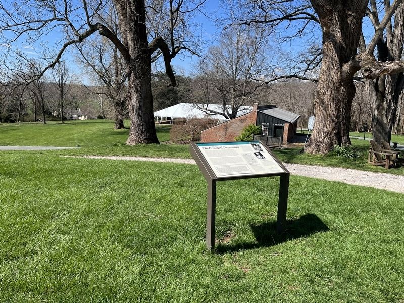
Location. 39° 2.441′ N, 77° 37.055′ W. Marker is near Leesburg, Virginia, in Loudoun County. Marker is on Oatlands Plantation Lane, 0.4 miles James Monroe Highway (U.S. 15), on the left when traveling south. Touch for map. Marker is at or near this postal address: 20850 Oatlands Plantation Ln, Leesburg VA 20175, United States of America. Touch for directions.
Other nearby markers. At least 8 other markers are within walking distance of this marker. The Mansion (here, next to this marker); The Greenhouse (within shouting distance of this marker); The Bachelor's Cottage (within shouting distance of this marker); The Walled Garden (within shouting distance of this marker); The Smokehouse (within shouting distance of this marker); Reclaim Your Story (within shouting distance of this marker); The Garden Dependency (within shouting distance of this marker); The Carriage House (about 600 feet away, measured in a direct line). Touch for a list and map of all markers in Leesburg.
Additional keywords. human trafficking; Underground Railroad
Credits. This page was last revised on April 9, 2022. It was originally submitted on April 9, 2022, by Devry Becker Jones of Washington, District of Columbia. This page has been viewed 404 times since then and 63 times this year. Photos: 1, 2. submitted on April 9, 2022, by Devry Becker Jones of Washington, District of Columbia.

