Rosiclare in Hardin County, Illinois — The American Midwest (Great Lakes)
The Ohio River Scenic Byway
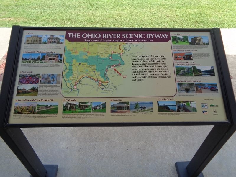
These are some of the places to explore on the Ohio River Scenic Byway.
Photographed by Jason Voigt, August 11, 2020
1. Ohio River Scenic Byway Marker
Travel the Byway and discover the importance of the Ohio River to the nation and the world. Experience the magnificent natural landscapes of southern Illinois while coming to know how the historic events and people that shaped the region and the nation. Enjoy the rural character, authenticity and hospitality of the Byway communities and people.
1. Cairo
Cairo is situated at the confluence of two of the nation's greatest rivers: The Ohio and the Mississippi. Cairo's Historic District showcases the city's unique architecture, including the Custom House and Museum (above left), Magnolia Manor (above right), Riverlore Mansion and the Safford Memorial Library, which many people consider Cairo's most beautiful building.
2. Mound City National Cemetery
The cemetery was established in 1864 and continues to serve as a national military cemetery. The cemetery contains tombstones dating to the Civil War, the Illinois State Soldiers and Sailors Monument and a caretaker's cottage that is on the National Register of Historic Places and serves as a museum (top right).
3. Metropolis
Metropolis is home to the nation's largest
this page online
4. Kincaid Mounds State Historic Site
Kincaid Mounds, the most significant pre-historic site on the Byway, was occupied from 1050-1400 AD. The mounds are man-made hills that supported homes, temples and buildings from which the Chief reigned. The Mounds hosts an Archaeology Field Day every October.
5. Golconda
Golconda features several buildings that are listed on the National Register of Historic Places and are part of the Golconda Historic District. In addition, the historic Lockmaster Homes (top right) provide the most unique lodging in the area. The Cherokee Trail of Tears entered Illinois at Golconda and is commemorated at a cemetery outside of town.
6. Rosiclare
Rosiclare is the home of the Miners Memorial, a river walk, the American Fluorite Museum and so much
Photographed by Jason Voigt, August 11, 2020
2. Mine It, Mill It, Ship It Marker
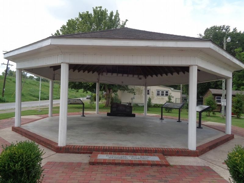
Marker is on the far right inside the Miners Memorial Pavilion.
7. Elizabethtown
Elizabethtown retains the charm of a river town, providing enchanting river views, historic hotels and amenities, and even a floating restaurant.
8. Cave In Rock State Park
Cave-In-Rock is a natural wonder with a long and colorful history. The ferry here still provided free service between Illinois and Kentucky.
9. Garden of the Gods Shawnee National Forest
The Garden of the Gods (top left) is a southern Illinois landmark. Nestled in the Shawnee National Forest, where hiking, hunting, swimming (Pounds Hollow, top right) and more are available. The forest also contains Illinois' only federally designated Wilderness Area.
10. Equality Visitor Center
Equality is the northern gateway to the byway and home to the Ohio River Visitor Center. Here you can learn about the Byway, regional history and local arts, crafts and amenities by browsing the exhibits and talking with knowledgeable local volunteers.
11. Old Shawneetown
Old Shawneetown was devastated by the Ohio River flood of 1937, and most of the town up and moved, creating Shawneetown. Structures remaining in Old Shawneetown are the John Marshall house, Illinois' first bank and now a museum (top left) and the Shawneetown Bank (top right). (New) Shawneetown has a monument to the region's African-American history.
Erected by Fluorspar Miners Memorial Committee, Ohio River Scenic Byway, City of Rosiclare, America's Byways, Illinois Department of Transportation.
Topics. This historical marker is listed in these topic lists: Anthropology & Archaeology • Cemeteries & Burial Sites • Forts and Castles • Indigenous Peoples and Communities • Settlements & Settlers • War, US Civil • Waterways & Vessels. A significant historical year for this entry is 1864.
Location. 37° 25.134′ N, 88° 20.669′ W. Marker is in Rosiclare, Illinois, in Hardin County. It is at the intersection of Main Street (Illinois Route 34) and 2nd Street, on the right when traveling east on Main Street. Touch for map. Marker is at or near this postal address: 215 Main St, Rosiclare IL 62982, United States of America. Touch for directions.

Regionally, this marker is in Southern Illinois — Little Egypt and in Shawnee Hills. It is also in the American Midwest, in the Ohio River Valley, and in the Corn Belt. Globally, it is in North America, the Western Hemisphere, the Western World, and the Anglosphere. Historically, it finds itself in what was once the territory of the Mississippian Culture and also the Northwest Territory.
Other nearby markers. At least 8 other markers are within 3 miles of this marker, measured as the crow flies: Rosiclare: The Fluorite Center of Hardin County, the United States and the World (here, next to this marker); Mine It, Mill It, Ship It (here, next to this marker); Fluorite Mining (approx. 0.3 miles away); The Elizabethtown First Baptist Church (approx. 2.8 miles away); Anna Bixby Trail/Historic Rose Hotel (approx. 2.9 miles away); Welcome to the Historic Rose Hotel Bed and Breakfast (approx. 2.9 miles away); War Memorial (approx. 2.9 miles away); You Are Not Forgotten (approx. 2.9 miles away). Touch for a list and map of all markers in Rosiclare.
Credits. This page was last revised on June 18, 2026. It was originally submitted on April 27, 2022, by Jason Voigt of Glen Carbon, Illinois. This page has been viewed 444 times since then and 40 times this year. Photos: 1, 2. submitted on August 21, 2020, by Jason Voigt of Glen Carbon, Illinois. • Devry Becker Jones was the editor who published this page.
