Bethlehem in Lehigh County, Pennsylvania — The American Northeast (Mid-Atlantic)
Springhouse
1764
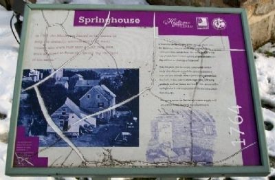
In 1747, the Moravians fenced in the spring to keep out domestic animals and fowl. Early recoreds also state that one a year, two men were assigned to clean the spring “by the light of the moon.”
A bountiful spring was one of the reasons why in 1741, the Moravians chose to settle where the Monocacy Creek jointed the Lehigh River. The spring flowed at the rate of more than 1 million gallons of potable water per day and it never dried up or froze over.
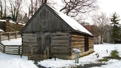
Over the years, the Moravians constructed various kinds of enclosures around the spring to protect it from dirt and animals. After a permanent springhouse was built, it was used to store vegetables and dairy products such as cheese and butter. The current timber springhouse is a reconstruction of the kind that stood here in 1764.
The spring served as Bethlehem's water supply until 1912 when it was found to be contaminated.
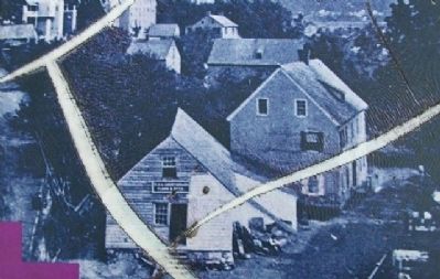
[Caption for photo on marker]
The springhouse helped Moravian families in early Bethlehem to preserve perishable foods. By the late 1800s, the springhouse had been converted to commercial uses.
[Marker is damaged]
Erected by Historic Bethlehem, HistoryWorks!, and Delaware & Lehigh National Heritage Corridor.
Topics. This historical marker is listed in these topic lists: Colonial Era • Environment • Man-Made Features • Natural Features • Natural Resources • Waterways & Vessels. A significant historical year for this entry is 1747.
Location. 40° 37.201′ N, 75° 22.999′ W. Marker is in Bethlehem, Pennsylvania, in Lehigh County. Marker is in the Colonial Industrial Quarter of Historic Bethlehem, along the former Ohio Road, about 50 feet east of the Tannery. Touch for map. Marker is in this post office area: Bethlehem PA 18018, United States of America. Touch for directions.
Other nearby markers. At least 8 other markers are within walking distance of this marker. Tannery (a few steps from this marker); Tawery (a few steps from this marker); Butchery (within shouting distance of this marker); Miller's House (within shouting distance of this marker); Luckenbach Mill (within shouting distance of this marker); Dye House (within shouting distance of this marker); Bark Shed (within shouting distance of this marker); First House of Moravian Settlement (about 300 feet away, measured in a direct line). Touch for a list and map of all markers in Bethlehem.
Also see . . . Colonial Industrial Quarter. (Submitted on February 2, 2010, by William Fischer, Jr. of Scranton, Pennsylvania.)
Credits. This page was last revised on October 6, 2020. It was originally submitted on February 2, 2010, by William Fischer, Jr. of Scranton, Pennsylvania. This page has been viewed 707 times since then and 17 times this year. Photos: 1, 2, 3. submitted on February 2, 2010, by William Fischer, Jr. of Scranton, Pennsylvania.


