Near Chivington in Kiowa County, Colorado — The American Mountains (Southwest)
Welcome to the Sand Creek Massacre National Historic Site
Sand Creek Massacre National Historic Site
| — | National Park Service, U.S. Department of the Interior | — |
Photographed by Connor Olson, August 30, 2021
1. Welcome to the Sand Creek Massacre National Historic Site Marker
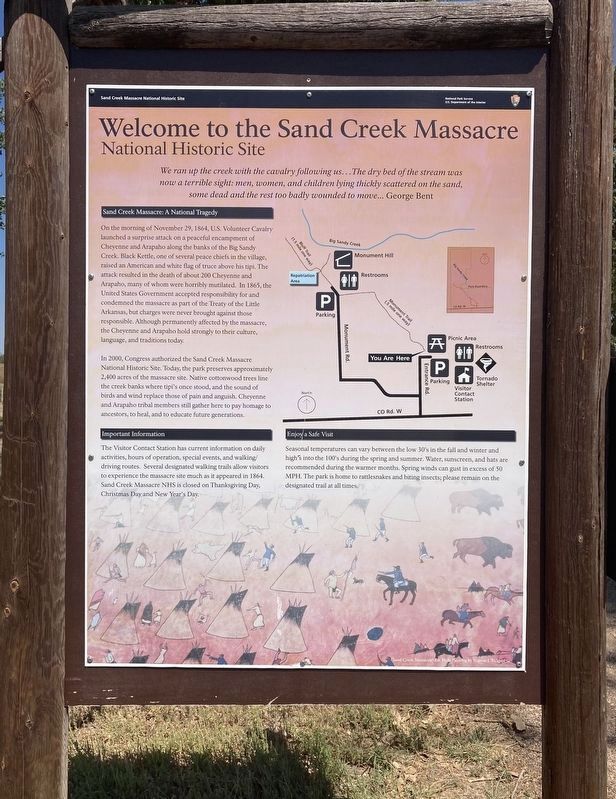
We ran up the creek with the cavalry following us…The dry bed of the stream was now a terrible sight: men, women, and children lying thickly scattered on the sand, some dead and the rest too badly wounded to move… George Bent
Sand Creek Massacre: A National Tragedy
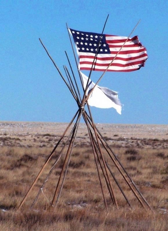
On the morning of November 29, 1864, U.S. Volunteer Cavalry launched a surprise attack on a peaceful encampment of Cheyenne and Arapaho along the banks of the Big Sandy Creek. Black Kettle, one of several peace chiefs in the village, raised an American and white flag of truce above his tipi. The attack resulted in the death of about 200 Cheyenne and Arapaho, many of whom were horribly mutilated. In 1865, the United States Government accepted responsibility for and condemned the massacre as part of the Treaty of the Little Arkansas, but charges were never brought against those responsible. Although permanently affected by the massacre, the Cheyenne and Arapaho hold strongly to their culture, language, and traditions today.
In 2000, Congress authorized the Sand Creek Massacre National Historic Site. Today, the park preserves approximately 2,400 acres
this page online
Important Information
The Visitor Contact Station has current information on daily activities, hours of operation, special events, and walking/driving routes. Several designated walking trails allow visitors to experience the massacre site much as it appeared in 1864. Sand Creek Massacre NHS is closed on Thanksgiving Day, Christmas Day and New Year's Day.
Enjoy a Safe Visit
Seasonal temperatures can vary between the low 30's in the fall and winter and high's into the 100's during the spring and summer. Water, sunscreen, and hats are recommended during the warmer months. Spring winds can gust in excess of 50 MPH. The park is home to rattlesnakes and biting insects; please remain on the designated trail at all times.
Erected by National Park Service, U.S. Department of the Interior.
Topics. This memorial is listed in these topic lists:
Photographed by Connor Olson, August 30, 2021
2. Welcome to the Sand Creek Massacre National Historic Site Marker
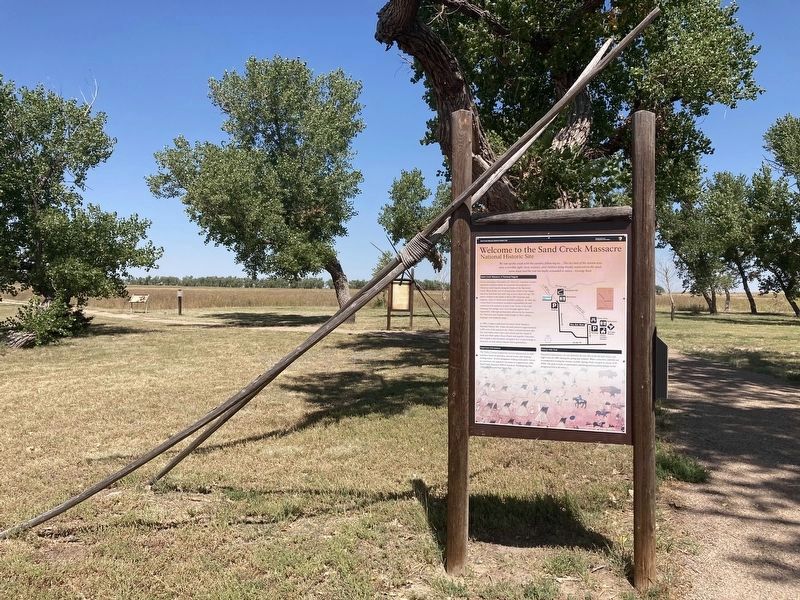
Location. 38° 32.68′ N, 102° 30.258′ W. Memorial is near Chivington, Colorado, in Kiowa County. It is on Unnamed entrance road north of County Road W, in the median. Touch for map. Memorial is in this post office area: Eads CO 81036, United States of America. Touch for directions.

Regionally, this memorial is in the Eastern Plains. It is also in the American Mountain West, on the Southern Plains, and specifically on the High Plains. Globally, it is in North America, the Western Hemisphere, the Western World, and the Anglosphere. Historically, it finds itself in what was once the Comanchería, the Dust Bowl, and the Republic of Texas.
Other nearby markers. At least 8 other markers are within walking distance of this marker: Conscience and Courage (a few steps from this marker); Why A 33 Star Flag (within shouting distance of this marker); Humans and the Prairie (within shouting distance of this marker); Sand Creek as Camp Site (approx. ¼ mile away); Fort Lyon Reservation
Courtesy of U.S. National Park Service
3. 33-Star American Flag, white flag, atop a tipi frame at Sand Creek Massacre National Historic Site
Other markers no longer nearby. The Sand Creek Massacre (was a few steps from this marker but has been permanently removed); The Attack (was approx. 0.3 miles away but has been permanently removed); Remains (was approx. half a mile away but has been permanently removed); Returned to Sand Creek (was approx. half a mile away but has been permanently removed); Healing (was approx. half a mile away but has been permanently removed); Pleas for Peace (was approx. half a mile away but has been permanently removed); Why? (was approx. half a mile away but has been permanently removed).
Related markers. Click here for a list of markers that are related to this marker. This is a list of interpretive panels along the trails at the Sand Creek Massacre National Historic Site
Also see . . . Sand Creek (National Park Service - Civil War). (Submitted on January 1, 2026, by Mike McKeown of Baltimore, Maryland.)
Credits. This page was last revised on January 1, 2026. It was originally submitted on September 15, 2021, by Connor Olson of Menomonee Falls, Wisconsin. This page has been viewed 1,721 times since then and 115 times this year. Last updated on January 1, 2026, by Mike McKeown of Baltimore, Maryland. Photos: 1, 2. submitted on September 15, 2021, by Connor Olson of Menomonee Falls, Wisconsin. 3. submitted on November 27, 2021, by J. J. Prats of Powell, Ohio. • Devry Becker Jones was the editor who published this page.
