Atlanta in Fulton County, Georgia — The American South (South Atlantic)
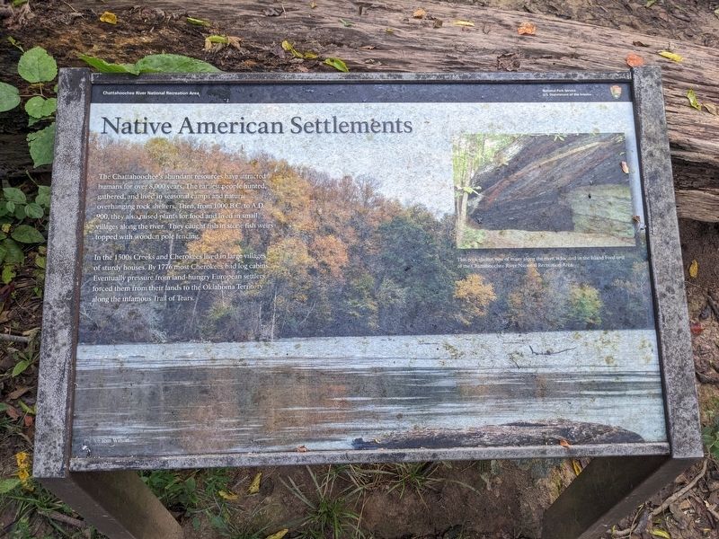
Native American Settlements
| — | Chattahoochee River National Recreation Area | — |
September 29, 2023
1. Native American Settlements Marker
In the 1500s Creeks and Cherokees lived in large villages of sturdy houses. By 1776 most Cherokees had log cabins. Eventually pressure from land-hungry European settlers forced them from their lands to the Oklahoma Territory along the infamous Trail of Tears.
(caption) This rock shelter, one of many along the river, is located in the Island Ford unit of the Chattahoochee River National Recreation Area.
Erected by National Park Service, U.S. Department of the Interior.
Topics. This historical marker is listed in these topic lists: Anthropology & Archaeology • Indigenous Peoples and Communities • Parks & Recreational Areas • Waterways & Vessels.
Location. 33° 52.673′ N, 84° 26.528′ W.
this page online

Regionally, this marker is in the Piedmont. It is also in the American South and specifically in the Deep South. Globally, it is in North America, the Western Hemisphere, the Western World, and the Anglosphere. Historically, it finds itself in what was once the territory of the Mississippian Culture, one of the original Thirteen Colonies, one of the Confederate States of America, and the Antebellum South.
Other nearby markers. At least 8 other markers are within 2 miles of this marker, measured as the crow flies: The 4th Corps Posted Along the River (approx. 0.9 miles away); Old Pace’s Ferry Road (approx. 1.4 miles away); Union Defense Line (approx. 1.4 miles away); The Errant Pontoon Bridge: Pace's Ferry (approx. 1½ miles away); The 14th & 20th A.C. Cross at Pace's Ferry
September 29, 2023
2. Native American Settlements Marker
Credits. This page was last revised on October 10, 2026. It was originally submitted on October 9, 2026. This page has been viewed 14 times since then. Photos: 1, 2. submitted on October 9, 2026. • Bernard Fisher was the editor who published this page.
