Near Croom in Prince George's County, Maryland — The American Northeast (Mid-Atlantic)
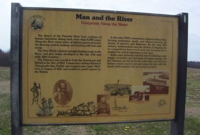
Man and the River
Footprints Along the Shore
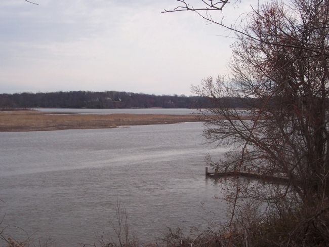
The shores of the Patuxent River bear evidence of human habitation dating back more than 8,000 years. Along the River many tribes of Indians practiced primitive farming, pottery making, and hunting with bow and arrow.
The New World colonists brought bustling trade to the River, and port towns developed in the late 17th and early 18th centuries.
The Patuxent was crucial to both the Americans and British in the War of 1812. Commodore Joshua Barney's Chesapeake Bay Flotilla was trapped near Upper Marlboro in August of 1814, and scuttled to avoid capture by the British.
In the early 1900s, steamboats replaced sailing ships, ferrying passengers, goods, and tobacco between the dozens of wharves and Baltimore. By the early 20th century, sedimentation and the decline of shipping due to competition from truck and rail transportation marked the end of commerce on the river.
Today, man primarily uses the river for drinking water supply, recreation and discharge of treated sewage. For the Patuxent, as well as for the entire Bay, our task is to balance man's need to use and enjoy the river with the needs of the resource we are trying to protect.
[Captions:]
Captain John Smith, Commodore Joshua Barney, Laurel Cotton Mill, Sturgeon Skiff, Chesapeake Beach Railway Crossing near Calvert, Steamboat near Wayson's Corner.
Erected by Maryland Department of Natural Resources and the Maryland National Capital Park and Planning Commission.
Topics. This historical marker is listed in these topic lists: Anthropology & Archaeology • Colonial Era • Environment • Native Americans • Settlements & Settlers • War of 1812 • Waterways & Vessels. A significant historical year for this entry is 1812.
Location. 38° 45.143′ N, 76° 42.08′ W. Marker is near Croom, Maryland, in Prince George's County. Marker is on Chesapeake Bay Critical Area Driving Tour Road, on the right when traveling south. Follow Croom Airport Road to its end and proceed north, east and southward, approximately 2.5 miles, via the Chesapeake Bay Critical Area Driving Tour Road - around the former Columbia Air Center and toward Shelby's Landing on the Patuxent River. The marker will be seen in the parking area for Shelby's Landing on the right (west) side of the road. Note that the Chesapeake Bay Critical Area Driving Tour Road is not always open to vehicular traffic, that it is not shown on some maps, and that it is labeled on some maps as Croom Airport Road. Touch for map. Marker is in this post office area: Upper Marlboro MD 20772, United States of America. Touch for directions.
Other nearby markers. At least 8 other markers are within walking distance of this marker. Woodland Indian Villages on the Patuxent River (about 300 feet away, measured in a direct line); Aviation History (approx. 0.4 miles away); Columbia Air Center (approx. 0.4 miles away); John W. Greene (approx. 0.4 miles away); The Compass Rose (approx. half a mile away); The Cloud Club (approx. half a mile away); The Chesapeake Bay Critical Area Driving Tour (approx. half a mile away); Eastern Bluebird (approx. half a mile away). Touch for a list and map of all markers in Croom.
Credits. This page was last revised on October 16, 2021. It was originally submitted on March 26, 2008, by Richard E. Miller of Oxon Hill, Maryland. This page has been viewed 2,107 times since then and 12 times this year. Photos: 1, 2, 3, 4. submitted on March 26, 2008, by Richard E. Miller of Oxon Hill, Maryland. • Christopher Busta-Peck was the editor who published this page.


