On King Street East (County Route 2) close to Russel Street, on the right when traveling east.
This company, incorporated in 1850, built a railway from Prescott to Bytown (Ottawa) for the shipment of lumber and farm products to markets of the north-eastern United States and Montreal. Substantial funds were raised at Bytown, Prescott and other . . . — — Map (db m83430) HM
Near Sophia Street, 0.1 kilometers south of Corrine Street.
On the morning of February 22, 1813, Lieutenant-Colonel "Red George" Macdonell of the Glengarry Light Infantry set out from Prescott with a force of some 480 regulars and militia to capture the strong United States military post at Ogdensburg. The . . . — — Map (db m86971) HM
On King Street East (County Route 2) close to Vankoughnet Street, on the left.
Born in Stamford, Connecticut, he forfeited 500,000 acres near Albany, New York, by taking up arms for the King on the outbreak of the American Revolution. He raised the Loyal (Jessup’s) Rangers and served under Burgoyne. This corps was disbanded at . . . — — Map (db m83429) HM
Near Vankoughnet Street close to King Street East, on the left when traveling south.
English: The first Fort Wellington was erected on this site during the War of 1812 to shelter British regular troops and Canadian militia defending the vital St. Lawrence River transportation route. In February 1813 those soldiers crossed . . . — — Map (db m209406) HM
On East Street at Henry East, on the left when traveling south on East Street.
This frame structure was originally constructed c. 1823 as a commissariat house for the Fort Wellington Garrison. From 1840-1854, the building served as a military hospital; mainly serving the local garrison of the Royal Canadian Rifle Regiment. The . . . — — Map (db m221390) HM
On Railway Avenue at St-Lawrence Street, on the right when traveling west on Railway Avenue.
The Grand Trunk was incorporated in 1853 to run from Sarnia to Portland, Maine. Although it took over existing lines, new ones had to be built, including sections of the key Toronto to Montréal line completed by the noted English . . . — — Map (db m45781) HM
On Centre Street at Dibble Street West, on the left when traveling north on Centre Street.
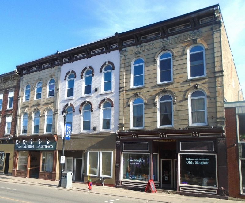
Harry Horwood came to Canada from England in the early 1850s and started working as a stained glass maker in Toronto. In 1881 he established his own stained glass business in Prescott, first on Water Street and later in the old municipal . . . — — Map (db m242712) HM
Jean Casselman Wadds, a resident of Prescott from 1946 until her death in
2011, was the first woman to serve as Canada's High Commissioner to
the United Kingdom. Appointed by Prime Minister Joe Clark in 1979,
Mrs. Wadds completed her term in . . . — — Map (db m203062) HM
On Provincial Highway 2 at Merwin Lane, on the right when traveling east on Provincial Highway 2.
Born in Connecticut, Sherwood settled in Vermont in 1774. On the outbreak of the American Revolution he was arrested as a Loyalist, but escaped to join the British at Crown Point. He was taken prisoner at Saratoga in 1777, and after being exchanged . . . — — Map (db m86972) HM
On Water Street West at Edward Street South, on the left when traveling west on Water Street West.
One of Canada's first military airmen during the Great War (1914-1918) was Prescott's native son, William F. N. Sharpe. His pioneering role in our country's earliest attempt to organize an air force has earned him a place in Canada's military . . . — — Map (db m242808) HM
On Water Street East just east of Edward Street South, on the right when traveling east.
This Lighthouse Restoration Project
was sponsored by
the Rotary Club of Prescott
as a 50th Anniversary project
in co-operation with the Town of Prescott
and the family of the late G. Judson Newell
a Past Rotarian and a Friend of the . . . — — Map (db m242888) HM
Born and educated in Prescott, Walsh was trained at military schools at Kingston and by 1873 had attained the rank of Major in the militia. In that year he was commissioned in the newly formed North-West Mounted Police. While in charge at Fort . . . — — Map (db m86953) HM
On James Street West at Centre Street, on the right when traveling east on James Street West.
The Grenville County Historical Society Inc. recognizes the contributions of the congregation
of the Anglican Parish of St. John the Evangelist, Prescott on their 175th anniversary in the year 1996.
The Anglican Parish of St. John the . . . — — Map (db m242719) HM
On East Street, 0.1 kilometers north of King Street East (Ontario Highway 2).
The front portion of this structure one of the earliest surviving military buildings in Ontario, was constructed as a residence about 1810 by Colonel Edward Jessup, the founder of Prescott. Following the outbreak of the War of 1812, the stone house . . . — — Map (db m86950) HM
On Centre Street at Water Street West, on the left when traveling south on Centre Street.
Lieut. Colonel 'Red' George Macdonnell crossed the frozen river
with 500 men and some light guns mounted on sleighs in a raid on
Ogdensburgh, New York. The capture of the village was a British
victory that removed the American threat to . . . — — Map (db m242865) HM
On Vankoughnet Street close to King Street East, on the left when traveling south.
World War I
1914-1918
Arthur E. Baker • Howard Baker • Philip V. Blacklock • Cecil Bovaird • Ward W. Burke • John H. Davy • Jacob S. Doyle • G. Harvey Ewart • Ira H. Glasgow • Albert Hurlbert • Royal W. Kingston • Roy Lindsay • John A. . . . — — Map (db m209407) WM
On King Street West (County Highway 2) at George Street, on the left when traveling east on King Street West.
Prescott is a town on the north shore of the Saint Lawrence River in [the] province of Ontario, Canada. The town is a part of the United Counties of Leeds and Grenville. In 2021, it had a population of 4,078. The Ogdensburg-Prescott International . . . — — Map (db m242848) HM
On King Street West at Centre Street, on the left when traveling west on King Street West.
[Original marker as base of clockworks]
The Memorial Clock
on this building was
presented to the
Corporation of Prescott
in memory of
Louis Hasbrouck Daniels
by his widow
Harriet Daniels.
[An identical modern marker]
This . . . — — Map (db m242945) HM
On Edwards Street South at Dibble Street West, on the right when traveling south on Edwards Street South.
English:
Born at Prescott, Scott was admitted to the bar in 1848 and practiced law in Ottawa. As a member of the legislature of United Canada (1857-63) he sponsored the Separate School Act of 1863. Subsequently, he represented Ottawa in . . . — — Map (db m83364) HM
On Windmill Road close to Leeds and Grenville Road (County Route 2), on the right when traveling east.
English: After the 1837 Rebellions many rebels fled to the United States where a few joined American sympathizers in a new attempt to overthrow British rule in Canada. On 12 November 1838 they landed 190 men here and seized this windmill and . . . — — Map (db m83433) HM
On Windmill Road close to Leeds and Grenville Road (County Route 2), on the right when traveling east.
English:
Prelude to the Battle
In 1837 the British army and loyal militia crushed the first armed revolt in Upper and Lowr Canada. Many rebels fled to the United States. The exiles joined with American sympathisers to form a secret . . . — — Map (db m83476) HM
On Provincial Highway 2 at Blue Church Road, on the right when traveling west on Provincial Highway 2.
On January 1, 1790, inhabitants of Augusta and Elizabethtown townships agreed to build a church here in the burying yard of the proposed town of "New Oswegatchie". Subscriptions were inadequate and nothing was built by 1804 when Barbara Heck, the . . . — — Map (db m87008) HM
On Water Street West, 0.1 kilometers west of Centre Street, on the left when traveling west. Reported missing.
Before the completion of the canals between here and Montreal in 1847, Prescott was the eastern terminus of Great Lakes navigation. Established at the head of Galops Rapids in 1810, it soon became a centre for the forwarding, or shipping, trade and . . . — — Map (db m221393) HM
On King Street West (County Highway 2) at Centre Street, on the right when traveling west on King Street West.
Commissioned by the Prescott Bicentennial Committee
and dedicated
December 18th, 2010
'The Prescott People's Place' is composed of over 3000
pictures from Prescott people. This mural was created
by Chuck Street and made . . . — — Map (db m242710) HM
On County Road 2, on the right when traveling east.
Launched February 2, 1868 at
St. John, New Brunswick the Rothesay
is a 65 m. (178') long twin side-wheeler
that initially sailed between Fredericton
and St. John but was later relocated
to service the Montreal to Prescott
route . . . — — Map (db m227967) HM
On Henry Street West just west of Edward Street, on the left when traveling west.
Arthur E. Baker • Howard Baker • Philip O. Blacklock • Cecil Bovaird
Ward W. Burke • John H. Davy • Jacob S. Doyle • Harvey G. Ewart
Ira A. Glasgow • Albert Hurlbert • Royal W. Kingston • William E. Lane
Roy Lindsay • John A. Macdonald • . . . — — Map (db m242784) WM
Near Windmill Road, 0.3 kilometers south of King Street East (County Route 2).
English:
You are standing on a battlefield where men fought and died. This battle took place in November 1838, during the Canadian rebellions. One side fought to "liberate" Canada from British rule. The other side rallied to protect . . . — — Map (db m83497) HM