The mound in the centre of the quarry was of an inferior grade of limestone and therefore not quarried. Left intact, it provided a natural viewpoint amid the developing garden beds. Jennie Butchart planted a pair of arbor vitae (trees of . . . — — Map (db m74451) HM
Eagle with Salmon, Orca, Bear with Salmon
This Totem Pole, carve in Contemporary Coast Salish style by master carver Doug LaFortune of the Tsawout First Nation, was dedicated on September 9th, 2004 in celebration of the 100th anniversary of . . . — — Map (db m74456) HM
This smaller quarry was a source of limestone in the 1860s. It was here that Ian Ross, grandson of Mr. and Mrs. Butchart, devised his spectacular fountain with the assistance of his plumber, Adrian Butler and his electrician, Vic Dawson. The Ross . . . — — Map (db m74441) HM
Directly behind the Ross Fountain lies Tod Inlet and the site of the Vancouver Portland Cement Company established in 1904. Adjacent to the plant at Tod Inlet was a village that housed the employees. — — Map (db m74444) HM
In 1903, the land now occupied by the Butchart Gardens was purchased from a local dairy farmer, Mr. Fernie. Reservoirs were excavated in 1969 to ensure a water supply for irrigation. The single jet fountain was installed to aerate the water supply . . . — — Map (db m74459) HM
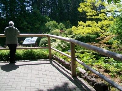
The barren rock face of the quarry presented Jennie Butchart with a challenge. She hung in a bosun's chair to plant ivy in the crevices in the rock walls. — — Map (db m74437) HM
On 1st Street just north of Bevan Avenue, on the left when traveling north.
If the Oceans of the world perish, so shall we. This mural was painted in celebration of the "International Year of the Ocean", and is a brief glimpse into the story of ocean science on the west coast. A mere fraction of the story is . . . — — Map (db m75463) HM
Before 1903 the remains of early Chinese immigrants were buried in the low-lying, southwestern corner of Ross Bay cemetery. This area was often flooded after a heavy rainstorm. In the early 1900s, high winds and waves eroded a few waterfront . . . — — Map (db m75449) HM
Imagine the expanse of water between Fisgard Lighthouse and Albert Head (to your right) filled with ships at anchor. Named “Royal Roads” in colonial times, this was a safe anchorage, a place to wait for daylight, calm seas . . . — — Map (db m99180) HM
On Beach Drive just south of Orchard Avenue, on the left when traveling south.
Turkey Head was known by the indigenous people as Spewhung.
A large shell-midden along this shoreline indicates that this was an ancient village site to which first peoples brought many fish, bird, mammal and plant resources. Food was . . . — — Map (db m75329) HM
On Beach Drive, 0.4 kilometers west of Newport Avenue, on the left when traveling west.
This small islet and the adjacent shore were once an indigenous encampment connected with the village at McNeill Bay, Chikawich, to the west. The people living here ate over 20 species of fish and 15 species of birds, as well as deer, sea . . . — — Map (db m75340) HM
Baptized: March, Cambridgeshire, England
June 7 1817
Died: Victoria, B.C., Canada
July 11, 1894
On August 17 of 1862, Barker struck gold at 52 feet on Williams Creek, Cariboo. The town of Barkerville bears his name. Like many miners he . . . — — Map (db m74827) HM
On Fairfield Road at Shotbolt Road, on the left when traveling east on Fairfield Road.
Peggy Pemberton-Carter met Prince Nicholas Abkhazi, in Paris in 1922. Prince Nicholas, the last surviving son of an ancient line of kings of Abkhazia on the Black Sea, had been living there in exile since escaping the Bolshevik . . . — — Map (db m75253) HM
ca. 1860
[Photo caption reads] A detail of the View of Victoria, 1860.
Major Bay is largely undeveloped.
BC Archives POP01538
1878
[Photo caption reads] Bird's-Eye View of Victoria, Vancouver Island, B.C. 1878, detail.
Drawn . . . — — Map (db m74383) HM
A sports field served James Bay for many years until the Community envisioned a new park space. On August 27th, 2009 City Council adopted the Fisherman's Wharf Management Plan. The plan was completed in two phases and the Mayor celebrated the . . . — — Map (db m74385) HM
On Circle Drive just east of Chestnut Row, on the right when traveling east.
Gaze up into a Giant sequoia. Let your imagination soar. Fully grown, they are the largest living things on the planet. Their ancestors stood among dinosaurs. Today, the Giant sequoia is found naturally in fewer than 100 groves in the Sierra . . . — — Map (db m74141) HM
There are messages in the landscape here, surviving traditional place names, and the soil itself preserves ancient stories waiting to be told.
This is the land of the Lekwungen People, known today as the Esquimalt and Songhees Nations. As . . . — — Map (db m74378) HM
On Crowsnest Highway (Provincial Highway 3) 0.8 kilometers north of British Columbia-Alberta boundary line, on the left when traveling west.
Rivers born in Canada's Rockies
carved passes eastward to Hudson
Bay or westward to the Pacific.
This one was long used by Indians,
but not shown on maps until the
Palliser Expedition of 1860, and
then only from hearsay. Michael
Phillipps . . . — — Map (db m187912) HM
Near Cole Road just south of South Parallel Road, on the right when traveling south.
In 1924, by a system of stream diversions, dams, dykes, canals and pumps, 33,000 acres of fertile land were reclaimed from Sumas Lake. Few areas in B.C. have such rich soil with transportation and markets in close proximity. Produce of the mixed . . . — — Map (db m187960) HM
Near Yellowhead Highway (Provincial Highway 16) at British Columbia-Alberta boundary line, on the right when traveling west.
Named after “Tete Jaune”, blond fur trader at Jasper House, this low pass was favoured by Sandford Fleming in his railway surveys of the 1870's. Rejected by the C.P.R., the route was later used by the Grand Trunk Pacific and the Canadian Northern . . . — — Map (db m187943) HM
On Provincial Highway 3B at Paterson-Trail Highway (Provincial Highway 22), on the right when traveling west on Provincial Highway 3B.
You have entered the crater of an ancient volcano rich in minerals. The waste dumps are the remains of famous Rossland mines staked in 1890 by prospectors passing on the near-by Dewdney Trail. From these fabulously rich workings came 6,000,000 tons . . . — — Map (db m187953) HM
On Vernon-Sicamous Highway (Provincial Highway 97A) just west of Creamery Road, on the left when traveling west.
“And our eyes feasted on the
long stretch of prairies…” wrote
A. L. Fortune, first settler in
this fertile valley, in June, 1866.
The natural meadows, rippling in
tall grasses, were ideal pasture
for cattle and sheep. Later, grain
replaced . . . — — Map (db m187929) HM
On Fairview Road, 0.2 kilometers east of Willowbrook Road, on the right when traveling east.
The 1890's held high hopes for the lode gold of mines such as Stemwinder, Morning Star, and Rattler. By 1902, when the Fairview Hotel or "Big Teepee" burned, the golden years were over. Fairview's population dwindled as miners left for more . . . — — Map (db m188011) HM
On Crowsnest Highway (Provincial Highway 3) 0.2 kilometers west of Observatory Road, on the right when traveling west.
A valley north and south, a sandspit east and west — this was the crossroad of the centuries. Down the valley on Indian trails came the laden horses of the Fur Brigade from 1824 to 1848. Later, miners and settlers streamed northward. Across the . . . — — Map (db m187930) HM
On Crowsnest Highway (Provincial Highway 3) at Kobau Look-Out Forest Service Road, on the right when traveling south on Crowsnest Highway.
The Okanagan nation knows Spotted Lake, just east of here, as K t li lxw. From time immemorial its healing waters and mud were used by First Nations to cure aches and illness, and for spiritual healing. High concentrations of Epsom . . . — — Map (db m187927) HM
On Sea-to-Sky Highway (Provincial Highway 99) 1.2 kilometers north of Copper Drive, on the left when traveling north.
Dr. A.A. Forbes first discovered copper on Britannia Mountain in 1888, leading to the creation of Britannia Mine in 1899. At one time it produced more copper than any mine in the British Commonwealth. Having survived landslide, flood and fire, the . . . — — Map (db m188024) HM
Near Elk Falls Park Road, 0.2 kilometers north of Brewster Lake Road, on the right when traveling north.
On a hot day in July 1938, an ominous smoke pillar near Gosling Lake signalled a forest fire which was to ravage 115 square miles of logged and timbered land. Over 1500 firefighters battled grimly for weeks to save timber and communities. Costs and . . . — — Map (db m188023) HM