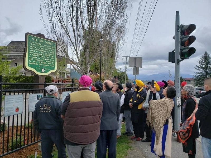
From 1908-1911, determined Sikh Settlers laboured to build this Gurdwara in the face of much racial discrimination. The temple served as a place of solace for new immigrants in difficult times. A National Historic Site, today it stands as a . . . — — Map (db m187881) HM
In 1924, by a system of stream diversions, dams, dykes, canals and pumps, 33,000 acres of fertile land were reclaimed from Sumas Lake. Few areas in B.C. have such rich soil with transportation and markets in close proximity. Produce of the mixed . . . — — Map (db m187960) HM
Chilliwack City Hall
Completed in 1912, this building is the only pre-1930
Canadian municipal hall constructed entirely of reinforced concrete. In size and purpose it is typical of a
class of modestly scaled civic structures . . . — — Map (db m303145) HM
Built in 1861, Christ Church is a fine example of the mid-19th-century revival of mediaeval Gothic forms in religious
architecture. This use of traditional models reinforced the
broader role of the Anglican church as a stabilizing . . . — — Map (db m303143) HM
In 1942, over 21,000 Japanese Canadians were unjustifiably removed from British Columbia's coast. Tashme internment camp held over 2,644 men, women, and children who lived in 347 crude tarpaper shacks. Despite horrible living conditions, the . . . — — Map (db m187902) HM
Early Saturday morning, January 9, 1965, an enormous landslide descended into this valley of the Nicolum Creek, destroying about 3 km of the Hope-Princeton Highway.
Apparently triggered by a minor earthquake, the slide, consisting of more than 46 . . . — — Map (db m161724) HM
A bold venture, this trail crossed the mountains of southern B.C., and kept the wealth of a new land from flowing to the U.S.A. Planned by the Royal Engineers, and built in 1860-61 by Edgar Dewdney, a young engineer, it led over the mountains to . . . — — Map (db m188017) HM
With the first wave of impetuous gold seekers in 1858, the Chinese came to B.C. Following the roving white miners, these industrious and patient people gleaned the gold that others failed to mine. With baskets and hand tools they helped to build the . . . — — Map (db m187906) HM
This was the head of navigation on the Fraser River. Founded in 1848, as a Hudson's Bay Company fur post, Fort Yale later became a roaring gold-rush town and for 20 years was the starting point of the famous Cariboo Wagon Road. Yale faded with the . . . — — Map (db m187996) HM
Construction of the Alexandra suspension bridge was the greatest achievement of one of British Columbia's first civil engineers, Joseph Trutch. Chief Commissioner of Lands and Works after 1864, he sat on the colony's Legislative Council. He led the . . . — — Map (db m187990) HM
By 1868, the gold rushes that had founded British Columbia were over, the public debt was soaring and many were dissatisfied with the colonial government. On September 14, 1868, 26 delegates from all over the colony met at Yale for a convention of . . . — — Map (db m187945) HM