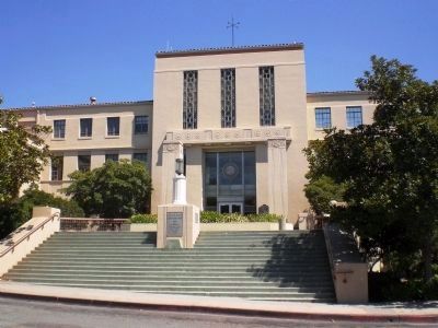
San Luis Obispo was established February 18, 1850, as one of the original counties of California. The first county government was housed in Mission San Luis Obispo de Tolosa. In 1854 county offices were transferred to the Casa Grande Building on . . . — — Map (db m16560) HM
This is the oldest store building along the north coast of San Luis Obispo County. Built in 1852 at Whaling Point, one half mile westward, it was moved in 1878 to its present location. Operated by the Sebastian family for half century, it is now . . . — — Map (db m50544) HM
Pismo clams (Tivela stultorum) were harvested by the millions on Pismo Beach and supported a thriving commercial and recreational fishery. Early clammers would use horse-drawn plows to find Pismo clams in the sand. From 1916 to the closure of the . . . — — Map (db m225445) HM
Few and Far Between
By the 1860s most land along California’s central coast was privately owned, but large territories farther inland were still unclaimed. A few hardy cowboys and stockmen began moving herds of cattle and sheep onto the . . . — — Map (db m249388) HM
An inspiring and varied history of the Mennonites in the Paso Robles area began in 1896. Pioneers Jacob Hege and Jacob E. Claassen came to this area to evaluate the land. They decided to settle east and west of Paso Robles. Mr. Hege liked the . . . — — Map (db m73175) HM
A Spanish mission founded by Fray Junipero Serra, O.F.M., First president of the California missions. This was the fifth in a chain of 21 missions stretching from San Diego to Sonoma. Built by the Chumash Indians living in the area. Its combination . . . — — Map (db m27237) HM
This Southern Pacific Railroad Station was the center of most of the commercial and transportation activities in South San Luis Obispo county from 1904 until the 1950’s. Retired from service in 1975. It has been moved 400 yards north of the . . . — — Map (db m103007) HM
On this site, the storied original Andrews Hotel stood. The grand opening of that remarkable structure was celebrated July 3, 1885. Nine and one half months later, on Palm Sunday, April 18, 1886 it burned to the ground. On the ashes, the present . . . — — Map (db m16502) HM
An important mariner's landfall for over 300 years, chronicled in the diaries of Portola, Fr. Crespi and Costanso in 1769 when they camped near this area on their trek to find Monterey. Sometimes called the "Gibraltar of the Pacific". It is the last . . . — — Map (db m24795) HM
This waterhole, only one in the sand dune area of Death Valley, was at the junction of two Indian trails. During the bonanza days of Rhyolite and Skidoo it was the only known water source on the cross-valley road. When sand obscured the spot, a . . . — — Map (db m94591) HM
The word morro means domed rock, or turban in Spanish. When explorer Juan Cabrillo sailed into Estero Bay in the year 1542, he gave the dramatic Morro Rock its apt name.
Prior to Cabrillo's arrival, California Indians made this area . . . — — Map (db m298385) HM
On May 11, 1889, with one million bricks piled at this site, the laying of the foundation of this famous hotel was begun.
In November of 1889, the El Paso de Robles Hotel Company was incorporated with five stockholders: Drury and Louisa James, . . . — — Map (db m60007) HM
In 1953, the Hearst Corporation donated the area comprising William Randolph Hearst Memorial Beach to San Luis Obispo County in memory of William Randolph Hearst.
In 1970, the property and pier were transferred to the state of California. . . . — — Map (db m297132) HM
Lost Linne
In the 1880s the colony of Linne was established a few miles east of Paso Robles. The Amerikanska Emigrant Kompaniet enticed Swedish immigrants to purchase land – sight unseen – by mail. Advertisements portrayed Linne as thriving . . . — — Map (db m249385) HM
Thin black lines indicate changes in relevance. Between each pair of lines entries are ordered geographically but all have the same relevance.
* Inflectional forms of words are their plurals, singulars, and possessives as well as gramatical tenses and similar variations.