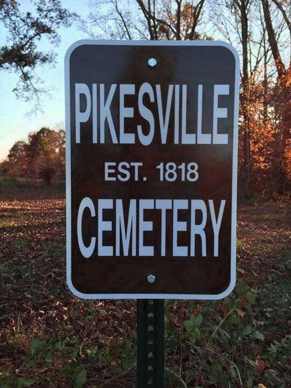
The proprietary town of "Pikesville" was established here with 10 streets and public square in August, 1818, east of Pikesville Branch and north of "Old Pikeville Rd" on 75 acres of land granted to Thomas Flippin in 1798. Pikesville was narrowly . . . — — Map (db m276682) HM
South of "Old Pikeville Rd" and Thomas Flippin's land was a military grant of 1,800 acres awarded to Virginia Navy Captain Thomas Lilly for his service in the American Revolutionary War, assigned to Charles Copland (1,442 acres) and William . . . — — Map (db m238141) HM
By 1798, pioneers had begun settling in this area. Around 1835, a small community was formed and named Gamaliel, after a teacher in the New Testament. In 1836, John Hayes and James Crawford donated 10 acres of land for community development. On this . . . — — Map (db m81344) HM
Named by early pioneers traversing thru the region, this designated Indian trail led these settlers into this area during Western migration. This mainly Cherokee trail, (although used some by the Shawnee), originated at Rockwood in Roane County, . . . — — Map (db m180021) HM
Hannah Boone was the youngest child born to Squire Boone and Sarah Morgan Boone.
The Boones were members of the Friends Society (Quakers) and Squire served as first a trustee and then an overseer of the Oley Meeting. The Boones moved to the Yadkin . . . — — Map (db m184060) HM
Twenty-two Kentucky courthouses were burned during Civil War, nineteen in last fifteen months: twelve by Confederates, eight by guerrillas, two by Union accident. See map on reverse side. Courthouse and other buildings in Tompkinsville burned by . . . — — Map (db m79184) HM
Historians agree it is impossible to know exactly how many Revolutionary War veterans migrated to what would become Monroe County. While it was a practice of the newly formed United States government to grant unsettled land to these veterans, not . . . — — Map (db m184062) HM
Ephraim Dicken was truly dedicated in his service to this country during the American Revolution. He was drafted into the Culpeper County Militia in 1781 and at the completion of that tour of duty he reenlisted as a substitute for Michael Wilhite; . . . — — Map (db m184059) HM
McMillian's Landing was a crossing point for both Union and Confederate troops making their way between Kentucky and Tennessee. Both forces viewed Monroe County and Tompkinsville as a key position for entry to central Kentucky and points northward. . . . — — Map (db m100955) HM
The Old Monroe County Courthouse, designed by prominent Southern architect Andrew Bryan, was built between 1903 and 1904 during the tenure of Probate Judge Nicholas Stallworth. One of two buildings of this type designed by Bryan (a sister courthouse . . . — — Map (db m47688) HM
Camp established by Union Army to train and drill troops and as a place of rendezvous. In October 1861, Col. S. S. Stanton, 25th Tennessee Infantry, Confederate Army, was ordered to capture the encampment. He marched his regiment into the county and . . . — — Map (db m236252) HM
John M. Fraim organized the 9th Kentucky Infantry (USA) at Camp Anderson in 1861.
Monroe County Cemetery Book Volume 2, page 98-99. — — Map (db m127889) HM
James Chism, married Mary Howard, the daughter of Obadiah Howard. Born in Virginia, James enlisted as a Private in the 2nd Virginia Regiment and served until the end of the Revolutionary War. Shortly thereafter, he moved his family to Kentucky where . . . — — Map (db m154976) HM
Born, Jefferson County, Kentucky, April 24, 1783 a distinguished son of the American frontier, he served his nation as a soldier, physician, and legislator. Following service as an officer in the Virginia Militia, and as a surgeon in the War of . . . — — Map (db m34486) HM
The word meetinghouse means a building for religious assembly (especially Nonconformists, ex. Quakers) This term is used repeatedly throughout the Book of Records of Mill Creek Baptist Church; spelled meetinghouse and meeting house.
When . . . — — Map (db m183993) HM
Famous Tree
In 1894, a huge Tulip Poplar tree was felled about 1½ miles south of this site. It measured 11 feet in diameter, 35 feet in circumference. Two six-foot saws were welded together to cut it. A four-foot log from the tree was . . . — — Map (db m237825) HM
In 1861, during Civil War, land was donated by J.B. Evans for burial of Union soldiers. By end of the war, it contained 115 troops who died in this region. Due to small size and remote location, most soldiers moved to Nashville Nat'l Cemetery, . . . — — Map (db m56147) HM
The oldest graves at Old Mulkey aren't at Old Mulkey, they are at Mill Creek. It's not the
Mill Creek built in 1811 but the Mill Creek built in 1798. If you are confused, you aren't
alone. In order to regain your bearings you must remember the . . . — — Map (db m183988) HM
Soldiers and Sailors Park. The oldest public park in Monroe County, Soldiers and Sailors Park was created in 1909 when the half mile long riverfront parcel was purchased by the City of Monroe from the Ilgenfritz family for $700. This came . . . — — Map (db m170067) HM
During late June 1863 Confederate Gen. John Hunt Morgan's scouts and portions of his nine regiments moved into Cumberland County preparing for the Great Raid in Kentucky, Indiana, and Ohio.
The 1st Brigade, numbering 1,450 cavalrymen under Col. . . . — — Map (db m98882) HM
Hubert Küenster immigrated to America from Germany in May 1852. He came to St. Louis, where he was a clerk in Dr. Berghoff’s drug store for a year. Some of his countrymen were residents in the neighborhood of Waterloo, and at their request, Küenster . . . — — Map (db m143986) HM
Mexico and Audrain County have some rich history, tied into the Civil War. This area was of vital strategic importance to both sides, politically and militarily, during the War. Politically, Southern sympathies ran deep in this area, the heart of . . . — — Map (db m288549) HM
Colonel William R. Morrison
One of Waterloo's most renowned and distinguished citizens was Colonel William R. Morrison, to whom the city owes its library.
The library building at the corner of Library and Park Streets was Colonel . . . — — Map (db m219967) HM
Thin black lines indicate changes in relevance. Between each pair of lines entries are ordered geographically but all have the same relevance.
* Inflectional forms of words are their plurals, singulars, and possessives as well as gramatical tenses and similar variations.