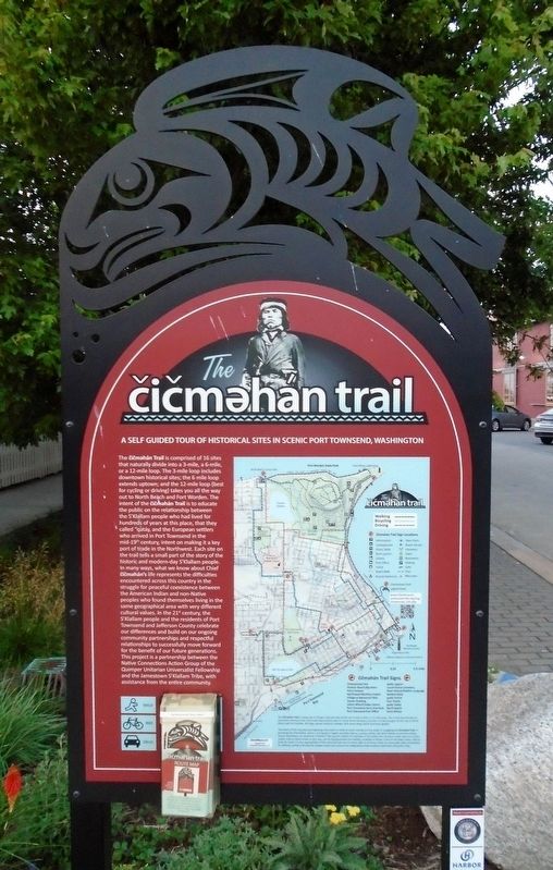
The Čičməhán Trail, Port Townsend, Washington Historical Markers
An interpretive trail with 18 stops throughout the City of Port Townsend, Washington,
that chronicles the history of the S'Klallam people and the European settlers as they worked to co-exist. In the 21st century, the S'Klallam people and residents of Port Townsend and Jefferson County celebrate their differences and build on their ongoing community partnerships and respectful relationships to successfully move forward for the benefit of future generations.
The čičməhán Trail is comprised of 16 sites that naturally divide into a 3-mile, a 6-mile, or a 12-mile loop. The 3-mile loop includes downtown historical sites; the 6 mile loop extends uptown; and the 12-mile loop (best for . . . — — Map (db m179367) HM
Port Townsend's first stone building was completed in 1874 for Enoch S. Fowler. It served as the Jefferson County Courthouse from 1880-1892 (and was also used as a store, performance hall, Masonic Temple, seamen's chapel, and, since 1916, home of . . . — — Map (db m179527) HM
Chetzemoka's Big Heart, a story by Mary Ann Lambert (1879-1966, also the author of The 7 Brothers of the House of Ste-Tee-Thlum) of the Jamestown S'Klallam Tribe's Lambert/Reyes family, illustrates Chetzemoka's heart, and the power and respect he . . . — — Map (db m179745) HM
Before the shoreline was filled to create the marina, Point Hudson was a popular clamming beach for S'Klallams and a landing point for tribes from locations across the Olympic Peninsula.
Change began as soon as settlers arrived, but grew . . . — — Map (db m179751) HM
This site is the last remaining vestige of the natural prairie that spanned the qatáy Valley, between wetland areas. Relatively dry, upland areas of the valley provided camas bulbs (qʷɬúʔi in Klallam and Camassia quamash in Latin) . . . — — Map (db m179762) HM
After signing the 1855 Point No Point Treaty, it was clear that there had been some misunderstandings, and the federal government was failing to follow through on its funding promises. Some of the Tribes of Washington rose up against what they saw . . . — — Map (db m179769) HM
Looking south, view Kilisut Harbor and Indian Island, now Naval Magazine Indian Island. Archeological evidence shows that Indian Island was an important location to the ancestors of the S’Klallam and Chimacum people for over 1,500 years. For . . . — — Map (db m179600) HM
The village of qatáy once sat near the bluff at what is now the corner of Monroe and Water Streets. It was the principal village of S'Klallam people at the time of the treaty signing, and home to their Chief, čičməhán . . . — — Map (db m179731) HM