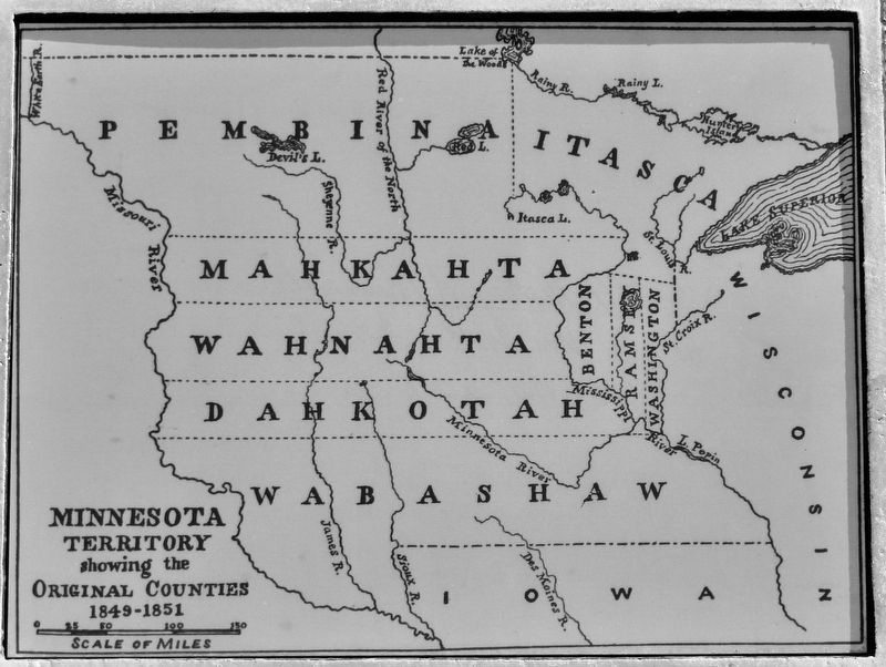
On 1st Street North just south of 3rd Avenue North, on the right when traveling north.
Minnesota Territory 1849-1858On March 3, 1849, during his last hours in office. President James K. Polk signed a bill adding a new name to the American political landscape — Minnesota Territory. A vast land, it stretched from the St. . . . — — Map (db m205213) HM
On West Front Street west of Elm Street, on the right when traveling west.
Washington Railroad Depot Burns
Confederate General Marmaduke's forces were advancing on Washington as October 1864 approached, with fear and widespread panic among the town's residents. Many citizens crossed the river to evade the advance of . . . — — Map (db m239173) HM
On West Kennewick Avenue at South Auburn Street, on the left when traveling west on West Kennewick Avenue.
P.J. Murphy Building (Roxy Theatre)
101 W. Kennewick Avenue
The first theatre building in Kennewick was The Liberty Theatre, constructed in 1920 for P.J. Murphy. The Liberty became The Roxy in 1939 when the theatre changed hands. It . . . — — Map (db m297445) HM
On SW 8th St at SW Madison Ave, on the right when traveling north on SW 8th St.
The First Congregational Church was built here in 1917 to serve a congregation that had outgrown its original 1889 building at Third and Jefferson streets. Designed by architect Roy Dobell, a former instructor at Oregon Agricultural College (OAC, . . . — — Map (db m117268) HM
On SW Madison Ave at SW 8th St, on the right when traveling west on SW Madison Ave.
Fred J. Porter was the great-grandson of Benton County pioneer, Johnson Mulkey.
In the winter of 1845, Mulkey filed a land claim for 640 acres along Oak Creek, on the north side of Baldy Mountain. This was only a few months after Joseph Conant . . . — — Map (db m117266) HM
On North Main Street (Business U.S. 65) at West Rush Avenue, on the right when traveling south on North Main Street.
Modern historical research has yielded information which was not readily available to those who designed the 1955 monument. Here is presented updated information and a modified more accurate map of the emigrants' route. Dedicated . . . — — Map (db m225248) HM
On Cemetery Circle, on the right when traveling east.
In memory to those soldiers
who fought for American
Independence during the
Revolutionary War.
These veterans of the
American Revolution came to
live and died in Northwest
Arkansas
Benton County . . . — — Map (db m21227) HM WM
Near Washington Route 225 1 mile west of Route 240, on the left when traveling south.
The Longmire Wagon Train
In 1853, Congress authorized the survey and construction of a road from the Snake and Walla Walla Rivers through the Cascade Mountains. Secretary of War Jefferson Davis ordered Captain George McClellan to construct . . . — — Map (db m297221) HM
Thin black lines indicate changes in relevance. Between each pair of lines entries are ordered geographically but all have the same relevance.
* Inflectional forms of words are their plurals, singulars, and possessives as well as gramatical tenses and similar variations.