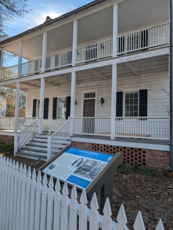
On Eden Street at Pollock Street, on the right when traveling south on Eden Street.
Union forces commandeered private dwellings in and around New Bern. They served as barracks, hospitals, headquarters and jails. The Jones House (built ca. 1809) served as a jail. According to local tradition, Union soldiers jailed a young Carteret . . . — — Map (db m294040) HM
Near 119th Street W. south of Cortez Road (Florida Highway 684), on the left when traveling south.
Cortez has been a commercial fishing village since 1888, when a handful of families came here from Carteret County, North Carolina.
Today the unincorporated community of Cortez is less than two square miles and has a population of . . . — — Map (db m309271) HM
On Turner Street north of Middle Lane, on the right when traveling north.
Before the outbreak of the Civil War in 1861, local citizens formed the Beaufort Harbor Guards. These Confederate sympathizers, led by Capt. Josiah Pender, occupied Fort Mason when the sole guard, U.S. Army Ordnance Sgt. William Alexander, quietly . . . — — Map (db m77029) HM
On U.S. 70 east of Merrimon Road, on the right when traveling east.
Ocracoke is an overwhelming step back in time, a mix of old traditions and community spirit infused with a steady flow of visitors from around the world. No community loves a good story more than Ocracoke, and locals can tell a tale with great . . . — — Map (db m212921) HM
On U.S. 70 at Otway Farm Road, on the right when traveling east on U.S. 70.
Otway’s first residents migrated northward from the Straits area in the 1700s. The rich farmland and access to water teeming with fish, crabs, and oysters made it desirable for homesteading.
A 1932 Beaufort newspaper recounts a fall ritual . . . — — Map (db m212875) HM
On Hill Road east of U.S. 70, on the left when traveling east.
In the 1820s, Smyrna was once called Jarrett’s Bay. It included Williston and an area to the south called Tusk. Community members renamed in Smyrna around 1836. Smyrna was one of the few communities whose name was not changed by the US Post Office. . . . — — Map (db m212939) HM
On U.S. 70 north of Emilee Lane, on the left when traveling south.
The first deeded property was in 1752 to William Salter. The early settlers called this area, Piney Point, for the piece of wooded land which jutted out into Core Sound and served as a navigational day mark. With the establishment of the post office . . . — — Map (db m212872) HM
On Straits Road at Black Bear Lane, on the right when traveling south on Straits Road.
This region from the mouth of North River to Core Sound was known is colonial times as, “The Straits of Core Sound”. Eventually, three different communities would evolve from this area: Straits, Gloucester, and Marshallberg.
New Englanders were . . . — — Map (db m213052) HM
On Pilottown Circle north of State Highway 12, on the right when traveling south.
Ocracoke is an overwhelming step back in time, a mix of old traditions and community spirit infused with a steady flow of visitors from around the world. No community loves a good story more than Ocracoke, and locals can tell a tale with great . . . — — Map (db m212919) HM
Thin black lines indicate changes in relevance. Between each pair of lines entries are ordered geographically but all have the same relevance.
* Inflectional forms of words are their plurals, singulars, and possessives as well as gramatical tenses and similar variations.