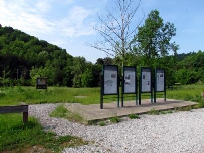
Near Kentucky Route 114 0.1 miles east of Route 104, on the right when traveling east.
Middle Creek was Eastern Kentucky's largest and most significant Civil War battle. It was fought during the first phase of the war, when it was still doubtful which government would control the region. The Confederates never regained the strategic . . . — — Map (db m69136) HM
On 15th Street at Front Street, on the left when traveling north on 15th Street.
Welcome to Boyd County, Kentucky, home of the Judds (the famous mother/daughter Nashville award winning duo). US 23 was named "The Country Music Highway" in 1994 in recognition of the numerous country music stars from the region. In 2002, through . . . — — Map (db m228072) HM
On U.S. 23/460 at Mare Creek, on the right when traveling south on U.S. 23/460.
In 1845, Ky. Legislature put Mare Creek farm of Tandy R. Stratton in Floyd County. In Pike since it was formed from Floyd, 1821. Strip separates farm area from Floyd, forming "island" in Pike. Reported to be the only instance in U.S. His grandfather . . . — — Map (db m170890) HM
This National Cemetery is one of the original 7 established in 1862 by Congress. 5.46 acres were purchased from Dr. Charles Bowman Dec. 1862 for burial of Union and Confederate casualties. There are over 5,000 interments from 7 conflicts. Civil War, . . . — — Map (db m26409) HM
Near Kentucky Route 114 0.1 miles east of Route 404, on the right when traveling east.
During the first few months of the war, Kentucky remained neutral. The August 1861 election, however, sent a Unionist majority to Frankfort. The new legislature voted to suppress the rebellion, and Federal marshals began arresting men suspected of . . . — — Map (db m69137) HM
On Bob Amos Drive at Cedar Creek Road ( Route 1384), on the left when traveling south on Bob Amos Drive.
Welcome to Pike County, Kentucky, home of Patty Loveless.
US 23 was named “The Country Music Highway” in 1994 in recognition of the numerous country music stars from the region. In 2002 through the efforts of Congressman Harold “Hal” Rogers and . . . — — Map (db m212048) HM
On N. Arnold Avenue south of Highway 114, on the left when traveling north.
(Side One)
The Burns House:
Garfield’s Headquarters Following the Battle of Middle Creek
Built in 1857 by Prestonsburg attorney John M. Burns, the house later known as “The Garfield Place” stood near this spot. . . . — — Map (db m97224) HM
On Huffman Avenue east of Main Street, on the right when traveling east.
John Paul Riddle
Riddle was born May of 1901 to two teachers, Tandy and Bessie Riddle. His mother passed in 1903, and he spent at least some time living with his paternal grandmother on Shelby Creek. It's said that he dreamed of flying even . . . — — Map (db m306441) HM
Near Ohio River Scenic Byway 0.1 miles west of Main Street, on the left when traveling west.
The Ohio River between Clark County, Indiana and Louisville, Kentucky, provides a treasure of historic bridges. The first bridge to your left is the George Rogers Clark Memorial Bridge, completed in Art-Deco style in 1929. Its original name was the . . . — — Map (db m198392) HM
On Ekin Avenue east of Thomas Street, on the left when traveling east.
An act of Congress in 1862 established fourteen national cemeteries for the interment of casualties from the Civil War. The first National Cemetery was at Gettysburg, Pennsylvania. The New Albany National Cemetery was one of the first seven . . . — — Map (db m68540) HM WM
On East Water Street 0.2 miles west of East 6th Street, on the right when traveling west. Reported missing.
The double-decked Sherman Minton Bridge was constructed to carry interstate I-64 traffic between Kentucky and Indiana. It was the work of the Louisville firm of Hazelet & Erdal, designers of the later John F. Kennedy Memorial Bridge, which connects . . . — — Map (db m198414) HM
On KY-1428 0.6 miles east of KY-302, on the right when traveling east.
Doris Faye Burchett • James Edison Carey • Glenda May Cisco • Kenneth Forrest Cisco • Paulette Cline • Sandra Faye Cline • Linda Darby • Emogene Darby • James Edward Goble • John Spencer Goble • Anna Laura Goble • Jane Carol Harris • Margaret Louise . . . — — Map (db m212046) HM
On Main Street (Kentucky Route 40) west of Holy Street, on the right when traveling west.
County Named, 1870
For Col. John P. Martin, born Va. 1811, came to Kentucky in 1828. State House of Representatives, 1841-43; U.S. Congress, 1845-47. State Senator, 1857-61. Delegate from State at large to Democratic National Convention, . . . — — Map (db m136957) HM
Thin black lines indicate changes in relevance. Between each pair of lines entries are ordered geographically but all have the same relevance.
* Inflectional forms of words are their plurals, singulars, and possessives as well as gramatical tenses and similar variations.