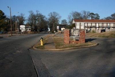
On 2nd Avenue South, on the right when traveling north.
Founded in 1841 at Marion in Perry County by Alabama Baptists, Howard College was named for British prison reformer John Howard.
The liberal arts college moved to this site in 1887 and relocated to its present campus in Homewood, Alabama in . . . — — Map (db m26693) HM
Near East M.L.K. Drive at South Ashley Street, on the right when traveling east.
In September 1951, King enrolled in Boston University's Ph.D. program in systematic theology. King met Coretta Scott while at Boston University, and they were married on June 18, 1953, in Perry County, Alabama. He received his Ph.D. in June 1955. . . . — — Map (db m258887) HM
Near Mill Street 0.2 miles south of Walnut Street (State Route 25), on the right when traveling south.
Centreville Cemetery is older than the town of Centreville itself. The earliest known burial is that of Willie Coleman, dated 1822, and Centreville was established in 1823. One half of the cemetery, known as Cooper Cemetery, contains mostly the . . . — — Map (db m156403) HM
On South Jackson Street at Tuscaloosa St. on South Jackson Street.
In 1900, Marshall Moore and his wife, Agnes V. McClain commissioned Joseph G. Nesbitt, Sr., an African-American contractor/builder, to construct this Victorian period cottage. The Moores, among the first graduates and early faculty members of . . . — — Map (db m310804) HM
On Bessie Munden Road 0.2 miles west of Alabama Route 221, on the right when traveling west.
This 22-acre park is named for its founder, Bessie W. Munden, a noted African American educator and civic leader in Wilcox County. Dedicated on October 25, 1959, Bessie W. Munden Recreational Park is significant as one of Alabama's oldest . . . — — Map (db m203708) HM
On Farm to Market Road 2710 at County Route 4126, on the left on Route 2710.
In 1879 William Lee Henderson (b. 1808), his wife Eleanor Shelby (b. 1817) and their nine children moved from their Alabama home to Texas by wagon train. Church records indicate worship services were held in a shelter built by the Hendersons shortly . . . — — Map (db m296443) HM
Near Sam Houston Avenue (State Highway 75) at 19th Street.
This building is named in honor of the person who was the blacksmith and factotum for the Houston Family until emancipation.
Joshua was considered family, taking "Houston" for his last name after emancipation.
As a blacksmith, he made . . . — — Map (db m195310) HM
On Cahaba Road (County Road 1) at East Avenue, on the left when traveling west on Cahaba Road.
First Colored Missionary Baptist Church was established in Uniontown in 1867. The church founder, John Dozier was a former slave and a native of Virginia. He came to Alabama in search of his wife and son who had been sold to a plantation owner. . . . — — Map (db m296984) HM
On 10th Street at Avenue O, on the right when traveling west on 10th Street.
Joshua Houston, trusted former servant to General Sam Houston and his wife, Margaret, was one of the first freedmen to purchase real estate from M.C. Rogers in the surrounding area that came to be known as "Rogersville". The homestead at Avenue O . . . — — Map (db m180426) HM
On Washington Street at Green Street, on the right when traveling north on Washington Street.
The site that became Marion was settled by Michael McElroy, traditionally known by his alias, Michael Muckle, around 1817. McElroy sold his property, which had become known as Muckle’s Ridge, to Anderson West in 1818. West and his wife moved into . . . — — Map (db m70089) HM
On County Road 838 0.2 miles east of County Road 836, on the right when traveling east.
This cemetery began with the burials of Mary C. Justice (d. 1861) and Roland Pair (d. 1865). It is located on land later owned by John Collins Oakes and his wife Winnie (Radford), who migrated here from Perry County, Alabama, in the years following . . . — — Map (db m293359) HM
On Magnolia Street south of Watts Avenue, on the left when traveling south.
Jackson County has seen many governments. The first European settlement in the Mississippi gulf coast area was at present-day Ocean Springs in 1699. The French found the area already occupied by several American Indian tribes, with the primary . . . — — Map (db m117281) HM
On Pickens Street at Jefferson Street, on the right when traveling north on Pickens Street.
On February 18, 1965, a night march was planned to support activist James Orange, incarcerated in the Perry County Jail. Preachers led participants from this church, Zion Chapel Methodist, the physical and spiritual base of the movement in Marion. . . . — — Map (db m116896) HM
On Pickens Street at Green Street, on the right when traveling north on Pickens Street.
Jailed as a leader in the
struggle for voting rights
Perry County, Alabama
- 1965 -
"Hey Leader!"
SCLC/W.O.M.E.N., INC.
Women's Organizational Movement for Equality Now
Evelyn G. Lowery, . . . — — Map (db m117076) HM
On Indiana Route 66 just east of County Road 1290E, on the right when traveling east.
These markers were funded with a grant from Federal Highway Administration through the National Scenic Byways Program.
The Hoosier National Forest - Then and Now
This area has been inhabited continuously by humans for 12,000 years. . . . — — Map (db m178232) HM
Thin black lines indicate changes in relevance. Between each pair of lines entries are ordered geographically but all have the same relevance.
* Inflectional forms of words are their plurals, singulars, and possessives as well as gramatical tenses and similar variations.