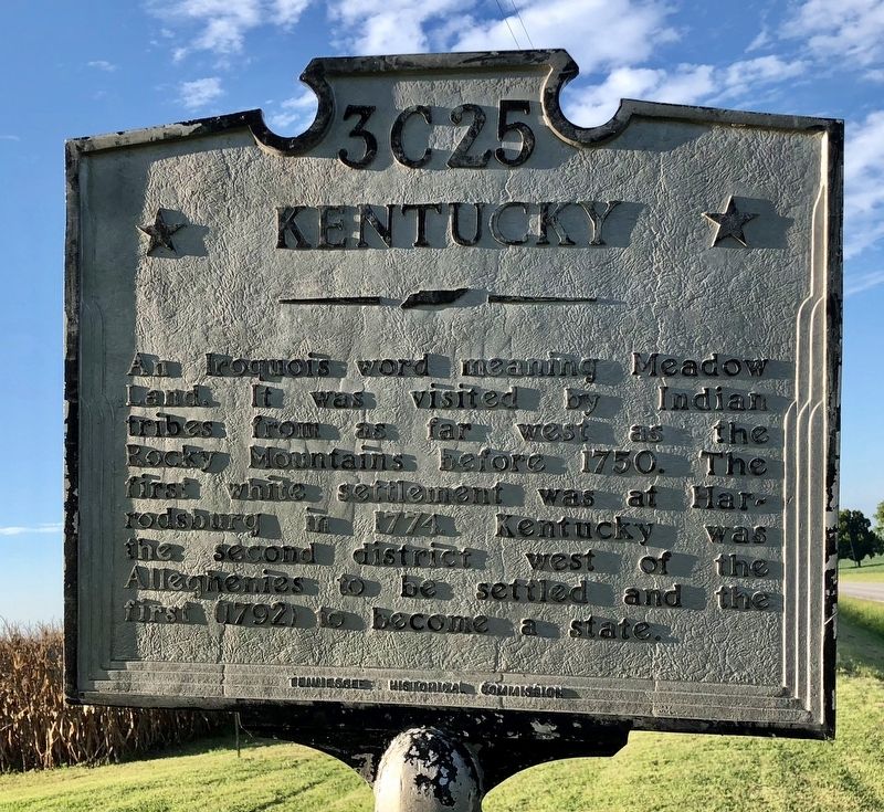
On Tennessee Route 49 0.5 miles south of State Line Road, on the right when traveling south.
★ Tennessee ★
Robertson County
Established 1796: named in honor of
James Robertson
Leader in establishment of the Watauga Settlement in East Tennessee. In 1778, explored the Cumberland country; in 1779 led an . . . — — Map (db m123302) HM
On 7th Avenue North, on the left when traveling south.
Tennessee became one of the three largest tobacco- producing states. Wessyngton in Robertson County was the largest U.S. tobacco plantation. — — Map (db m215509) HM
On U.S. 41 0.5 miles east of Foster Road, on the right when traveling west.
Joseph Wellington Byrns was born in 1869 in a small cabin near Cedar Hill. A graduate of the Law Department of Vanderbilt University, he served in both chambers of the Tennessee General Assembly. Elected to the United States House of . . . — — Map (db m68595) HM
Near South 2nd Street (Tennessee Route 76) south of Franklin Street, on the left when traveling south.
Clarksville, located along the banks of the Cumberland River, was established by John Montgomery and Martin Armstrong in 1784, before Tennessee became a state. It was governed by the Clarksville Compact of 1784 and named for General George Rogers . . . — — Map (db m169076) HM
On 7th Avenue North north of Union Street, on the left when traveling north.
The tallest office building in Nashville was purchased from American General Life and Accident Insurance Company by the State of Tennessee on January 3, 1994.
It was originally built in 1970 as the National Life Center, home of the National Life . . . — — Map (db m166570) HM
Near Boonville Road 0.1 miles east of Austins Colony Parkway.
Eli Seale 1793-1857
Elias (Eli) Seale was born in North Carolina in 1793. He served as a fifer in the War of 1812 in Mississippi, and in 1835 moved with his three brothers and his family from Alabama to Texas. He received his Mexican . . . — — Map (db m170484) HM
On Tom Austin Highway (U.S. 431) south of Abednego Road, on the right when traveling south.
★ Davidson County ★
Established 1783; named in honor of
Brig. Gen. William Lee Davidson
of North Carolina. Distinguished
officer in the Revolutionary War.
Served with the Army at Valley
Forge. Killed in action at . . . — — Map (db m151813) HM
Near Cox Cemetery Road 0.2 miles south of Farm to Market Road 589.
William Driscol Cox (1839-97) and his wife Amanda (Shugart) moved with their family from Tennessee to Texas in 1872. Cox taught in Robertson County then (1876) bought and moved to a 300-acre ranch at this site. He taught the first school in Sidney . . . — — Map (db m162130) HM
On Woodhead Street at Harold Street, on the left when traveling north on Woodhead Street.
Obedience Smith was a pioneer of three American frontiers: Kentucky, Mississippi, and Texas. Newly widowed, she arrived in the Mexican state of Coahuila y Texas from Jackson, Mississippi just weeks before the Texas Declaration of Independence on . . . — — Map (db m269167) HM
On U.S. 41 east of Keysburg Road (County Route 1884), on the right when traveling west.
The Edgefield and Kentucky Railroad was vitally important for transporting soldiers and supplies. Confederate forces constructed Fort Redmond to protect and defend the railroad bridge a mile northwest of here, near the confluence of the Red River . . . — — Map (db m82327) WM
On W. Court Square at W. 6th Avenue, on the right when traveling north on W. Court Square.
Robertson County was established April 9, 1796, during the first session of the General Assembly of Tennessee. The act provided commissioners to establish the county government system and raise money to build a courthouse and jail. Court meetings . . . — — Map (db m84493) HM
Near Boonville Road 0.1 miles east of Austins Colony Parkway.
"Welcome to My Town"
Father of Brazos County
Harvey Mitchell was born in 1821 in Tennessee. Because his parents could not afford to send him to college, the ambitious 18 year old came to Texas in 1838. From 1839 to 1842, . . . — — Map (db m170405) HM
On Interstate 30 Frontage Road 0.2 miles west of Division Street, on the right when traveling west.
"Gone to Texas" was the popular slogan for settlers during the 1830s who immigrated from numerous countries and states to the newly formed Republic of Texas (1836-1846). Although the Republic of Texas struggled, the desire for vast amounts of cheap . . . — — Map (db m285487) HM
On Tennessee Route 49 at Old Coopertown Road, on the right when traveling north on Tennessee Route 49.
2 miles S.E., along Battle Creek in Jan. 1780, settlers fleeing from Renfro's Station on Red River about 17 miles away, were caught by Indians and massacred. The sole survivor was a widow named Jones who made her way 4 days later into a Settlements . . . — — Map (db m123306) HM
Thin black lines indicate changes in relevance. Between each pair of lines entries are ordered geographically but all have the same relevance.
* Inflectional forms of words are their plurals, singulars, and possessives as well as gramatical tenses and similar variations.