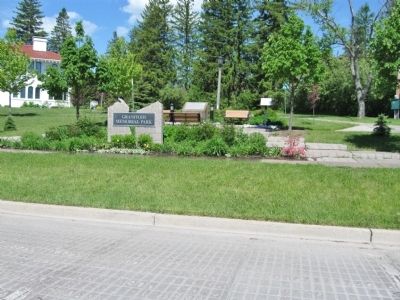
On East 7th Street at East Clover Street on East 7th Street.
The streets of this Duluth neighborhood are the first concrete pavements constructed in Minnesota. They were built of portland cement concrete in 1909 and 1910 and ushered in the era of modern roads and streets in the state. A distinctive feature of . . . — — Map (db m44081) HM
On West 3rd Street (State Highway 23) west of 130th Avenue West, on the right when traveling west.
Fond du Lac was incorporated in 1857 and became a part of the City of Duluth in 1895. This is the site of a major Chippewa Indian settlement from the sixteenth through the nineteenth centuries and is situated on the early canoe route along the St. . . . — — Map (db m43723) HM
On County Highway 112, on the left when traveling east.
This 28 ton piece of magnetic taconite was removed from the Peter Mitchell Mine near the area where Peter Mitchell, in 1871, put down the first recorded test pit on the Mesabi Range. Pit location: 6,246 yards 40 degrees east of south from this . . . — — Map (db m207684) HM
On County Road 526, off of Minnesota 169 (State Highway 169), on the right when traveling west on County Road 526, off of Minnesota 169.
On October 28, 1865, geologist Henry H. Eames returned to St. Paul after initiating a survey of the mineral wealth present in the Lake Vermilion area only to find an abundance of rumors concerning a valuable gold strike on the shores of that . . . — — Map (db m313350) HM
On Poirier Road, on the left when traveling south.
Named for Charlemagne Tower, one of the developers of the Vermilion Range and Duluth and Iron Range Railroad. It was incorporated as a village in 1884 and as a city in 1889. A saw mill was established here in 1882.
An Indian settlement was . . . — — Map (db m207695) HM
Near Congdon Boulevard (North Shore Drive) (State Highway 61) at McQuade Road, on the left when traveling north.
Storms can quickly and unpredictably pose dangerous threats to small and large vessels on Lake Superior. McQuade Small Craft Harbor offers lake access and a safe haven for boaters and anglers along the shoreline between Duluth-Superior Harbor and . . . — — Map (db m266792) HM
Near South Lake Avenue, on the left when traveling south.
The near-by canal marks the site of Little Portage on Minnesota Point crossed on June 27, 1679 by Daniel De Gresolon, Sieur Du Lhut, a gentleman of the Royal Guard of Louis XIV on his way to explore the Upper Mississippi. — — Map (db m2876) HM
On Bodas Road (County Road 95) 0.2 miles east of Scout Camp Road (County Road 536), on the left when traveling east.
“Politics is not just about power and money games, politics is about the improvement of peoples lives, about lessening human suffering in our world and bringing about more peace and justice.”
Near this site on October 25, . . . — — Map (db m2891) HM
On County Road 393 1.4 miles south of U.S. 98, on the right when traveling south.
Gulf Cemetery was established circa 1910 when the town of Santa Rosa was established on Hogtown Bayou. The town's first families began to bury their loved ones at this site, the area's highest elevation with a view of the Gulf of Mexico. The . . . — — Map (db m78730) HM
On Main Street (County Road 708) just east of Mountain Avenue, on the left when traveling east.
This is magnetic TACONITE — part of Minnesota's iron formation and in many ways similar to other iron-bearing materials found in the United States and throughout the world. Forty years of work in mining firms' laboratories and at the University of . . . — — Map (db m155587) HM
On East 1st Street at North 2nd Avenue East, on the right when traveling west on East 1st Street.
Lynching in America. Thousands of African Americans were the victims of lynching and racial violence in the United States between 1877 and 1950, including in St. Louis County, MN. Lynching of African Americans during this era was a form of . . . — — Map (db m204590) HM
Times were tough in the life of an immigrant farmer in northeastern Minnesota. Subsistence farming was a way of life that had gone on for centuries in Finland. Immigrants knew what was needed to survive in the harsh climate of the area. All family . . . — — Map (db m127866) HM
Thin black lines indicate changes in relevance. Between each pair of lines entries are ordered geographically but all have the same relevance.
* Inflectional forms of words are their plurals, singulars, and possessives as well as gramatical tenses and similar variations.