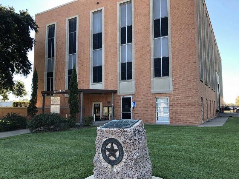
On Austin Street (Business U.S. 290), on the right when traveling west.
Created from Austin and Grimes counties, April 28, and organized Aug. 16, 1873. Named for Edwin Waller (1800-1861), a signer of the Texas Declaration of Independence, 1836; Postmaster General, Texas Republic; First mayor of Austin.
Site of rich . . . — — Map (db m125605) HM
On Farm to Market Road 241 0.6 miles north of County Highway 1104.
At this site. Housed some of the more than 3,000 Federals captured at Mansfield, La., on April 8, 1864, in Red River campaign to prevent Federal invasion of Texas. Camp Ford, at Tyler, was largest P.O.W. camp west of the Mississippi. Texas had 2 . . . — — Map (db m232128) HM
On Farm to Market Road 723 0.1 miles south of Farm to Market Road 359, on the left when traveling south.
Born in the Natchez District of Spanish West Florida on March 12, 1790, Randolph Foster was the son of John and Rachel (Gibson) Foster. After service in Captain Randal Jones' Company during the War of 1812, Randolph hunted and explored throughout . . . — — Map (db m156724) HM
On University Drive at U.S. 290, on the right when traveling north on University Drive.
In response to the political, social and economic turmoil in Texas and the South after the Civil War, the federal government enacted the Reconstruction Act on March 2, 1867. Many local and state officials were removed from office and a . . . — — Map (db m136910) HM
Near Navasota Street north of East 7th Street, on the right when traveling north.
Born in Virginia, November 4, 1800 · Died in Waller County, Texas, January 3, 1881
His Wife Juliet M. De Shields Waller Born in 1801 · Died May 13, 1867
Erected by the State of Texas 1936
Reverse Signer of the Texas . . . — — Map (db m240957) HM
On East 44th Street at Avenue G - Avenue H Alley, on the right when traveling west on East 44th Street.
World-renowned sculptor; lived 35 years in Texas, where she executed works of many noted citizens.
Born in Muenster, Westphalia, Germany, Elisabet grew up beautiful, talented, and self-willed. At 19 she began to study at the Academy of Arts, . . . — — Map (db m99581) HM
On Farr Street at Cherry Street, on the left when traveling south on Farr Street.
Extension of the Houston and Texas Central Railroad here about 1857 provided the means for a growing number of settlers in this area to market their farm and ranch products. The town was platted by K. H. Faulkner in 1884 and named Waller for . . . — — Map (db m159244) HM
On North Thompson Street, on the right when traveling north.
The Montgomery County Courthouse in the center of downtown Conroe memorializes the remarkable history of one of the oldest counties in the state of Texas. Montgomery County is the third county created by the Republic of Texas, originally part of the . . . — — Map (db m117350) HM
On 2nd Street at Avenue B, on the right on 2nd Street.
Karankawa Indians hunted buffalo on this site as late as the 1820s. Present Fifth Street follows the course of the San Felipe Road, which was opened to Austin's colony in that decade. In 1836 Santa Anna used that road in his march toward San . . . — — Map (db m211564) HM
On Avenue F (State Highway 60) south of 7th Street (State Highway 35), on the right when traveling north.
(front side)
Born in Vermont. Came to Texas in 1824. Worked to establish the Republic. Represented Matagorda in the First Congress of the Republic where he served as speaker, Oct. 1836 to April 1837. At his death in Sept. 1837 left . . . — — Map (db m117462) HM
On Cochran Road 0.5 miles south of Rochen Road, on the left when traveling north.
John Frey, born Johannes Frei in 1857 in Switzerland, came to America in 1877. He settled in Austin County, Texas, where he married German immigrant Mary Baethe in 1879. They eventually were the parents of fifteen children. They moved to . . . — — Map (db m157644) HM
On 13th Street (State Highway 159) at Kosse Street, on the left when traveling south on 13th Street.
When the town of Hempstead was founded in 1856, a centrally located school site was platted, however, no school building was erected until after the Civil War (1861-65) and ensuing era of economic stress. There were several private schools . . . — — Map (db m159341) HM
On 2nd Street (Farm to Market Road 359) at Avenue G, on the right when traveling east on 2nd Street.
Near this site stood the depot of Texas Western Narrow Gauge Railway, chartered August 4, 1870, operated from Houston to Sealy until 1899. Right of way was donated by the Pattison family, founders of the town of Pattison. Waller County . . . — — Map (db m145836) HM
On Bird Lane 0.1 miles south of U.S. 281, on the left when traveling south.
For more than 50 years after becoming a pioneer settler of this area, North Carolina native Joseph Bird greatly contributed to the development of Blanco County as a distinguished frontier Baptist minister, postmaster, Civil War soldier, county . . . — — Map (db m248539) HM
Near Avenue H east of Moody Avenue, on the right when traveling west.
Born a slave on the Waller County plantation of his father, Philip Cuney, Norris Wright Cuney was sent to Wyle Street School in Pennsylvania for an early education. At the age of seventeen he moved to St. Louis and found employment on Mississippi . . . — — Map (db m143813) HM
Thin black lines indicate changes in relevance. Between each pair of lines entries are ordered geographically but all have the same relevance.
* Inflectional forms of words are their plurals, singulars, and possessives as well as gramatical tenses and similar variations.