North Carolina. Washington Co. Bicentennial Commission Historical Markers
Named in honor of the first president of the United States, George Washington, the coastal county of Washington was established in 1799. These markers were erected in Washington County to commemorate its 1799-1999 bicentennial.
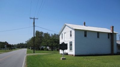
On Cherry Road 0.1 miles south of Ambrose Road, on the right when traveling west.
Conceived in the 1900's by black educator Booker T. Washington and his Tuskegee staff. The Rosenwald program represented a massive effort to improve black rural schooling in the South through public-private partnership. Rosenwald schools were also . . . — — Map (db m57043) HM
On Cherry Road 0.2 miles west of Middle Street, on the left when traveling west.
Was known as Cool Spring in 1826. Hillie Holmes' Store was the last surviving relic as Cool Spring post office was moved into what became the town of Creswell in 1874. — — Map (db m57039) HM
On Mt Tabor Road at Arnold Hill Road, on the right when traveling west on Mt Tabor Road.
Colonial home of Daniel Davenport, farmer, surveyor, and first Senator from Washingtyon County. He served in the Revolutionary War. Homestead 3 miles -> — — Map (db m57044) HM
On Mackeys Road (State Highway 308) at Mackeys Ferry Road, on the right when traveling east on Mackeys Road. Reported missing.
Established by permission of King George II. Operated for 203 yrs. making 8 mile trips from Mackeys to Edenton.
The largest vessel to operate was the John W. Garrett, a twin side wheel steamer 351 ft. x 41 ft. It carried railroad passengers, . . . — — Map (db m226504) HM
On Water Street at Washington Street, on the right when traveling west on Water Street.
Owned by Arthur Rhodes. From this plantation, he sectioned off one hundred acres into what is now the town of Plymouth circa 1790. — — Map (db m57047) HM
On West Main Street east of Jefferson Street, on the right when traveling east.
Dr. John Hampton, Benefactor
Hampton Academy replaced Plymouth Academy and other small schools as principal white school in Plymouth 1902-1922. Reopened as a primary school 1928-1958.
Plymouth Woman's Club acquired and preserved it in 1959 and . . . — — Map (db m57059) HM
Built by Charles Latham who occupied the house until 1882. Home was occupied for decades by descendants of its builder, a Lawyer, County Sheriff, and State Representative. During the battle of Plymouth, town residents sought protection in the . . . — — Map (db m62226) HM
On Madison Street at East Third Street, on the right when traveling south on Madison Street.
Established in 1867. Rev. Abraham Mebane entered into a lease agreement with the Lowell Colored School Society, giving New Chapel the right to erect a church on lot No. 41 in the town of Plymouth. — — Map (db m57053) HM
On Madison Street at Little Court, on the left when traveling north on Madison Street.
Established by the NC General Assembly as one of two NC schools for training black teachers. Moved to Elizabeth City, NC in 1903 and was parent school to Elizabeth City State University. — — Map (db m57050) HM
On Madison Street south of East Water Street, on the right when traveling south.
1st Bishop Diocese of East Carolina
Rector of Grace Episcopal Church
Plymouth, NC
St. Luke's Episcopal Church
Roper, NC 1844-1858
"The past is gone, the future is here." — — Map (db m57060) HM
On Adams Street north of East Main Street, on the right when traveling north.
The first courthouse was located at Lee's Mill, Roper 1801. Moved to Plymouth 1823. It was destroyed by fire three times, 1860-1862-1881. Present courthouse built 1918. — — Map (db m57062) HM
On Cross Road 0.5 miles north of Woodlawn Road, on the right when traveling south.
Built on Edward Buncombe property purchased from the estate for one dollar. De-consecrated and torn down in 1918. The Church of the Advent Episcopal Church in Roper renamed St. Luke's Episcopal Church. It became St. Luke's-St. Anne's Episcopal . . . — — Map (db m57069) HM
On State Highway 32 at Breezy Banks Road, on the left when traveling north on State Highway 32.
1837-1840 Josiah Collins & Ebenezer Pettigrew purchased 500 acres of land, planted 40,000 mulberry trees and raised silk worms for the silk business.
S.S. Simmons Fishery circa 1835
Piney Grove Freewill Baptist Church circa 1895
Sound . . . — — Map (db m57067) HM