On Devonshire St. at State St., on the right when traveling south on Devonshire St..
“ . . . there the child Independence was born.” Built in 1713, the Old State House was the seat of government of the Province of Massachusetts Bay. In this building the Royal Governors, the Colonial Courts, and the . . . — — Map (db m18689) HM
Near Tremont Street at Bromfield Street, on the left when traveling north. Reported missing.
Three hundred years ago this location did not have ideal conditions for a graveyard. There were many underground springs which made it soggy and damp. Tomb owners routinely found their tombs filled with water, with caskets and bodies floating about. . . . — — Map (db m18770) HM
On Tremont Street, on the left when traveling north.
The remains of Samuel Gray Samuel Maverick James Caldwell Crispus Attucks and Patrick Carr Victims of the Boston Massacre, March 5th, 1770, were here interred by order of the Town of Boston. ---------- Here also lies buried the body of . . . — — Map (db m19282) HM
This building served as Boston's City Hall from 1865 until 1969, when it was renovated for use as an office building. Boston's Old City Hall is one of the first examples of adaptive reuse. In the 1960's the concept of recycling out-dated public . . . — — Map (db m76635) HM
On Tremont Street, on the right when traveling north.
Buried here are many notable people in Boston’s early history, from its first governor, John Winthrop, to Frederic Tudor, the “Ice King.” This is Boston’s oldest burying ground, established in 1630 on what were then the outskirts of the . . . — — Map (db m18979) HM
Near Tremont Street, on the right when traveling north.
Patriot, Son of Liberty, and first messenger sent by Warren from Boston to Lexington on the night of April 18-19 1775 to warn Hancock and Adams of the coming of the British troops. Born April 6 1745 Died February 25 1799 Placed by the Massachusetts . . . — — Map (db m18712) HM
On Bromfield Street east of Province Street, on the right when traveling east.
Three of the original five storefronts remain from this 1848 commercial row, which was built and occupied by the Ballard family. Its design reflects the Egyptian Revival entrance gate at the nearby Granary Burying Ground.
Few Boston Granite . . . — — Map (db m215672) HM
On Summer Street at Washington Street, on the left when traveling east on Summer Street.
Since its beginning in 1851 Jordan Marsh has grown with the City of Boston. It is to the continued faith in this city and its great people that this building is dedicated. - 1977 - — — Map (db m176060) HM
On Washington Street at School Street, on the left when traveling north on Washington Street.
An Gorta Mor The great famine which ravaged Ireland between 1845-50 was the major catastrophe of the 19th century. It brought horrific suffering and loss to Ireland’s 8.5 million people. Over one million died of starvation and disease. Another . . . — — Map (db m176151) HM
On Hamilton Place at Tremont Street, on the right when traveling east on Hamilton Place.
On this site in 1887, the first commercial dental laboratory in America, the W.H. Stowe and Co. Dental Laboratory, was established by William H. Stowe and Mr. Frank F. Eddy. This historical marker, placed by the National Association of Dental . . . — — Map (db m175914) HM
On Province Street north of Bromfield Street, on the left when traveling south.
The Province Street of today was once a narrow cross street called Governor's Alley in the period before the American Revolution, referred to as the "Province Period". This alley was originally the avenue to the stables and rear grounds of . . . — — Map (db m215673) HM
On Hamilton Place at Tremont Street, on the left when traveling east on Hamilton Place.
In 1754 the Province of Massachusetts Bay erected
here the Manufactory House, which housed the
working poor in exchange for manufacturing linen.
This early public housing program was unsuccessful,
and the Province began leasing to private . . . — — Map (db m175926) HM
1630-1673
Zacheus Bosworth, Captain Thomas Clarke and Lieutenant Richard Cooke dwelt here on School House Lane
1704
John Mico built a mansion on this site which was occupied in turn by Colonel Jacob Wendall, Governor Moses Gill and . . . — — Map (db m21664) HM
On School Street just east of Province Street, on the right when traveling east.
On this site stood the church of the French Huguenots 1716 - 1741. Used as a Congregational church 1748 - 1788.
Occupied by Roman Catholics 1788 - 1803. First public Mass celebrated in Boston November 2 - 1788. — — Map (db m215165) HM
On School Street at Province Street, on the right when traveling east on School Street.
On this site stood the Public Latin School 1748 – 1844 Directly opposite stood the first and the second school building occupied by this school 1645 – 1748 This tablet placed here on the 300th anniversary April 23 1935 by the City of . . . — — Map (db m18511) HM
On Winter Street east of Tremont Street, on the right when traveling east.
The patriot and propagandist Samuel Adams
(1722-1803) lived in a house on this site from
1784 until his death. A cousin of John Adams,
Samuel Adams wrote many criticisms of the British
government, advocated separation from Great
Britain, and . . . — — Map (db m175913) HM
On School Street at Province Street, on the right when traveling east on School Street.
One of Boston’s luxury hotels, opened by innovative hosteller Harvey Parker, the Parker House has been operating on this site since 1856. Parker introduced the European Plan, started the practice of scrod, the fresh white fish catch of the day. The . . . — — Map (db m18510) HM
On Washington Street south of Milk Street, on the right when traveling south.
Here stood The Province House Occupied by the Royal Governors of the Province of Massachusetts Bay until the Evacuation of Boston by
the British Army March 17, 1776
Residence of Peter Sargeant
Built 1679
Bought by the Province April . . . — — Map (db m176115) HM
On Temple Place west of Washington Street, on the right when traveling west.
This three-story, Greek revival building was built in 1833, as the
residence of Colonel Thomas Handasyd Perkins (1764–1854), a
Boston Brahmin, philanthropist, and China Trade merchant.
Situated in what was then a residential neighborhood, the . . . — — Map (db m176197) HM
On Tremont Street south of School Street, on the left when traveling south.
Tremont Temple was once the renowned Tremont Theater. Most of the famous actors, singers and lecturers of the day performed here. John Gilbert, Jenny Lind, Daniel Webster and Charles Dickens all made appearances.In 1843, the Theater became the . . . — — Map (db m76638) HM
On Cambridge Street at Tremont Street, on the right when traveling west on Cambridge Street.
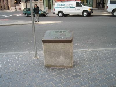
Here, on June 2, 1875, Alexander Graham Bell and Thomas A. Watson first transmitted sound over wires.
This successful experiment was completed in a fifth floor garret at what was then 109 Court Street and marked the beginning of world-wide . . . — — Map (db m49787) HM
On Court Street at Franklin Ave, on the right when traveling west on Court Street.
D.L. Moody, Christian Evangelist, Friend of man, Founder of the Northfield Schools, was converted to God in a shoe store on this site April 21, 1855 — — Map (db m129367) HM
On Marshall Street at Creek Square, on the right when traveling north on Marshall Street.
The Ebenezer Hancock House, built in 1767, is the only remaining house in Boston associated with John Hancock. He owned the house but it was lived in by his brother Ebenezer, who was Deputy Paymaster General of the Continental Army. This is one . . . — — Map (db m18092) HM
On Congress Street at North Street, on the right when traveling north on Congress Street.
Known as America’s “Cradle of Liberty” Faneuil Hall was a central location for organized protests against British tyranny prior to the American Revolution. Given to Boston in 1742 by Peter Faneuil and designed by the painter John Smibert, it was . . . — — Map (db m18067) HM
Near Congress Street at North Street, on the right when traveling north.
This is Faneuil Hall the Cradle of Liberty built and given to the town of Boston by Peter Faneuil ***** 1742 ***** Still used by a free people 1930 — — Map (db m18088) HM
On Marshall Street at Creek Sq, on the right when traveling north on Marshall Street.
Near this spot the Green Dragon Tavern The secret meeting place of the Sons of Liberty and in the words of Webster the Headquarters of the Revolution To mark a site forever memorable as The birthplace of American Freedom This Tavern is . . . — — Map (db m18091) HM
On Union Street north of North Street, on the left when traveling north.
James Michael Curley, four times Congressman, four times Mayor of the City of Boston, Governor of the Commonwealth of Massachusetts, was born in Boston's South End, of Irish immigrant parents. His formal education cut short at age ten by the . . . — — Map (db m215594) HM
On Court Street, on the right when traveling west.
Here in 1719 stood the printing office of James Franklin publisher of the New England Courant. Here served as an apprentice his brother Benjamin Franklin
Here 1769 to 1776 Edes and Gill published the Boston Gazette — — Map (db m56692) HM
On Union Street south of Hanover Street, on the right when traveling north.
“Old Jimmy” Wilson, Boston’s last town crier, first hoisted the sign of the “Bell” in 1795 under the Exchange Coffee House in Congress Square.
The tavern gained a popular reputation for selling “the best Ale in . . . — — Map (db m115270) HM
On Congress Street at North Street, on the right when traveling north on Congress Street.
Samuel Adams 1722 – 1803 A patriot He organized the Revolution and signed the Declaration of Independence. A Statesman Incorruptible and Fearless Governor A true leader of the people. Erected A.D. 1880 from a fund bequeathed to the City of . . . — — Map (db m19013) HM
On Marshall Street at Creek Square, on the left when traveling north on Marshall Street.
The Bell-in-Hand America's Oldest Continuously-Run Tavern Established 1795
The Bell-in-Hand has been the premier gathering place for generations of Bostonians. The first owner was Jimmy Wilson, the city's last known town crier, who rang his . . . — — Map (db m176012) HM
On Union Street north of North Street, on the left when traveling north.
Carmen Park is named in recognition of William Carmen's service to the community and his vision and leadership in creating the New England Holocaust Memorial.
Welcome to the New England Holocaust Memorial
This site is in memory of . . . — — Map (db m215601) HM WM
On Court Street at Tremont Street, on the right when traveling east on Court Street.
The Norman B. Leventhal Walk to the Sea
The Walk to the Sea encompasses four centuries of Boston history. Beginning at the State House on Beacon Hill, overlooking Boston's ancient Common, the Walk passes among historic landmarks and . . . — — Map (db m215814) HM
On Union Street at Marsh Lane, on the right when traveling north on Union Street.
has been designated a National Historic Landmark This site possesses national significance in commemorating the history of the United States of America The oldest continually operated restaurant and oyster bar in the United States, constructed . . . — — Map (db m18090) HM
135 entries matched your criteria. Entries 101 through 135 are listed above. ⊲ Previous 100