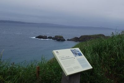
'For the boiling breakers are ever dashing themselves madly between the rocks hundreds of feet beneath, and the rope bridge thrown about by the wind like a fabric of thread. Few trust themselves upon this airy fabrication but Mr Wilson and I for . . . — — Map (db m88325) HM
On Dundarave Road east of Whitepark Road (A2), on the right when traveling east.
Symbols and Meanings
Backpack with Hearts
Contains forgotten words and meanings of the Ulster Scots tongue.
Heart 1
Represents the heart of the land and the soul of the place.
Heart 2
Represents the heart . . . — — Map (db m70763) HM
The Salmon
The natural life cycle of a salmon is one of nature's wonders. A salmon begins its life in the shallow water and gravel beds of the river as eggs then fry. These small fry stay in the river until they mature into par. The next . . . — — Map (db m70892) HM
Side A
Welcome to Dunluce Castle
Dunluce Castle, dramatically positioned on this sheer headland between the Giant's Causeway and Portrush, was built between the 15th and 17th centuries. At this time it was one of the finest . . . — — Map (db m70900) HM
On Main Street (A2) just north of the town square, on the right when traveling north.
The Giant’s Causeway railway provides a passenger link between the historic town of Bushmills and the famous basalt stone columns of the Giant’s Causeway World Heritage Site.
The Railway is an interesting heritage experience and travels along . . . — — Map (db m70850) HM
On Main Street, on the right when traveling south.
Side A
Welcome to Hamill Terrace
Renowned as the gateway to the Giant's Causeway and for the oldest licensed whiskey distillery in the world, Bushmills has a unique heritage of historic buildings and mills.
Images (clockwise . . . — — Map (db m70873) HM
Dedicated to the memory of
Sgt. Robert Quigg, 12th Battalion R.I.R.
who won the V.C. at
the Battle of the Somme
on the 1st July 1916
Died 14th May 1955 — — Map (db m70774) HM WM
On Causeway Road (B146), on the left when traveling east.
Dunseverick Castle and its rocky peninsula were given to the National Trust in 1962 by farmer Jack McCurdy.
The term Dun (fort) indicates a royal site. This was the fort of Sobhairce. It may have been a royal stronghold in the Iron Age . . . — — Map (db m70859) HM
On Main Street (A 29), on the left when traveling north.
The town of Garvagh owes its 17th century origins and subsequent development to the Canning family. George Canning was the first family member to come to Ireland when, in September 1614, he arrived at Agivey on the banks of the Bann as an agent . . . — — Map (db m70740) HM
Near Main Street (A 29), on the right when traveling north.
Side A
Welcome to the historic town of Garvagh, situated on the banks of the Agivey River.
We hope you enjoy your visit. Please use the information and maps on this sign to find out about the history of Garvagh and to discover its . . . — — Map (db m70748) HM
On Main Street (A 29), on the left when traveling north.
The Great War 1914 - 1918
"The Fallen"
Faithful unto death
Black H.C. • Bradley J. • Bradley P. • Caldwell, W. • Caskey M. • Collins R. • Dale T. • Dempsey J. • Faith J. • Gavin R. F. Capt. • Hall T. Cpl. • Hazlett J.B. • Lynch J. Cpl. . . . — — Map (db m70726) WM
On Main Street (A371) at Newtown Square, on the right when traveling east on Main Street (A371).
It was in Limavady that
the famous melody "Danny Boy"
was noted down by Jane Ross
from a tune played by a blind street
fiddler named Jimmy McCurry
Oh Dan-ny Boy, the pipes, the
pipes are calling from glen to glen
and . . . — — Map (db m70913) HM
On Alexander Road just south of Ballyclose Street (A371), on the right when traveling south.
In the early 1900s, Northern Ireland Railways were at their peak. They allowed fast and efficient transport of goods, mail and promoted local seaside resorts. They also established standard time.
From the early 1920s, road and air transport . . . — — Map (db m70902) HM
On Shipquay Place at Guildhall Square, on the right when traveling west on Shipquay Place.
A city fit for war and merchandise…for ever a free, entire and perfect city and county of itself, to be called the city and county of Derrie.
Charter from James I, 1604
One City…Fifty Names
All of the . . . — — Map (db m70942) HM
A night at Talbot's theatre
Actor/manager Michael Atkins opened the city's first purpose-built theatre at the top of Artillery Street in 1774. It soon became the fashionable place to be seen especially at grand social occasions when the . . . — — Map (db m71080) HM
On Rossville Street (B527) at William Street (B527), on the left when traveling north on Rossville Street (B527).
[Side A]
On 12 August 1969, as the Apprentice Boys Parade passed the edge of the Bogside, nationalists clashed with parade followers and police. The police and loyalists followed the nationalists back into the Bogside, where defences had . . . — — Map (db m71441) HM
On Fahan Street at Lecky Road (B507) when traveling west on Fahan Street.
The Artists' first coloured mural is a tribute to the women of Derry and their role in the civil rights campaign. Bernadette Devlin, Britain's youngest MP, addresses the crowd during the Battle of the Bogside: her actions resulted in a six month . . . — — Map (db m71187) HM
The centenary of the siege
In 1789 the cannons roared in peace, the bells rang out and the Protestant and Catholic bishops processed together to St Columb's Cathedral to celebrate the centenary of the siege. To mark the event Bishop Hervey . . . — — Map (db m71012) HM
On Bishop Street just north of Orchard Row, on the left when traveling north.
It was here that James II demanded entry to the city during the 1689 siege. The present gate was built at the suggestion of Bishop Hervey in 1789 to celebrate the centenary of the siege. The head facing Bishop Street represents the river Boyne . . . — — Map (db m71021) HM
On Rossville Street (B507) just north of the Free Derry Corner, on the right when traveling south.
This mural depicts the events of 30th January 1972 when the British Army opened fire on a civil rights demonstration, killing 14 people. A local priest waves a bloodstained handkerchief at the soldiers as he leads a group of men, carry the body . . . — — Map (db m71215) HM WM
On Rossville Street (B527) at Joseph Place, on the left when traveling south on Rossville Street (B527).
On 30 January 1972, a massive British military operation in Derry's Bogside ended in the murder of thirteen unarmed civil rights demonstrators and the wounding of fifteen others - one of whom died later of his injuries on 16 June 1972.
The . . . — — Map (db m71306) HM
On Rossville Street at Glenfada Park, on the right when traveling south on Rossville Street.
On 30 January 1972 the ‘elite’ British Parachute Regiment opened fire on a peaceful civil rights march along this street, killing 14 unarmed marchers and wounding 14 more. The dead and wounded were labelled gunmen and bombers by a partisan . . . — — Map (db m71435) HM
Two million gallons of whisky
Smoke from illicit poteen whisky stills used to waft over the walls from the Bogside. Legal distilleries opened in the Waterside and in the Bogside in the 1820s. Watt's Abbey Street distillery became the . . . — — Map (db m70971) HM
On Magazine Street at Butcher Street, on the right when traveling west on Magazine Street.
This was one of the four original gates of 1617. It was initially called the 'Nugate' or King's Gate, later being renamed Butcher Gate after the nearby meat market and slaughterhouse. The gate was nearly destroyed by cannon fire during the 1689 . . . — — Map (db m70972) HM
Demolish the walls
The Maiden City withstood two sieges without its walls being breached. In the 18th century the city grew too big for its walls and increasingly houses and factories were built on the slopes below. Castle Gate (1803) was . . . — — Map (db m70960) HM
On Magazine Street at Castle Street, on the right when traveling west on Magazine Street.
Constructed in 1803 this was the second of the three new gates into the city. Although originally named New Gate, by the mid 19th century it was known as Castle Gate after the medieval tower house built by the O'Doherty family. — — Map (db m70970) HM
The watchers and the watched
There have been watchers on the walls for centuries. In 1627 two watch towers were built near the Cathedral after the guards complained about having to do duty in the rain. In the 19th century the bastions . . . — — Map (db m71053) HM
On Rossville Street (B527) at Glenfada Park, on the right when traveling south on Rossville Street (B527).
This mural captures the mood of a typical civil rights march in the years up to 1972. Inspired by the civil disobedience campaign of Martin Luther King in the United States, young and old, Catholics and Protestants, politicians and mothers took . . . — — Map (db m71434) HM
On Lecky Road (B507) at Westland Street, on the left when traveling north on Lecky Road (B507).
Annette McGavigan
Aged 14
Shot dead by the British Army
6 September 1971
———————
Here the innocence of a child's world contrasts vividly with the chaotic violence with which others have surrounded her. The mural commemorates . . . — — Map (db m71155) HM WM
Livery Companies of the
City of London
Demi-culverin (C3)
Bore 4.25" - Length 120"
Weight 3750lb
One of a pair sent to the city
in May-June 1642 by the
Worshipful Company of Merchant Taylors.
Probably cast by John Browne at one . . . — — Map (db m71049) HM
Livery Companies of the
City of London
Demi-culverin (C11)
Bore 4.6" - Length 120"
Weight 3988lb
The second of a pair sent to the city
in May-June 1642 by the
Worshipful Company of Merchant Taylors.
Probably cast by John Browne . . . — — Map (db m71052) HM
Demi-culverin with
Rose and Crown (C12)
Bore 4.5", Length 120"
Weight 3417lb
Cast in 1590 by Thomas Johnston
Founder of iron ordnance to
Queen Elizabeth I — — Map (db m71125) HM
The city has always expressed its soul in verse.
Derry mine! My small oak grove
Little cell, my home, my love!
Attributed to St. Colmcille
The saint's story is told as St Columb in the Cathedral and as St Colmcille in Long Tower . . . — — Map (db m71005) HM
Roaring Meg
Roaring Meg is the most famous of the city's cannon. She weighs a mighty 1794 kilograms. The Fishmongers' Company of London presented her to the city in 1642. She saw action in the 1689 siege, probably from this bastion. It . . . — — Map (db m71007) HM
Locking the gates
In 1688 James II proposed to replace the Protestant garrison in the city with Catholic troops. Rumours were rife that the citizens were to be massacred. Meeting in the Diamond, the city leaders could not make up their . . . — — Map (db m71097) HM
On Carlisle Road / Ferryquay Street, on the right when traveling north.
This gate was built in 1865 on the site of one of the four original entrances to the city. Like Bishop's Gate it had a drawbridge, which could be pulled up in times of troubles, to allow people to cross the dry moat. This was the gate that the . . . — — Map (db m71104) HM
On Lecky Road (B507) at Fahan Street, on the right when traveling north on Lecky Road (B507).
On 5 January 1969, after a night of rioting and sustained police attacks on the Bogside, the words "You Are Now Entering Free Derry" were painted on the gable wall of 33 Lecky Road. This simple graffiti became the defining symbol of the civil . . . — — Map (db m71204) HM
Fourteen sycamores
There are 14 sycamore trees on the Grand Parade, one for each of the 13 Apprentice Boys and one for James Morrison, their look-out on Ferryquay Gate. The fruit of the sycamore are like bunches of keys. They represent the . . . — — Map (db m70984) HM
On Shipquay Place at Guildhall Square, on the right when traveling west on Shipquay Place.
City under siege
The city was twice besieged for over a hundred days. In 1649 the garrison held out against royalist troops during the English Civil War. Forty years later the city supported Protestant William III against Catholic James II . . . — — Map (db m70943) HM
The roaring cannon
The city claims Europe's largest collection of cannon whose precise origins can be traced. These are the earliest surviving cannon. Some were shipped over for Sir Henry Docwra's campaign of 1600-3: others were sent to . . . — — Map (db m71131) HM
On Rossville Street (B527/B507) at Fahan Street (B507), on the right when traveling south on Rossville Street (B527/B507).
IRA. Vol. Bobby Sands,
Born 9th March 1954
Died 5th May 1981
Age: 27 (66 Days).
IRA. Vol. Francis Hughes,
Born 28th Feb 1956
Died 12th May 1981
Age: 25 (59 Days)
INLA. Vol. Patsy O'Hara,
Born 11th July 1957
Died 21st May . . . — — Map (db m71219) WM
Bulwarks and bastions
When first built, the bastions were known as bulwarks, each called after a person associated with the city from King James I to the Governor of the Plantation. They were renamed during the 1689 siege. This is . . . — — Map (db m70957) HM
On Rossville Street (B527) just north of Joseph Place, on the left when traveling north.
This mural depicts one of the surviving hunger strikers as he looked after 53 days without food. He was one of seven men who went on hunger strike at the Maze prison in Belfast from 28th October, 1980 in protest against loss of their rights as . . . — — Map (db m71436) HM
On Rossville Street (B527/B507) close to Fahan Street (B507), on the right when traveling south.
Throughout this city the Republican Movement has marked the spots, with commemorative plaques where IRA Volunteers died on active service.
This stone is dedicated to those Volunteers who died in places where circumstances do not
permit the . . . — — Map (db m71283) WM
On Union Hall Place, on the left when traveling north.
Magazine Gate is the city's newest gate, built in 1865. At the same time the wall between Magazine and Shipquay Gates was raised by two metres and ornamental battlements added. A line of stonework on the outside shows the height of the original . . . — — Map (db m70915) HM
Fire power
Magazine Gate takes its name from the Plantation city's gunpowder store. The mixture of saltpetre, sulphur and fine charcoal had to be kept very dry as it easily absorbed water. A barrel of gunpowder and a pile of shot was . . . — — Map (db m70956) HM
On Rossville Street (B527) at William Street (B527), on the left when traveling north on Rossville Street (B527).
In proud and loving memory of
I.N.L.A. Volunteer Colm Mc Nutt
Killed in Action 12th Decembert 1977
Comrade Patrick “Hessy” Phelan
Murdered in New York, 21st January 1996
Comrade Dermot “Tonto” Mc Shane
Murdered by British Army, . . . — — Map (db m71442) WM
On Union Hall Place, on the left when traveling north.
Near this spot was landed the body of
Michael Browning
Master of the ship
Mountjoy
of Londonderry - killed in action at the breaking of the boom, July 28th 1689.o.s. while leading the van of the relieving squadron against the . . . — — Map (db m70925) HM
On Rossville Street (B527) at Fahan Street (B507), on the left when traveling north on Rossville Street (B527).
Free Derry ended at 4am on 30th July 1972 when thousands of British troops in tanks and armoured cars invaded the Bogside and Creggan 'no-go' areas. During Operation Motorman, they tore down the barricades with bulldozers. The Artists chose the . . . — — Map (db m71284) HM
In 1787 the walls were breached for the first time to improve access to the city centre. It is said that the gate was built to cope with crowds flocking to the New Theatre in Artillery Street but was closed in 1799 due to complaints from the . . . — — Map (db m71085) HM
The first shot
On 13th April, 1689 the first shot of the siege was fired. Citizens on the walls spotted the vanguard of the Jacobite army approaching under Lieutenant General Richard Hamilton. To make his presence known, Hamilton fired a . . . — — Map (db m71098) HM
On Newmarket Street at City Wall, on the right when traveling east on Newmarket Street.
You are standing on the city walls. Newmarket Street slopes up and over the wall. The street was created in the mid 19th century on the site of the Smithfield Meat Market to allow carts to the new covered market. — — Map (db m71100) HM
The siege governors
The Royal Bastion is associated with the city's four governors during the 1689 siege. Professional soldier Robert Lundy was unconvinced that the city could be defended against Jacobite attack. His indecisiveness and . . . — — Map (db m70987) HM
On Shipquay Street at Union Hall Place, on the right when traveling west on Shipquay Street.
This was one of the four original 17th century gates to the city. It had a watch tower, battlements and a portcullis. The carvings on the outside of the present gate, built between 1803-5, celebrate the city's wealth. The cornucopia is a symbol of . . . — — Map (db m70927) HM
'A city fit for war and merchandise'
In 1600 Elizabeth I of England instructed Sir Henry Docwra to establish and fortify a new settlement on the Foyle. An explosion in the cathedral in 1567 had largely destroyed the town. Docwra and his . . . — — Map (db m71123) HM
On Shipquay Street near Castle Street, on the right when traveling north.
Living above the 'shop'
Many banks and offices started life as 18th and 19th century family houses. The building at the corner of Shipquay Street and Bank Place was both home and place of business for the manager of the Belfast Bank. On . . . — — Map (db m71140) HM
On this site of St Augustine's Church, St Columba built his Abbey circa 543AD, and departed from Derry down the River Foyle with his supporters to the Island of Iona in 563AD. — — Map (db m70989) HM
The Mother Church
The first settlers worshipped in the ruins of the former Augustinian abbey. In 1613 the London merchant companies sent over a silver-gilt chalice as a promise of their commitment to build a cathedral to grace their new . . . — — Map (db m71072) HM
On Westland Street west of Lecky Road (B507), on the right when traveling west.
This mural was painted to commemorate the 25th anniversary of Bloody Sunday. A circle frames the faces of the 14 victims with the youngest in the centre. The circle is the symbol of wholeness, the goal of the healing process. Fourteen oak . . . — — Map (db m71158) HM WM
On Rossville Street (B527) just north of Joseph Place, on the left when traveling north.
This mural shows a dove and an oak leaf, as symbols of hope for the city’s future. The dove is the name of St Columba, the city’s founder, who is said to have built his monastery in an oak grove. The background mosaic of the colours of the . . . — — Map (db m71440) HM
On Lecky Road (B507), on the left when traveling north.
After the 1981 hunger strikes the republican movement embarked on a political process that resulted in the IRA ceasefire in August 1994. Loyalist paramilitaries declared their ceasefire in October 1994. In 1998 local politicians and the British . . . — — Map (db m71218) HM
On Fahan Street at Lecky Road (B507), on the left when traveling west on Fahan Street.
For two days in August, 1969 local people resisted attempts by the Royal Ulster Constabulary to break down the barricades which they had erected to defend their community. The Battle of the Bogside ended when the British government sent in the . . . — — Map (db m71168) HM WM
The Apprentice Boys
From the early 18th century clubs have celebrated the role of the 13 apprentices who locked the gates of the city in December, 1688 rather than admit the new Jacobite garrison. Local architect, John Guy Ferguson, . . . — — Map (db m70974) HM
On Shipquay Street at Guildhall Square, on the right when traveling west on Shipquay Street.
If 'stones could speak', what a story they would have to tell. Their voices still echo on the walls and in the city streets.
According to tradition St. Colm Cille chose the oak grove on top of the hill for his monastery in 546 AD. His . . . — — Map (db m70928) HM
[Keyed photo of Double Bastion overlook]
1. Lumen Christi College - co-educational school on the site of Bishop Hervey's casino.
2. The Windmill - the stump of the building fought over during the 1689 siege.
3. St Columba's, Long Tower . . . — — Map (db m71004) HM
On Bishop Street just north of Orchard Row, on the left when traveling north.
If 'stones could speak', what a story they would have to tell. Their voices still echo on the walls and in the city streets.
According to tradition St. Colm Cille chose the oak grove on top of the hill for his monastery in 546 AD. His . . . — — Map (db m71026) HM
On Carlisle Road / Ferryquay Street, on the right when traveling north.
If 'stones could speak', what a story they would have to tell. Their voices still echo on the walls and in the city streets.
According to tradition St. Colm Cille chose the oak grove on top of the hill for his monastery in 546 AD. His . . . — — Map (db m71121) HM
The Former First Derry Primary School was established on the city walls as a Blue Coat School in 1773 and moved to this site in 1894. The (listed) building was purchased in 1996 and then renovated by the Verbal Arts Centre: it has been designed . . . — — Map (db m70998) HM
This monument was erected to perpetuate the memory of the Rev. George Walker, who, aided by the garrison and brave inhabitants of this City, most gallantly defended it through a protracted siege, viz., from the 7th Dec. 1688 O.S. to the 12th . . . — — Map (db m70988) HM
Feabhail
The river Foyle lapped against the Water Bastion until the late 18th century. The name Foyle probably arose because English-speaking settlers had difficulty saying the Irish 'Feabhail', used traditionally to describe the stretch . . . — — Map (db m71122) HM
On Shipquay Street at Ferryquay Street, in the median on Shipquay Street.
To Our
Honoured Dead
and
Those Who Served
1914 - 1918
1939 - 1945
Names of the Fallen
[Panels not transcribed]
Sculptures by Vernon March, 1926 — — Map (db m71133) WM