On Erie Boulevard East (New York State Route 5) east of Montgomery Street, on the right when traveling west.
You are standing across from the Weighlock Building on the towpath of the canal where the mule drivers and the mules that pulled canal boats once trod.
The Syracuse Weighlock Building, built in 1850 to weigh canal boats, is the last surviving . . . — — Map (db m138698) HM
On Erie Boulevard East (New York State Route 5) east of Montgomery Street, on the right when traveling west.
That's the Weighlock Building across Erie Boulevard, where canal boats were weighed and tolls paid when this busy street was the Erie Canal. Cargo boats entered the stone lock chamber beneath the overhang, gates were closed at each end, the water . . . — — Map (db m138700) HM
On Erie Boulevard East (New York State Route 5) east of Montgomery Street, on the right when traveling west.
The historic 60 foot wide right-of-way that became the Erie Canal in 1825 established N.Y.S. as the route to the west for an expanding nation. This corridor of commerce and culture, extending from Albany to Buffalo, made New York the Empire State. — — Map (db m138685) HM
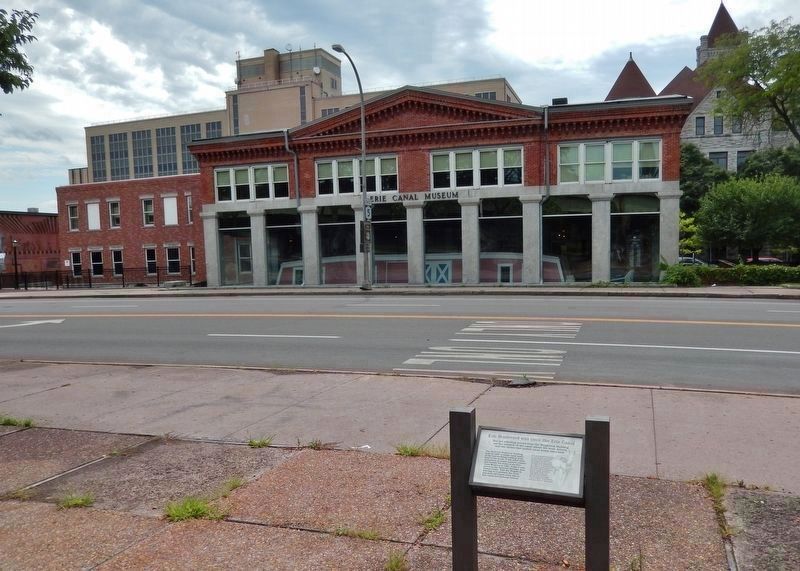
On Erie Boulevard East west of Montgomery Street, on the right when traveling east.
Pitts Park is located next to the Syracuse Weighlock Building, on the site of a former widewaters where boat captains would wait their turn to enter the weighlock. At your left, where Oswego and Erie Boulevards intersect today, was the confluence of . . . — — Map (db m138699) HM
Near East Water Street just east of Montgomery Street, on the left when traveling east.
A weighlock was used to weigh canalboats so that a tariff could be determined on the cargo. Each time a boat captain took on a new cargo, he was required to have the cargo weighed and pay a toll.
Boats were weighed once a year to determine the . . . — — Map (db m144192) HM
Near Erie Boulevard East (New York State Route 5) just east of Montgomery Street, on the right when traveling east.
The locks at the Weighlock are designed in the same manner as a standard lock. However, the basic function between a traditional lock and a weighlock differ. In a traditional lock, flooding the chamber was a simple function of gravity. The locks . . . — — Map (db m144191) HM
On East Water Street just east of Montgomery Street, on the left when traveling east.
The Erie Canal did much more than link the cities of Albany and Buffalo.
It opened America's midwestern heartland to European immigrants entering New York Harbor. The Weighlock Building, the only one remaining in the world, was built in 1850 . . . — — Map (db m144190) HM
Near East Water Street just east of Market Street, on the left when traveling east.
Buildings constructed on the banks of the canal had two distinct sides, one faced the canal and one faced the street.
The street sides of the buildings along the canal featured ornate facades to attract passing pedestrians and carriages. The . . . — — Map (db m144193) HM
Near East Water Street just east of Montgomery Street, on the left when traveling east.
Typically both taverns and general stores were found at the lock sites. Both maintained gardens which supplied fresh vegetables not only for the patrons of the stores but also to the passing boatmen.
Flower gardens were also common . . . — — Map (db m144189) HM
Near Erie Boulevard East (New York State Route 5) just east of Montgomery Street, on the right when traveling east.
This building was originally a dry goods store typical of those along the Erie Canal. The south side of the building, opening onto Water Street, featured a storefront, while the north side served to unload goods arriving by the canal. The building . . . — — Map (db m144224) HM