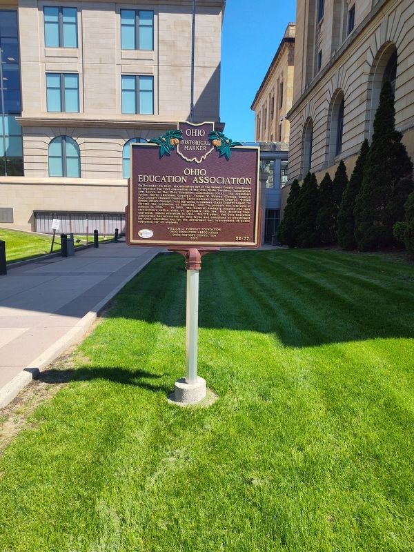
On South High Street at Church Street, on the right when traveling north on South High Street.
On December 30, 1847, six educators met at the Summit County Courthouse to organize the first convention of the Ohio State Teachers' Association, now known as the Ohio Education Association (OEA). The organizers Josiah Hurty (Richland County), . . . — — Map (db m299758) HM
On George W Stanton Hwy (Massachusetts Route 2) west of Lunenburg Road ( Route 70), on the right when traveling west.
This is a descendant of the last surviving Rambo apple tree planted in Nova, Ohio, around 1840 by John Chapman (better known a Johnny Appleseed). John Chapman, born in Leominster, Massachusetts, on September 26, 1774, had a plan for the . . . — — Map (db m220703) HM
On Mound Rd at Enterprise Ct., on the left when traveling south on Mound Rd.
This is the highest and largest of the many conical burial mounds in Ohio. Erected in prehistoric times by the so-called Mound Builders. It stands as an imposing memorial to those first Ohioans.
The mound is 70 feet in height; 877 feet in . . . — — Map (db m164256) HM
On North College Road 0.2 miles south of West Wiggin Street (Route 308), on the left when traveling south.
Born in Ashland County in 1819, Lorin Andrews studied at Kenyon College (1838-41) and achieved renown as an Ohio school superintendent and advocate for public elementary and secondary education. As Kenyon's president beginning in 1854, the . . . — — Map (db m95128) HM
Grafted from rootstock, this sapling apple tree is an authentic descendent of the last verifiable tree planted by John Chapman, aka Johnny Appleseed.
Born in 1774, John Chapman really loved his apples and was legendary for traveling around . . . — — Map (db m238118) HM
On West Main Street at South High Street, on the right when traveling east on West Main Street.
School
The citizens of Jeromesville have always taken a great interest in their youth and they have gone to great lengths to provide them with proper training. For many years, the chil- dren of Jeromeville attended school in . . . — — Map (db m298167) HM
On Ohio Route 3 at Route 97, on the right when traveling south on Ohio Route 3.
In 1861, German immigrants Constantine and Agnes Cline purchased two adjoining parcels of land southwest of here on a hillside near the Mohican-Memorial Shrine. The Clines started farming the area, and they constructed a spring house, barn, orchard, . . . — — Map (db m269964) HM
On Wooster Road (Ohio Route 3), on the left when traveling north.
Greene Ville Treaty Line
Surveyed by Israel Ludlow, 1797- 1799
The southern boundary of Ashland County is a portion
of the original Greene Ville Treaty. The line was
established at the Treaty of Greene Ville signed August 3,
1795 by . . . — — Map (db m77342) HM
Near University Drive at Rye Beach Road (County Route 122).
The history of the Firelands is linked to the American Revolutionary
War. During the British raids of 1777 and 1779 the Connecticut
towns of Danbury, East Haven, New Haven, Fairfield, Norwalk,
Greenwich, Groton, Ridgefield and New London were . . . — — Map (db m150043) HM
Near Hayes Avenue (Ohio Route 4) at Cooke Street, on the right when traveling north.
The history of the Firelands is linked to the American Revolutionary
War. During the British raids of 1777 and 1779 the Connecticut
towns of Danbury, East Haven, New Haven, Fairfield, Norwalk,
Greenwich, Groton, Ridgefield and New London were . . . — — Map (db m182694) HM
Thin black lines indicate changes in relevance. Between each pair of lines entries are ordered geographically but all have the same relevance.
* Inflectional forms of words are their plurals, singulars, and possessives as well as gramatical tenses and similar variations.