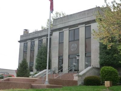
May the sun of righteousness shining on the American Flag glorify the sacrifice and hold in grateful remembrance the Thousands of our sons and daughters who suffered for our freedom. — — Map (db m75791) WM
On Public Square at East Main Street, on the left when traveling north on Public Square.
Established 1837; named in honor of Baron Johann De Kalb, the Bavarian officer who accompanied Lafayette to America in 1777. Appointed a Major General in the Continental Army, he was killed at the Battle of Camden in 1780 while commanding Delaware . . . — — Map (db m129993) HM WM
On South Public Square near East Public Square, on the left when traveling east.
DeKalb County differed from surrounding counties. A sizeable minority of its citizens opposed secession and voted against it in the June 8, 1861 referendum. Their champion was a slave owner, Congressman William B. Stokes. The majority followed . . . — — Map (db m81483) HM
On Cumberland Street at Main Street on Cumberland Street.
Erected in Honor of the Confederate Veterans of Wilson County and all other true southern soldiers 1861-1865
(Bronze plaque at base of monument)
Gen. Robert Hopkins Hatton (1826-1862)
Born in Ohio, moved to Lebanon, Tennessee to . . . — — Map (db m268192) WM
On Highland Rim Trail north of Edgar Evins State Park Rd, on the right.
Dedicated - August 2, 1975
by
Governor Ray Blanton
and
Honorable B.R. Allison
Commissioner of Conservation
State of Tennessee
This rustic state park consisting of approximately 6,000 acres was built jointly by the U.S. Corps of Engineers . . . — — Map (db m268339) HM
On East Dixie Avenue (Kentucky Route 61) at South Crestwood Street, on the left when traveling north on East Dixie Avenue.
"The Parrott gun was placed in the pike; it was opened as soon as the last message from Colonel Smith was received; and, as suddenly as if its flash had ignited them, Palmer's four guns roared out from the hill on the left of the road, about six . . . — — Map (db m170819) HM
On Gault Avenue North (U.S. 11) east of 4th Street, on the right when traveling east. Reported missing.
Born in Tennessee, Sequoyah moved to Wills Town (DeKalb County, Alabama) area of the Cherokee Nation in 1818.
Here, in 1821, he invented an 86 symbol alphabet providing the Cherokees with the only written Indian language in the United . . . — — Map (db m261859) HM
On West Trinity Place 0.1 miles east of West Ponce De Leon Avenue, on the right when traveling east.
Ante-bellum residence of Benjamin F. Swanton; once the property of Ammi Williams, a DeKalb County pioneer. Built prior to 1842.
In 1864 the Swanton family was in residence here when the Federal Army of the Tennessee occupied Decatur. This force . . . — — Map (db m9364) HM
On Edgewood Avenue SE at Park Place NE, on the right when traveling west on Edgewood Avenue SE.
[Main marker]
SunTrust Bank played a key role in the New South's economic growth in the late nineteenth and twentieth centuries and became the largest bank headquartered in Georgia. In 1891 the Georgia General Assembly chartered the . . . — — Map (db m187137) HM
Near State Street (Illinois Route 64) west of Main Street ( Route 23), on the right.
To the men from DeKalb County who died in Vietnam during the Vietnam Conflict
Francis A. Anderson • Dale C. Brewer • Eatterson Byrd, Jr. • David Donnelly • Rodney G. Drake • Jimmy R. Harrison • Richard A. Henke • Richard L. Jossendal • George . . . — — Map (db m257965) WM
On South Public Square at South 3rd Street, on the left when traveling east on South Public Square.
(south face)
Atlanta • Chickamauga • Murfreesboro
This monument is dedicated to the memory of all DeKalb Countians who served the Confederacy. They sacrificed much for the cause of an independent South. Their courage and patriotism . . . — — Map (db m75792) WM
Near West Court Square south of West Ponce de Leon Avenue.
Five DeKalb County courthouses have been
erected here in the center of Decatur since 1823.
The third courthouse structure, between 1847
and 1898, was where DeKalb County's two
anti-secession delegates were selected to attend
Georgia's secession . . . — — Map (db m142543) HM
Thin black lines indicate changes in relevance. Between each pair of lines entries are ordered geographically but all have the same relevance.
* Inflectional forms of words are their plurals, singulars, and possessives as well as gramatical tenses and similar variations.