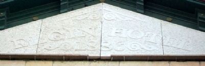
On 3rd Street at Santa Fe Street, on the left when traveling north on 3rd Street.
This property has been
placed on the
National Register
of Historic Places
by the United States
Department of the Interior
In grateful memory of
Van Keith Anderson
Nov. 4, 1921 - Jan. 11, 1986
the engineer who developed . . . — — Map (db m60955) HM
On Aztec Lane 0.2 miles east of 18th Avenue, on the left when traveling west.
Elder Jacob Stucky and Rev. Jacob D. Goering laid the foundation for orderly church life that centered in the Immigrant House and later in the Hopefield Church, Moundridge, Kansas. After some time the group began to disperse. Today, . . . — — Map (db m57144) HM
On South Polk Street (Farm to Market Road 134) near East Dallas Street, on the right when traveling north.
In the mid-1800s, Jefferson was regarded as the steamboat entry port into Texas. When the Army Corps of Engineers cleared the Red River Raft, the water level near Jefferson fell and steamboats could no longer reach the town year-round. In 1873, . . . — — Map (db m266693) HM
On Cokesbury Road (State Highway 254), on the left when traveling east.
[Original Marker]
Site of Old Tabernacle Methodist Church. Buried here are Confederate Generals Martin Witherspoon Gary, Nathan George Evans and other Confederate officers and soldiers.
[Second Marker]
1000 feet east is . . . — — Map (db m11095) HM
Near Lincoln Street west of Houston Avenue, on the right when traveling west.
The history of Pella goes back much further than the settlement of Pella in 1847. The Pella-area's Native American history precedes its Dutch history as the Sac and Fox tribes lived nearby. The Sac became their Americanized name, but they called . . . — — Map (db m236379) HM
On 11th Avenue (U.S. 43) at U.S. 278, on the right when traveling west on 11th Avenue.
City of Guin, Alabama: The Early Years
In 1889, Dr. Jeremiah Guin gave land to the Kansas City, Missouri & Birmingham Railroad to allow completion of its Memphis to Birmingham railway. The rails connected at Dr. Guin's farm, about ¼ . . . — — Map (db m96796) HM
On North Main Street (Business U.S. 65) at West Rush Avenue, on the right when traveling south on North Main Street.
In early September, 1857, the train arrived in a valley known as Mountain Meadows in southwestern Utah. Beginning early on the morning of September 7, the emigrants' camp was attacked by a group of Mormon militiamen and some Paiute Indians whom the . . . — — Map (db m225250) HM
On West Front Street (State Highway 1) north of Main Street (State Highway 168), on the left when traveling north.
United Gas Public Service Company, discovered the Rodessa Oil Field one mile west of this historical marker on July 7, 1935. Rodessa was a “Boom Town” a few weeks later.
United’s L.L. Young No. 1, Lease 6875, Sec.21-23N-16W Rodessa Field Caddo . . . — — Map (db m128263) HM
On State Highway C 0.6 miles east of U.S. 61, on the right when traveling east.
(front side)
Originally a milling settlement known as Wyaconda, the town named LaGrange was settled by John S. Marlow in 1828, and incorporated as a city in Marion County in 1832. A popular steamboat landing until after the Civil War, . . . — — Map (db m150196) HM
Thin black lines indicate changes in relevance. Between each pair of lines entries are ordered geographically but all have the same relevance.
* Inflectional forms of words are their plurals, singulars, and possessives as well as gramatical tenses and similar variations.