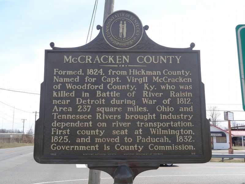
On North 8th Street (Business U.S. 45) at North H C Mathis Drive (U.S. 45), on the right when traveling east on North 8th Street.
Paducah, Kentucky
McCracken county seat, founded by Gen. William Clark of Lewis and Clark Expedition at confluence of Ohio and Tennessee Rivers. Named for legendary Indian Chief Paduke. Home of Vice Pres. Alben Barkley and birthplace of Irvin . . . — — Map (db m146587) HM
On Irvin Cobb Drive 0.1 miles east of Bethel Street, on the right when traveling west.
Paducah, Kentucky. McCracken county seat, founded by
Gen. William Clark of Lewis and
Clark Expedition at confluence of
Ohio and Tennessee Rivers. Named
for legendary Indian Chief Paduke.
Home of Vice Pres. Alben Barkley
and birthplace . . . — — Map (db m170135) HM
On North 2nd Street north of Jefferson Street, on the right when traveling south.
Lewis and Clark in McCracken County
Lewis and Clark, with the nucleus of the Corps of Discovery, stayed in present McCracken Co. in Nov. 1803 while traveling down the Ohio River on their journey to the Pacific. Clark returned 1827 to . . . — — Map (db m47208) HM
On North 8th Street south of Adams Street, on the right when traveling south.
Traditionally on August 8, African Americans assemble in Paducah to celebrate freedom and pay tribute to their roots. They gather annually for dances, ballgames, and picnics, as a family occasion and in a spirit of community remembrance. In some . . . — — Map (db m158747) HM
On South 7th Street north of Clark Street, on the right when traveling north.
In 1792, Kentucky separated from Virginia and became fifteenth state in the Union. It was not until 1818 that Indian lands west of Tennessee River were bought from the Chickasaws and named the Jackson Purchase.
On Broadway Street east of North 6th Street, on the left when traveling east.
Established in 1897, it is also known as the Fraternity Building. During WWII, it was home of the Paducah-McCracken County Draft Board. Nearly 5,000 men & women from the Paducah area served in the war. It was designated a Kentucky Landmark in 2002 . . . — — Map (db m154672) HM WM
On South Water Street at Broadway Street, on the right when traveling north on South Water Street.
Wiliam Clark, 1770 - 1838, a soldier, explorer,
Superintendent of Indian Affairs, and Governor of Missouri Territory, is best known for the Lewis and Clark voyage of discovery up the Missouri River in 1804. William got title to the 37,000 acre site . . . — — Map (db m249949) HM
On Broadway Street west of 3rd Street (Business U.S. 60), on the left when traveling east.
On this site stood the office of Reuben Saunders, M.D., credited with discovering that hypodermic use of morphine~atropine halted cholera during epidemic here in 1873. Telegraphed prescription to other plague~stricken areas.
Accepted by Materia . . . — — Map (db m47252) HM
Thin black lines indicate changes in relevance. Between each pair of lines entries are ordered geographically but all have the same relevance.
* Inflectional forms of words are their plurals, singulars, and possessives as well as gramatical tenses and similar variations.