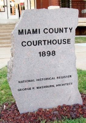
On Pearl Street near Miami Street, on the right when traveling south.
1803 - Louisiana Purchase, Native American Lands
1854 - Kansas Territory established & open settlement began
1861 - Kansas Statehood - Miami County renamed from Lykins County
1873 - First courthouse on this site converted . . . — — Map (db m34418) HM
On East Peoria Street east of Pearl Street, on the right when traveling west.
The Jefferson Highway was created in 1915 as an early north-south automobile highway through America. The route went from Winnipeg to New Orleans through lands procured by President Thomas Jefferson in the Louisiana Purchase. Miami County . . . — — Map (db m312678) HM
On William Street north of West Broadway Street, on the left when traveling north.
Units assigned to guard the Alton Federal Military Prison
13th U.S. Regular Infantry
Ordered to Alton February, 1862
77th Ohio Volunteer Infantry
Ordered to Alton August, 1862
37th Iowa Volunteer Infantry (The . . . — — Map (db m210701) HM
On Main Street at the Floodwall, on the right when traveling south on Main Street.
"The Marsh of the Swans" is the meaning of the river's French name. In 1828, Baptist missionary Isaac McCoy brought a group of Indians on a journey to examine this area as a possible relocation site for eastern and Great Lakes tribes. McCoy . . . — — Map (db m67727) HM
The Park
1858 - The City Park is donated by Baptiste Peoria, Chief of the Confederate Tribes, with the provision that no building should ever he placed there. In the early days, the park area was an open commons where American Indians ran . . . — — Map (db m312680) HM
On Main Street at 3rd Street, on the right when traveling south on Main Street.
This is the oldest surviving courthouse designed by George P Washburn of Ottawa. Before coming to town, Washburn had worked for the Kansas City architectural firm of Cross and Taylor where he supervised construction of Union railroad depots . . . — — Map (db m67586) HM
On West Canal Street at West Lafayette Street, on the right when traveling east on West Canal Street.
Peru River Walkway Park
This site along the Wabash River has been an important transportation route and life center from the first Indigenous People to today. Pressure for Native People to move began before Indiana became a state in 1816. . . . — — Map (db m310943) HM
On North Dodgion Street at East Truman Road, on the right when traveling south on North Dodgion Street.
(front:)
In remembrance of the forced removal of the Potawatomi (Neshdabe) people from their homes in northern Indiana to Miami County, Kansas in 1838
(reverse:)
This historical landmark was made possible by the Eagle . . . — — Map (db m200147) HM
Thin black lines indicate changes in relevance. Between each pair of lines entries are ordered geographically but all have the same relevance.
* Inflectional forms of words are their plurals, singulars, and possessives as well as gramatical tenses and similar variations.