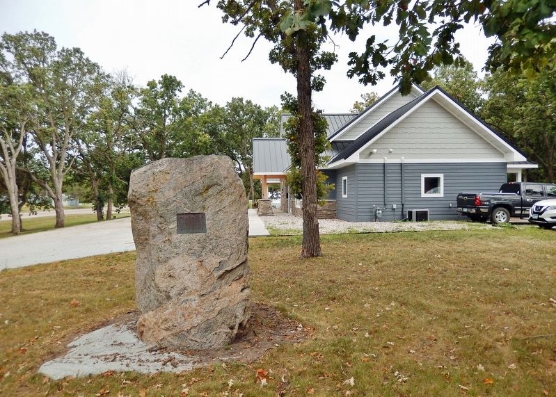
On Bay View Road just west of Otter Tail Scenic Byway (State Highway 78/108), on the left when traveling west.
This tablet commemorates Otter Tail City, the first County Seat of Otter Tail County, 1858 to 1872. This site was chosen for the erection of the court house and jail. Dedicated by the Otter Tail County Historical Society on June 25, 1933. — — Map (db m233574) HM
On County Highway 9 north of U.S. 59, on the right when traveling north.
Dakota and Ojibwe Homeland
Archaeologists have documented human activity within Minnesota to at least 11,000 years ago. By the 1600s, when the first French explorers reached present-day Minnesota, the two main groups of people now occupying . . . — — Map (db m261165) HM
On State Highway 78 south of Otter Road, on the right when traveling north.
Marking the Past
This wayside honors the Craigie Flour Mill, the first flour and grist mill in Otter Tail County, built by James Craigie, a Scottish immigrant. Craigie built the mill near this spot in 1870 along Balmoral Creek, which still . . . — — Map (db m261311) HM
Ice Age Glaciers Leave Their Mark on the Land
Geological History
The last two million years or so Minnesota has seen the formation and disappearance of the glaciers of the Great Ice Age. The last of the major glacial . . . — — Map (db m260553) HM
On North Broadway (U.S. 59) north of County Highway 9, on the left when traveling north.
Pelican Rapids Village
First settler: Harrison Harris, 1869
Village platted 1872
Village incorporated May 16, 1882
First church organized: Congregational, May 10, 1882
First school district organized, No. 10, Nov. 17, 1871
First . . . — — Map (db m261161) HM
On West Main Street (Otter Tail Scenic Byway) (County Road 80) just west of 2nd Avenue Southwest, on the left when traveling east.
This tablet is placed here to commemorate the arrival of the Northern Pacific Railway at Perham September 30, 1871. The first railroad to enter Otter Tail County, Minnesota. Dedicated by the Otter Tail County Historical Society June 28, . . . — — Map (db m233683) HM
On State Highway 78 0.4 miles west of 430th Avenue, on the right when traveling south.
Fur-bearing animals were plentiful when French fur trappers came to Otter Tail County in the early 1700's.
Cashless Commerce
Native Americans were skillful hunters and trappers of bear, beaver, bobcat, lynx, buffalo, . . . — — Map (db m260429) HM
Near 4th Avenue north of West Lincoln Avenue, on the right when traveling south.
Damage estimates list $4.5 million in property losses. That would translate into $120 million in today's dollars.
Day of Death & Destruction
The term "cyclone" does not mean "tornado" in the strictest sense. In 1919, the . . . — — Map (db m260089) HM
On Centennial 84 Drive (County Highway 84) east of Walker Avenue, on the right when traveling east.
"Come to Minnesota! Mill hands and timber cutters needed! Large forested area promises prosperity! Homesteads available!"
The rousing newspaper ads in Michigan, New York and other eastern areas lured many settlers to Minnesota during the . . . — — Map (db m260427) HM
Near North Broadway (U.S. 59) south of 1st Avenue Northeast, on the right when traveling north.
This tablet is placed here to commemorate the arrival of the railroad at Pelican Rapids, Minnesota July 4, 1882
Dedicated by the Otter Tail County Historical Society May 17, 1932 — — Map (db m261114) HM
Near County Highway 45 0.5 miles west of 288th Street, on the left when traveling north.
In September 2002, a water turbine was found by members of the Friends of Phelps Mill in the rubble of the 1876 Parkdale Mill in Tumuli Township. Built as a flour and grist mill, Parkdale was one of many mills in the late 19th century that made . . . — — Map (db m261029) HM
On Summit Avenue East east of Friberg Avenue, on the right when traveling east.
Lake Alice Has Become an Important Focal Point for the People of Fergus Falls
Lake Alice
(2 blocks west & 1 block north of this spot)
Lake Alice has been a leading attraction for residents since Fergus Falls was first . . . — — Map (db m260128) HM
Near 120th Street (County Highway 38) north of 435th Avenue when traveling east.
For Minnesota's Nobel Prizewinning novelist Sinclair Lewis, Inspiration Peak more than lived up to its name. From its "bald top," he wrote, "there is to be seen a glorious, 20-mile circle of some 50 lakes scattered among fields and pastures, like . . . — — Map (db m120098) HM
On State Highway 210 0.3 miles east of County Highway 5, on the right when traveling east.
Flight From Religious Persecution Led to the Organization of Otter Tail County's First Permanent Settlement.
The Cutlerites
Clitherall was settled by the Cutlerites, a branch of the Church of Latter Day Saints on May 6, . . . — — Map (db m260485) HM
On County Highway 1 east of County Highway 35, on the right when traveling east.
From the Earliest Days, Education Has Been of Prime Importance for Residents of Otter Tail County
History Of Rural Schools
In 1869, Clitherall, Minnesota won the distinction of becoming Otter Tail County School District . . . — — Map (db m260172) HM
On Otter Tail Scenic Byway (State Highway 78/108) at Bay View Road, on the right when traveling south on Otter Tail Scenic Byway.
A Snapshot of Ottertail City Trading Post - Otter Tail City was originally settled by trappers that traded with the natives of the area. Donald McDonald located a trading post on the east side of Otter Tail Lake because of its . . . — — Map (db m233573) HM
Near South Court Street north of West Washington Avenue, on the right when traveling north.
One of the most enduring legends in Otter Tail County is that Fergus Falls stole the county seat from Otter Tail City, a once thriving town on the eastern shore of Otter Tail Lake.
On March 18, 1858, the Minnesota Territorial Legislature . . . — — Map (db m260854) HM
Near North Lake Avenue (State Highway 78) south of Lake Shore Avenue, on the right when traveling south.
As the site of many battles between Indian tribes, the lake was named Lac du Battaile by early French mapmakers. Later, in explorer Jean Nicollet's map of the Mississippi Valley, the name was anglicized to Battle Lake.
A Conflict of . . . — — Map (db m260481) HM
On South Central Avenue (County Highway 35) south of Pioneer Lane, on the right when traveling north.
Founder of Dalton
Ole C. Dahl, founder of the city of Dalton immigrated from Norway in 1865. Initially settling in Iowa, he worked as a farm hand and painter until he had enough money to bring his wife Oline and their six . . . — — Map (db m260556) HM
On South Cascade Street south of East Lincoln Avenue, on the right when traveling south.
Frontiersman Joe Whitford first set foot on this spot in the winter of 1856 because a businessman named James Fergus had employed him to establish a townsite. Indians had told Whitford about a good site with "big swift water"on the Otter Tail . . . — — Map (db m260093) HM
Near County Road 120 west of County Highway 33, on the left when traveling east.
What Is A Continental Divide?
A continental divide or watershed is a naturally occurring ridge on the continent that forces the separation of river systems. As rivers, streams and creeks separate, they are collected into many . . . — — Map (db m260558) HM
On State Highway 78 south of Otter Road, on the right when traveling north.
Mills and the Advancing Frontier
For centuries this region has been the homeland of the Dakota and Ojibwe people. The late 1700s brought French and British fur traders and, by the late 1800s, Euro-American settlement had pushed the tribes . . . — — Map (db m261312) HM
On State Highway 210 at Soule Avenue, on the right when traveling east on State Highway 210.
This Towns Remarkable Roadside Sculptures are Impossible to Miss
History of Vining
The village of Vining is in the northeastern part of Nidaros township on the branch line of the Northern Pacific Railroad running between . . . — — Map (db m260551) HM
On South Sherman Street near East Lincoln Avenue, on the right when traveling south.
"A Last Moment for Friends"
Dedicated to the memory of the veterans from Ottertail County who gave their lives in
W.W. I ·
W.W. II ·
Korea ·
Viet Nam ·
OEF / OIF
in the service of their country
Donated by: . . . — — Map (db m262164) WM
Thin black lines indicate changes in relevance. Between each pair of lines entries are ordered geographically but all have the same relevance.
* Inflectional forms of words are their plurals, singulars, and possessives as well as gramatical tenses and similar variations.