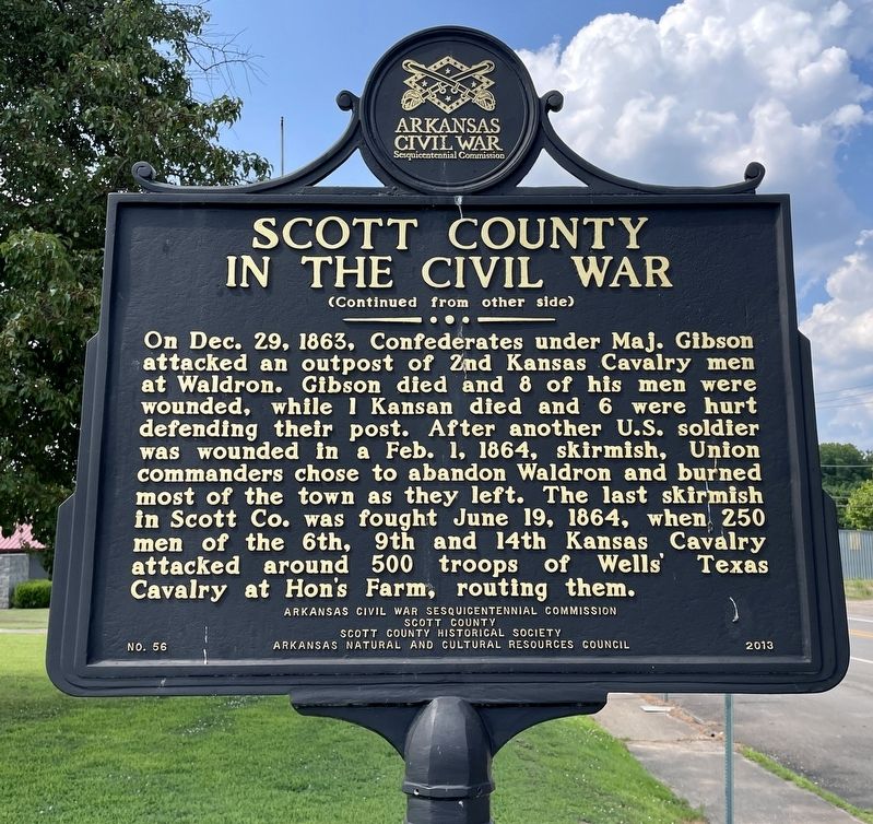
On South Main Street (Business U.S. 71) at Duncan Street, on the right when traveling south on South Main Street.
While Scott County residents were divided on the issue of secession, once Arkansas left the Union, many supported the Confederacy. The first fighting there was a Sept. 11, 1863, skirmish near Waldron where the 14th Kansas lost 1 dead and 2 wounded . . . — — Map (db m200627) HM
On West 2nd Street just east of Huston Street, on the right when traveling east.
In 1905, after several previous courthouses had burned down in Waldron, another was commissioned. The new courthouse would also be accompanied by a new jail in 1907. The new jail was to be built of stone unlike its wooden predecessor. J.L. . . . — — Map (db m262762) HM
On Main Street south of Virginia Avenue, on the right when traveling south.
When established in 1789, New Madrid was one of a handful of settlements in the Spanish territory west of the Mississippi River. First as a district and later as a county, the New Madrid jurisdiction extended as far south to the northern border of . . . — — Map (db m179976) HM
On South Main Street (Business U.S. 71) just south of Danville Road, on the right when traveling south.
Businesses flourished on Main Street after the turn of the century. In 1901 the Bank of Waldron and First National Bank both opened on South Main Street. By 1902 the Kansas City Southern Railroad went through Waldron, making it an important . . . — — Map (db m262791) HM
On Main Street (Arkansas Route 27) at East 5th Street, on the right when traveling north on Main Street.
The first court house in Yell County was erected in 1840, at Danville. About 1885, another court house was erected at Dardanelle, and since then the county has maintained two seats of justice. The county was named for Governor Archibald Yell. — — Map (db m156865) HM
This marks the site of the last encounter in the State of Kansas between Native Americans and the United States Troops. Homesick and ill, the Northern Cheyenne under the leadership of Chief Dull Knife and Little Wolf were trying to return to . . . — — Map (db m65978) HM
Near Lt Billy Webb Avenue 0.1 miles north of Cook Street.
The American Civil War (1861-1865) was the result of decades of tension between the North and the South. Chief among the issues were expansion of slavery into the western territories, the South's declining political power, states' rights, and the . . . — — Map (db m210072) HM
Thin black lines indicate changes in relevance. Between each pair of lines entries are ordered geographically but all have the same relevance.
* Inflectional forms of words are their plurals, singulars, and possessives as well as gramatical tenses and similar variations.