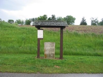
On County Highway B west of State Highway 27, on the left when traveling west.
700 Sac Indians July 31,
1200 Soldiers Aug. 1, 1832
followed this ridge west
into Vernon County over this
ground.
_____________________
Two human skeletons were
found at a spring west of
Wilder's Hotel, Rising
Sun in 1852.
. . . — — Map (db m32003) HM
On Great River Road (State Highway 35) 2.5 miles north of Main Street (State Highway 82), on the right when traveling north.
Battle Bluff ↑ Elv 1139ft
Battle Hollow →
Severe fighting 1 mile east between Gen. Henry's 300 Ill. militia and 300 Sac Indians Aug. 2 1832.
← Battle Island
Hard fighting opposite. 1200 white soldiers . . . — — Map (db m24501) HM
Near County Road BI 1.9 miles west of Great River Road (State Highway 35).
← Head of Battle Isle.
_____________________
On the eve of Aug. 1, 1832,
Black Hawk and his men
with a flag of truce, went to
the head of this island to sur-
render to the captain of steamer
"Warrior." Whites on . . . — — Map (db m32351) HM
On County Highway UU 0.8 miles west of Orlando Road, on the left when traveling west.
August 2 1832 twenty
picked Sacs were station-
ed here to decoy the US
Army northward and per-
mit the Indian main body
with women and children
to escape across the riv-
er. Fourteen of the out-
post were shot here wh-
ile . . . — — Map (db m32171) HM
On State Highway 82 0.8 miles west of Fortner Avenue, on the right when traveling west.
On night of August 1 and 2
1832, Gen. Atkinson's
army of 1200 mounted men
in pursuit of Black Hawk
encamped on this area
from 8 p.m. until 3 a.m.
The spring from which
men and horse drank
is 140 rods northwest.
No. 2 CVP . . . — — Map (db m32114) HM
On State Highway 82 0.8 miles west of Fortner Avenue, on the right when traveling west.
At shallow pond 115 rods due
south Blackhawk's 700 Sac
Indians encamped July 31 1832.
Soldiers found six decrepit
Indians there and "left them
behind."
Lee Sterling in 1846 found
a handfull of silver brooches
there. Hence . . . — — Map (db m32117) HM
Near Elm Street 0.1 miles north of Water Avenue (Wisconsin Highway 80), on the left when traveling north.
The Cheyenne Valley area near Hillsboro was Wisconsin’s largest rural African American settlement in the 19th century. The State’s early defiance of the 1850 Fugitive Slave Act and the later demise of the slavery system after the Civil War . . . — — Map (db m151602) HM
On Hornby Hollow Road west of Wisconsin Highway 27/82, on the right when traveling west.
Near here
John McCulloch in 1844
Erected the First Permanent
Cabin in this County. He Sold
in 1852, went to Calif.; died on
Plains 1853.
________________________
Sept. 4, 1848
Democratic Nominating Conven–
tion . . . — — Map (db m31919) HM
On State Highway 82 at Anderson Ridge Road, on the right when traveling west on State Highway 82.
Two trails across
Dr. Bean's door yard, the
Black Hawk Retreat and
the Winnebago Trail
which ran from Winne-
shiek's (De Soto) village
to large Winnebago town
above the forks of the
Kickapoo at Manning
prior to 1840.
. . . — — Map (db m32170) HM
On County Route Y 3 miles County Route M, on the left when traveling north. Reported missing.
Blackhawk Memorial Park is on the site of the Battle of Pecatonica, the first of three military engagements fought in present-day Wisconsin during the American-Indian conflict of 1832, known as the Black Hawk War. On June 16, 1832, following . . . — — Map (db m262388) HM
On North Rock Avenue south of Church Street, on the right when traveling south.
Here July 4, 1856 Lucy Stone "Morning Star of the Woman's Rights movement" delivered the first woman's rights address and anti slavery speech ever given by a woman in the great northwest. The platform broke down. Rising unhurt she cried "So . . . — — Map (db m31939) HM
On Superior Street south of Broadway Road (State Highways 13, 16, and 23), on the left when traveling south.
A Wisconsin Pioneer
One of the founders of Wisconsin Dells, Joseph Bailey completed the first dam across the Wisconsin River here in 1859. Opposition from upriver lumbermen required the dam's removal in 1860. Bailey's dream to build an . . . — — Map (db m134610) HM
Thin black lines indicate changes in relevance. Between each pair of lines entries are ordered geographically but all have the same relevance.
* Inflectional forms of words are their plurals, singulars, and possessives as well as gramatical tenses and similar variations.