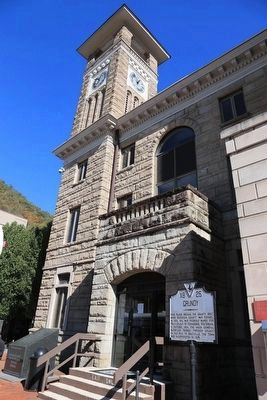
On Main Street at Walnut Street (Local Route T-1003), on the left when traveling south on Main Street.
This place became the county seat when Buchanan County was formed, in 1858, and was probably named for Felix Grundy of Tennessee, Statesman. In October, 1864, the Union General Burbridge passed through Grundy on his raid to Saltville. The town was . . . — — Map (db m89737) HM
On Main Street at Walnut Street, on the left when traveling south on Main Street.
To the gallant Confederate
soldiers of Buchanan County
Virginia 1861–1865.
10th Kentucky Cavalry Co.'s F, G, H, & I
21st Virginia Cavalry – Co. E
21st Virginia Infantry Battalion – Co. E
22nd Virginia Cavalry – Co. B
34th Virginia . . . — — Map (db m228609) WM
On Plumb Alley east of Brewers Alley, on the left when traveling east.
Walnut Grove, a recreation of an early Appalachian homestead, is an authentic representation of what was common to pioneer life in this region from the late 1700's until the early 1900's.
Beginning with a simple log cabin, pioneer settlers, over . . . — — Map (db m210000) HM
On U.S. 460 south of Shortt Gap Road, on the right when traveling north.
Buchanan County Buchanan County is situated in the heart of
Southwest Virginia's coalfields in the Appalachian
Plateau and was formed from Tazewell and
Russell counties in 1858. The county is named
for James Buchanan who served as . . . — — Map (db m228601) HM
On Patty Loveless Drive (Kentucky Route 80), on the right when traveling east.
Russell Fork originates at the confluence of a
number of small streams near Council
Virginia. Typical of the Appalachian Plateau,
the river valley is narrow and V-shaped. Flash
floods are not uncommon. Major tributaries
are McClure River and . . . — — Map (db m90657) HM
On U.S. 460 just east of the Kentucky State Line, on the left when traveling west.
Buchanan County. Formed in 1858 from Tazewell and Russell and named for James Buchanan, President of the United States, 1857–1861.
Kentucky. The first permanent settlement was made at Harrodsburg in 1774. Kentucky County was . . . — — Map (db m89744) HM
On Main Street at Walnut Street, on the left when traveling south on Main Street.
This tablet is placed in honor of all citizens of Buchanan County,
Virginia who served their country for the preservation of democracy.
Those who made the supreme sacrifice are enrolled below.
World War I
Army: Ellis Charles • . . . — — Map (db m228610) WM
On April 3, 1860, the Pony Express started from this neighborhood on its historic run to the West. Eight months after the Pony Express joined East and West, the country split North to South when South Carolina seceded. Missouri, including St. . . . — — Map (db m48063) HM
Thin black lines indicate changes in relevance. Between each pair of lines entries are ordered geographically but all have the same relevance.
* Inflectional forms of words are their plurals, singulars, and possessives as well as gramatical tenses and similar variations.