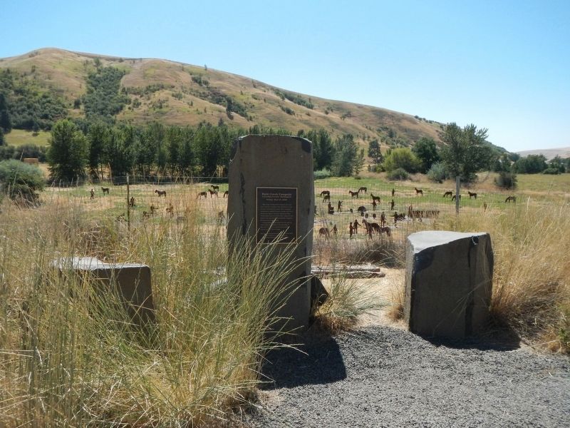
On Patit Road at Ronan Hill Road, on the right when traveling east on Patit Road.
"Friday, May 2d, 1806"
The Corps of Discovery camped near this spot with fair weather and a southwest wind on their return to St. Louis. They recorded seeing deer, sandhill cranes, beaver, and otter. There was camas in bloom along the . . . — — Map (db m159068) HM
On East Main Street west of North 3rd Street, on the right when traveling west.
Columbia County Courthouse: 1887 Washington’s Oldest Courthouse.
Construction of the Territorial Courthouse was completed two years before Washington became a state in 1889.
Designed by local architect W.H. Burrows, the courthouse was . . . — — Map (db m129474) HM
Near New York State Route 9H 0.2 miles north of Fischer Road, on the right when traveling south.
Called "the first American man of letters," Washington Irving (1783-1859) found fame and success as a writer of short fiction in the early years of the republic. Mixing fact, legend and folklore, his whimsical tales captured the cultural character . . . — — Map (db m244713) HM
The Old Log Jail is one of the oldest log structures in Oregon. In 1853, Washington County
included all of what is now Multnomah and Columbia Counties, Hillsboro (originally
Hillsborough) was the county seat. The town was composed of twelve . . . — — Map (db m303691) HM
On Schoenbar Road south of Water Street, on the right when traveling south.
Before the Klondike Gold Rush of 1897, there was the Silver Rush: a fierce contest on the North Pacific Coast for glittery, meaty Alaskan salmon. In the late 1880s, nearly 40 canneries operated in Alaska. They flooded the market and barely a . . . — — Map (db m308944) HM
On Taconic State Parkway 0.5 miles north of Route 217, on the right when traveling north.
Columbia County
Historic New York
Columbia County, which extends from the Hudson River to the New England border. was formed in the late 18th century from parts of two 17th century land patents. Early settlers came from Holland, followed by . . . — — Map (db m237040) HM
The Hudson River as we know it today has played a central role in the evolution of culture and commerce for at least 20,000 years, when the last ice sheet the 350 food thick Wisconsin began to retreat in an era glacial warming. The river begins at . . . — — Map (db m306141) HM
Near The Strand south of St. Helens Street, on the left when traveling south.
In October 1856, the U.S. Lighthouse Board entered this fog bell and Cape Disappointment Lighthouse into service, thus establishing the first light station on the Oregon and Washington coast.
Positioned on the north side of the entrance to . . . — — Map (db m113153) HM
On East Main Street west of North 3rd Street, on the right when traveling west.
Palouse Indians To supplement a diet of salmon, families migrated from riverside “mat lodge” villages to the mountains for game, roots, and berries. “Appaloosa” horses played a paramount role in tribal life.
. . . — — Map (db m129473) HM
On Tucannon Rd 1 mile north of Majorie Road, on the left when traveling north.
Columbia County Washington
“Saturday, May 3d, 1806”
The Corps of Discovery crossed the “high plains” and descended to this location after a cold morning of rain, snow, and hail. They described the Kimooenim Creek . . . — — Map (db m118600) HM
Near New York State Route 9H 0.2 miles north of Fischer Road, on the right when traveling south.
Welcome to Columbia County Historical Society's interpretive exhibit exploring the
early heritage of the site, specifically the people, stories and events that shaped the
history and character of northern Columbia County.
The cultural heritage . . . — — Map (db m244315) HM
Near Capitol Avenue Southwest south of M.L.K. Junior Drive Southeast, on the left when traveling north.
Expelled Because of Color” is dedicated to the memory of the 33 Black state legislators who were elected, yet expelled from the Georgia House because of their color in 1868.
The cinder block forms at the base of the sculpture symbolize the . . . — — Map (db m130191) HM
Near New York State Route 9H 0.2 miles north of Fischer Road, on the right when traveling south.
From the early 1950s through the mid 1960s, the defunct Ichabod Crane Schoolhouse was revived as an ad hoc community meeting hall. On October 10, 1952, former First Lady Eleanor Roosevelt visited the schoolhouse to officially dedicate the Ichabod . . . — — Map (db m244478) HM
On Centre Street (Pennsylvania Route 54) at Catawissa Street, on the left when traveling west on Centre Street.
This park is dedicated to the memory of those who suffered and died in the anthracite coal mining communities of eastern Pennsylvania during the 1862-1879 Molly Maguire era.
This fragile period erupted into a multi-faceted socioeconomic . . . — — Map (db m236538) HM
Thin black lines indicate changes in relevance. Between each pair of lines entries are ordered geographically but all have the same relevance.
* Inflectional forms of words are their plurals, singulars, and possessives as well as gramatical tenses and similar variations.