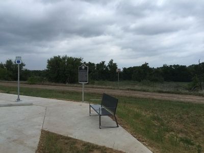
Near Bankhead Highway 0.5 miles north of Interstate 20, on the right when traveling east.
Early 20th century development of the automobile led to major road system improvements throughout the United States. Senator John H. Bankhead of Alabama sponsored the 1916 Federal Aid Road Act, which supplied matching funds to states to upgrade . . . — — Map (db m93962) HM
On South Seaman Street (Texas Route 6) at West Commerce Street, on the right when traveling south on South Seaman Street.
The Texas Legislature created Eastland County in 1858, but sparse settlement delayed organization until 1873, when Merriman (8 mi. NE) became the first county seat. Charles Connellee and Jack Daugherty platted the new town of Eastland near the . . . — — Map (db m105245) HM
On South Lamar Street at West Olive Street, on the right when traveling north on South Lamar Street.
First known Eastland area inhabitant was Frank Sanchez (d. 1867), who grazed herds here in the 1850s. The United States in 1853 established Army posts at Fort Phantom Hill, in present Taylor County, and Fort Belknap, in present Young County, giving . . . — — Map (db m105242) HM
On South Seaman Street at East Commerce Street, on the right when traveling north on South Seaman Street.
The evolution of Eastland banks reflects local economic conditions and global influences. Soon after the Texas and Pacific Railway reached town in October 1880, a Mr. Berry of Stephenville opened the first bank in Eastland in Jacob Alexander's dry . . . — — Map (db m105256) HM
On W Commerce Street at S Seaman Street, on the right when traveling west on W Commerce Street.
Under an 1891 legislative act, Texas created a court of appeals system. These courts are part of the judicial branch of the Texas government and are located at a level above trial courts but below the Texas Supreme Court and the Texas Court of . . . — — Map (db m310215) HM
Near County Road 147 at County Road 151, on the right when traveling south.
Settled in the 1870s, the Scranton community grew to include a post office, stores, a cotton gin, blacksmith, school and academy. In Oct. 1896, Joseph Jackson Ray and Sarah Frances (Morgan) Ray donated land for a Baptist church and graveyard. The . . . — — Map (db m80071) HM
On South Seaman Street (Texas Route 6) at West Commerce Street, on the right when traveling south on South Seaman Street.
County seat, Eastland County. Named for William M. Eastland—Texas War for Independence hero who was in Mier Expedition against Mexico, and was executed in "Black Bean" lottery at Rancho Salado in 1842.
Most noted early local people were . . . — — Map (db m105247) HM
On I-20 Access Road (Northside) 0.1 miles west of Main Street ( Highway 112), on the right when traveling west.
North Carolina native Larry Hargus (1810-87) and his wife Mary (Corder) (1824-1910) came to Eastland County in 1879. In 1881 they bought the original tract of their farm at this site from C.U. Connellee, a founder of Eastland. Members of the Hargus . . . — — Map (db m97804) HM
Near Davidson Cemetery Road 2.4 miles west of Highway 108, on the left when traveling west.
Born in Giles County, Tennessee, Joseph Peter Davidson moved to Texas and settled in Palo Pinto County about 1856. Davidson established a trading post near this site. In 1865 he started a ranch in present Eastland County and later helped organize . . . — — Map (db m97807) HM
Near Avenue H at W. 8th Street, on the left when traveling south.
The Rev. Lamb Trimble, a Methodist circuit rider, organized this church at Red Gap (two miles west) in 1880. The four charter members met in the home of M.V. Mitchell, a sheep rancher. The congregation moved to Cisco one year later when the city was . . . — — Map (db m113525) HM
On State Highway 16 0.2 miles south of Farm to Market Road 8, on the left when traveling south.
A few miles to the southwest. Largest far western "Family Fort" used throughout Civil War. Started by C.C. Blair, 1857 settler. 1861-1865 occupants were Wm. Arthur, Blair, J.M. Ellison, Jasper, Jim and Tom Gilbert, W.C. McGough, W.H. Mansker and . . . — — Map (db m181883) HM
Near Oddie Street 0.1 miles south of Vespasian Avenue.
The Texas Department of Transportation’s Aviation Division lists this field as the third oldest operating airport in the state. The earliest documentation for an airplane landing in Ranger was on November 24, 1911, when Robert G. Fowler landed his . . . — — Map (db m98129) HM
Dolphin William Bint (1845-1883) came to the United States from England in 1876 and settled in Eastland County in the Red Gap community. While on a journey to Fort Worth to buy lumber for their home, his wife gave birth to a stillborn son. His . . . — — Map (db m113526) HM
On Park Road 54 0.5 miles east of U.S. 283, on the left when traveling east.
(Front Side)
Few in numbers and with little protection from the military but refusing to abandon their country, certain families of courageous and determined people on the Texas frontier during the Civil War gathered together in hastily . . . — — Map (db m93646) HM
Thin black lines indicate changes in relevance. Between each pair of lines entries are ordered geographically but all have the same relevance.
* Inflectional forms of words are their plurals, singulars, and possessives as well as gramatical tenses and similar variations.