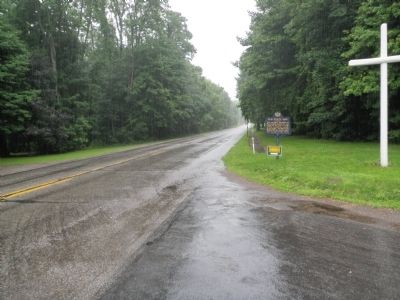
On West Lake Road (Pennsylvania Route 5) at Happy Valley Road, on the right when traveling east on West Lake Road.
The northern boundary of Pennsylvania, before the purchase of the Erie Triangle in 1792, crossed the highway at this point. The state paid $151,640.25 for the Erie tract and its port on the Lakes. — — Map (db m84767) HM
On West 6th Street (Pennsylvania Route 5) 0.1 miles east of Sassafras Street, on the right when traveling west.
Formed March 12, 1800 from Allegheny County. Named for Lake Erie, which took its own name from the Erie Indians. Erie, the county seat, was laid out 1795; made a city in 1851. Ships of Perry's fleet which won the 1813 Battle of Lake Erie were built . . . — — Map (db m41035) HM
On Pennsylvania Route 89 at Station Road ( Route 430), on the right when traveling south on Pennsylvania Route 89.
Judah Colt as Agent began the first Pennsylvania Population Co. development here in 1797, setting up the first organized settlement in Erie County, at head of flatboat navigation on French Creek. — — Map (db m64579) HM
On Madison Avenue at 6th Street, on the left when traveling north on Madison Avenue.
Clinton Griffey
Clinton George Griffey (1841-1937) was born in Erie County, Pennsylvania. He published his first newspaper, the Girard Union in Girard, Pennsylvania, at age nineteen. In 1862 he enlisted in the 15th . . . — — Map (db m316197) HM
Near Fisher Drive at Thompson Drive, on the right when traveling east.
Welcome to Presque Isle State Park and Perry Monument
This monument honors Commodore Oliver Hazard Perry, a naval war hero who defeated the British at the Battle of Lake Erie during the War of 1812.
Crystal Point Under the command of . . . — — Map (db m129899) HM
On Mill Road west of Welton Road, on the right when traveling west.
The prehistory of Ohio is generally divided into four major time periods: The Paleoindian, Archaic, Woodland, and Proto-historic periods. The Archaic and Woodland are each further sub-divided into Early, Middle, and Late time periods.
The . . . — — Map (db m214343) HM
On German Street north of East 5th Street, on the left when traveling south.
Hon. Judah Colt (1761-1832), one of Erie County's earliest citizens, settled at Colt Station, 1796, as the agent for Pennsylvania Population Co., the county's first land developer. Moved to Borough of Erie, 1804, serving as Burgess, 1813 & 1820-21. . . . — — Map (db m132253) HM
On East Front Street at Parade Street, on the right when traveling west on East Front Street.
Native American influence on this area of northwestern Pennsylvania pre-date the 1492 encounter by at least 13,500 years.
Erie County is named after its first known inhabitants, the Erie Nation.
The Erie Nation, also known as the Cat . . . — — Map (db m25977) HM
On East Quaker Street (U.S. 20A) 0.1 miles west of Freeman Road, on the left when traveling east.
The Quaker Meetinghouse, formally known as the "Meetinghouse of the Orchard Park Monthly Meeting of the Religious Society of friends", is home to Erie County's oldest active congregation. Known as "Quakers" they brought with them their lifestyle, . . . — — Map (db m80772) HM
On West 6th Street (Pennsylvania Route 5) west of Peach Street, on the right when traveling west.
Erie County Government, with financial assistance from the Pennsylvania Historical and Museum Commission, began restoration work on the courthouse in June of 2001. The West Wing of this Classical U-shaped Greek Revival structure was built in . . . — — Map (db m116377) HM
On French Street at East 6th Street, on the right when traveling south on French Street.
Oliver
Hazard
Perry
"We have met
the enemy and
they are ours
Dedicated
to the Pennsylvanians
who built and served
aboard Perry's Erie-based
ships for the decisive
Battle of Lake Erie
September . . . — — Map (db m116459) HM WM
On Marine Drive at Commercial Street, on the left when traveling west on Marine Drive.
Pre-1800 The Ongiara Confluence of Little Buffalo Creek and the Buffalo River with Lake Erie in the background, 1815. The region's original inhabitants were the Ongiara, a peaceful Iroquois tribe, from whom the name Niagara is derived. Long . . . — — Map (db m84777) HM
On West 6th Street (Alternate Pennsylvania Route 5) west of Myrtle Street, on the right when traveling west.
This Victorian Eclectic style house was built for the socially prominent Selden sisters, Joanna Sill Selden (1845-1925)and Emma Josephine Selden (1850-1927), on property purchased in 1896 from John T. Boyd. Carriage house was built about . . . — — Map (db m310387) HM