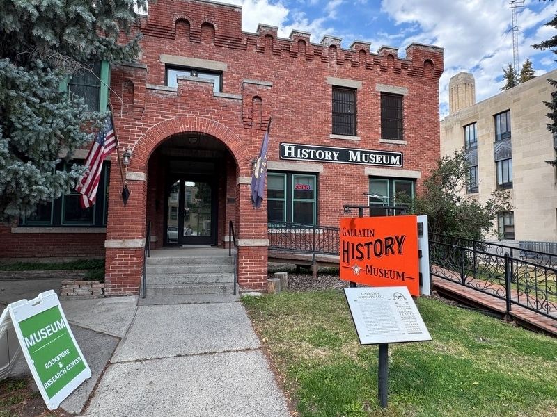
On West Main Street, on the right when traveling west.
Calls for a better Gallatin County jail came in 1886, only five years after the county's second jail was established in the original courthouse's basement. A grand jury found that the facility lacked proper ventilation, sewer, and security, as well . . . — — Map (db m292625) HM
On Frontage Road (County Route 205), on the right when traveling east.
The original townsite of Gallatin City, north of here on the
west side of the combined Madison and Jefferson Rivers,
was selected in 1862. In Feb., 1863 sixty cabins were being
constructed. The river was forded when it was low and a
ferry was . . . — — Map (db m127042) HM
On Lone Mountain Trail (State Highway 64) at Little Coyote Road, on the right when traveling west on Lone Mountain Trail.
Frank Crail, County Commissioner from 1889 to 1900, started proving up on his homestead in 1902 at what is now Meadow Village. The ranch became a cattle and wheat ranch of some 960 acres. Crail developed a strain of wheat called Crail Fife. His son . . . — — Map (db m192613) HM
On US Highway 191 (U.S. 191 at milepost 35), 0.3 miles south of Flints Creek Road, on the right when traveling south. Reported damaged.
Eldridge was an early day tie and lumber camp for the Northern Pacific Railway from 1902 to 1914. Walter Cooper operated the camp which was located a few miles up Taylor Fork. The "tie camp" was where logs were milled for railroad ties. In the . . . — — Map (db m308648) HM
On East Valley Center Drive at North 19th Avenue when traveling east on East Valley Center Drive.
The museum, located next to the Gallatin County Courthouse at 317 West Main, was the former county jail. Along with many museum exhibits showcasing the history of Gallatin County is an historical research library, the photo archives, and one of the . . . — — Map (db m193258) HM
Near N. 19th Avenue near I-90 eastbound entrance ramp (at milepost 305), 0.1 miles east of N. 19th Ave. and E. Valley Center Rd., on the left when traveling south.
The Pioneer Museum, located next to the Gallatin County Courthouse at 317 West Main, was the former County jail. Along with many museum exhibits showcasing the history of Gallatin County is an Historical Research Library. The photo archives, and . . . — — Map (db m29085) HM
On Frontage Road (County Route 205), on the right when traveling east.
Approx.. 2 miles north on the Trident Road (#286) is the
confluence of the Jefferson and Madison Rivers. A mile
further downstream you can view the Gallatin River
merging to form the headwaters of the Missouri River, the
longest U.S. river. . . . — — Map (db m99206) HM
On Hebgen Lake Road (U.S. 287) 3.5 miles west of U.S. 191, on the right when traveling west.
By 1898 a 10-foot wide road was built through the Gallatin Canyon to Taylors Fork and the park line. In 1911 a crude, narrow wagon road went to "Yellowstone" (West Yellowstone), 90 miles from the county seat at Bozeman. In 1926, the road was . . . — — Map (db m113833) HM
On Targhee Pass Highway (U.S. 20), on the left when traveling north.
This basin was settled by ranchers and homesteaders.
Bannock Indians had encampments here as late as 1913. Near
here is the west entrance to Yellowstone Park, the nation’s
first National Park(1872). West Yellowstone was founded in
1908 with the . . . — — Map (db m100066) HM
On Jackson Creek Road near Bridger Vista Drive, on the left when traveling north.
Built in 1905, Malmborg School is one of the most architecturally interesting one-room schoolhouses in Gallatin County. The one-story octagonal school originally sported an open front porch with wooden Doric columns resting on high plinths. An open . . . — — Map (db m191973) HM
On North Wallace Avenue near East Cottonwood Street, on the right when traveling north.
Gallatin County boasted twenty-seven grain elevators in 1915, a testament to farming’s important economic role. Despite drought and low commodity prices, Montana Mercantile added this towering elevator to the Bozeman skyline in 1933. It added the . . . — — Map (db m192445) HM
Near Three Forks Airport Road near Frontage Road (State Highway 2), on the left when traveling west.
Aviation captivated America during the 1920s, particularly when Charles Lindbergh flew solo across the Atlantic in 1927. The United States made rapid strides and airfields opened all over the country. The town of Belgrade constructed Gallatin . . . — — Map (db m206125) HM
On U.S. 287 near Interstate 90, on the left when traveling north.
The Gallatin Valley
While known to Montana First Citizens for Millennia, it was not until William Clark explored the valley in July 1806 that we have the first written description of the Gallatin Valley. Clark described the valley as an . . . — — Map (db m282810) HM
On N. 19th Avenue near I-90 eastbound entrance ramp (at milepost 305), 0.1 miles east of N. 19th Ave. and E. Valley Center Rd., on the left when traveling south.
Settlers came to the Gallatin Valley on the heels of the first Montana gold strike at Grasshopper Creek near Bannack, Montana, in 1862. As Meriwether Lewis had predicted, farmers found the valley well suited for agriculture. They planted crops and . . . — — Map (db m29078) HM
Thin black lines indicate changes in relevance. Between each pair of lines entries are ordered geographically but all have the same relevance.
* Inflectional forms of words are their plurals, singulars, and possessives as well as gramatical tenses and similar variations.