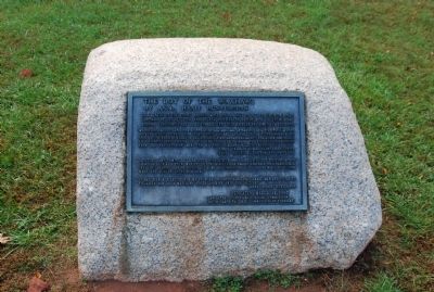
On Andrew Jackson State Park Road 0.4 miles east of U.S. 521.
This statue of the young Andrew Jackson is a gift to the children of South Carolina by the sculptor, Anna Hyatt Huntington. Children of the elementary schools throughout the state contributed their nickel and dimes for the base.
"We, the . . . — — Map (db m23779) HM
Near Gervais Street at Assembly Street, on the left when traveling west.
J. Marion Sims 1813 1883 Where the love of man is there also is love of the art. Hippocrates
(Lower Left): The first surgeon of the ages in ministry to women treating alike empress and slave (Lower Right): He founded the science of . . . — — Map (db m49773) HM
On Broad Street 0.1 miles King Street, on the left when traveling east.
Notable for its fine Georgian
paneling, this was home and
office to Dr. David Ramsay,
the distinguished patriot,
Revolutionary Historian and
physician. Dr. Ramsay
introduced the Small Pox
vaccine to Charleston
and helped found the . . . — — Map (db m27447) HM
On Twitty Mill Road at 522, on the right when traveling west on Twitty Mill Road.
Originally called Russell Place for the Irish immigrant William Russell who settled near here on a branch of Beaver Creek in 1768. General William Tecumseh Sherman passed through Russell Place in 1865 on his way to North Carolina. In 1871 James . . . — — Map (db m51641) HM
On State Highway 72 at Mt. Carmel Road (State Highway 823), on the left when traveling south on State Highway 72.
5.5 miles southeast is the burial ground of Patrick and Martha Caldwell Calhoun, Parents of John C. Calhoun; Deputy Surveyor 1756; First Representative from Up Country to Commons House of Assembly, 1769-1772; Member of First Provincial Congress, . . . — — Map (db m10627) HM
On West Main Street (State Highway 184) north of Brooks Lane, on the left when traveling south.
Surveyed in 1762 by Patrick Calhoun and named for Gov. Thomas Boone, this 20,500-acre township was one of four townships laid out west of Ninety-Six as a buffer between white and Cherokee lands. In 1763 Scots-Irish families began to settle in the . . . — — Map (db m10605) HM
Born in South Carolina December 12, 1793 Killed by Indians October 8, 1848 Served in the Army of Texas, 1835-36 Signed the Texas Declaration of Independence, 36 Member of the Senate of the Second, Third, Fourth, Fifth, Sixth, and Seventh Congresses . . . — — Map (db m239507) HM
On South Main Street at West Arch Street, on the right when traveling south on South Main Street.
[Marker Front]:
Lancaster, founded in 1798, was first called Lancaster Court House and later known as Lancasterville. The seat of Lancaster District from 1800 to 1868, it has been the seat of Lancaster County since then. The town and . . . — — Map (db m286355) HM
On South Main Street at West Dunlap Street, on the right when traveling south on South Main Street.
The Courthouse Lancaster County
Built in 1825-1828. Designed by Robert Mills of Charleston, South Carolina, America's first native born, professionally trained architect, State Civil and Military Engineer and designer of the Washington . . . — — Map (db m233044) HM
On West Gay Street east of South French Street, on the left when traveling east.
(front)
The Jail
This is the "gaol" that Willis W. Alsobrook contracted to build for Lancaster District "…agreeable to the plans and specifications signed by Robert Mills…." In 1868 Lancaster District became Lancaster County . . . — — Map (db m232463) HM
Near this spot stood the Rock Hill residence of Robert Moorman Sims, Captain, C.S.A., who on April 9, 1865, carried the flag of truce which led to the surrender of Lee's forces at Appomattox, He later was S.C. Senator for Lancaster County, . . . — — Map (db m16721) HM
On Herring Run Trail 0.5 miles Belair Road, on the right when traveling west. Reported permanently removed.
Home of a Founding U.S. Congressman
William Smith was born in 1728 in Lancaster County, Pennsylvania. He became a successful merchant, and moved to Baltimore in 1761 to expand his shipping business. At the time, revolutionary feelings were . . . — — Map (db m307510) HM
Near Rocky River Road (State Highway 522) 0.1 miles south of Pageland Highway (State Highway 9), on the right when traveling south.
Early Memorialization
In the decades after the Revolution, the woodland surrounding the battlefield was gradually converted to farm fields and pasture. In 1845, James A. Witherspoon led an effort to raise money for a grave monument and . . . — — Map (db m71573) HM
On W. White Street at Chatham Avenue, on the right when traveling north on W. White Street.
This textile mill, built in 1881, was the first in Rock Hill and the first in S.C. to use steam power. A.E. Hutchison, J.M. Ivy, W.L. Roddey, and A.H. White founded the Rock Hill Cotton Factory to boost the city's status as a cotton market and to . . . — — Map (db m16725) HM
On South Hampton Street (South Carolina Route 521) at Marion Street, on the left when traveling north on South Hampton Street.
This 2-story brick building was originally the Bank of Kershaw. Kershaw Banking and Mercantile Co., a local department store, chartered the bank in 1904 and quickly merged it with another bank formed around the same time. Bank of Kershaw's first . . . — — Map (db m312456) HM
Thin black lines indicate changes in relevance. Between each pair of lines entries are ordered geographically but all have the same relevance.
* Inflectional forms of words are their plurals, singulars, and possessives as well as gramatical tenses and similar variations.