On Interstate 29, on the right when traveling south.
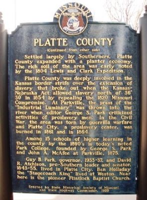
[Front]
Platte is one of 6 counties formed from the U.S. Government's 1836 Platte Purchase in which Iowa, Sac, Fox, and small bands of other Indian tribes gave up over 2 million acres of land for $7,500 and other benefits. The Purchase was . . . — — Map (db m66465) HM
On NW River Park Drive (Missouri Route 9) 0.1 miles east of East Street, on the right when traveling east. Reported permanently removed.
Northwest Missouri Tinderbox
Conflict and uncertainty were widespread in northwest Missouri in the summer of 1864. Federal forces struggled in a heavy-handed manner to control areas much too large for their capabilities. Raiders from . . . — — Map (db m65997) HM
On Main Street at Short Street, on the left when traveling south on Main Street.
Panel 1
1837 Weston is established by Joseph Moore taking a land claim and building the first cabin at present intersection of Market and Main
1837 Salem Christian Church is founded. Building constructed in 1841
1838 . . . — — Map (db m77143) HM
On 27th Street at Sewell Avenue, on the left when traveling north on 27th Street.
Near this site was located the historic town of Quindaro, founded in 1856 as a port-of-entry for free-soil immigrants into Kansas. The principal founder was Abelard Guthrie, who named the town for his Wyandotte Indian wife, Nancy Quindaro Brown. . . . — — Map (db m69458) HM
On Brownville Recreation Road at South Wharf Street, on the right when traveling west on Brownville Recreation Road.
The site of the Nebraska House, a former hotel completed in 1857 and located in Brownville, Nebraska, was associated with an escape of three runaway slaves (freedom seekers) from Missouri who engaged in a bloody shootout with slave catchers. . . . — — Map (db m251893) HM
On County Road JJ 1 mile west of State Highway 45/273, on the left when traveling west.
Weston, Missouri, as shown on Edwards Brother's map of 1877, was placed on the National Register of Historic Places August 21, 1972. The historic area encompasses sixteen full blocks and portions of eight additional city blocks and approximately . . . — — Map (db m302070) HM
Wild mustang grapes growing profusely in this area inspired the name "Grape Vine" for this community. Ambrose Foster (1794?-1847) and his wife Susannah Medlin (1796-1876) were among the first settlers in 1845, from Platte County, Missouri. The . . . — — Map (db m147807) HM
On Main Street, on the right when traveling north.
This marker is dedicated to the memory of
John H. Dillingham
Sheriff of Platte County, Missouri
from 1896 to 1900
First law enforcement officer killed in the line of duty in Platte County
Killed on this spot on August 20, 1900, by . . . — — Map (db m40986) HM
On N Ambassador Drive at Cookingham Drive, on the left when traveling east on N Ambassador Drive.
In 1931 Emmett Breen built Red Crown Tavern and Tourist Cabins west of here.
On July 19, 1933, Platte County Sheriff Holt Coffey led a coalition of lawmen from the Platte County Sheriff's Office, Missouri Highway Patrol and the Jackson . . . — — Map (db m64391) HM
Near North First Street near Main Street, on the left when traveling north.
This 13-ton anchor is from the USS Platte (AO-186), the second U.S. Navy warship named after the Platte Rivers flowing through Iowa, Nebraska and Missouri, including Platte City. The first USS Platte (AO-24) served in three wars from 1939 to 1970 . . . — — Map (db m254872) HM WM
On Lonesome Dove Road at Alexandrea Court, on the right when traveling south on Lonesome Dove Road. Reported missing.
The 1843 Bird's Fort Treaty between the Republic of Texas and several Native American tribes opened this area for new immigrants. In the ensuing years, about 35 related families arrived from Platte County, Missouri, and settlers for other parts . . . — — Map (db m270443) HM
On Northwest Old Pike Road at Northwest 51st Street, on the right when traveling south on Northwest Old Pike Road.
Old Pike Road is the oldest, most westerly, north-south road in Clay County. Starting at Kawsmouth on the north bank of the Missouri River in Harlem it ran north, skirting on the east an old river scar the settlers called “the slough bank,” until it . . . — — Map (db m252107) HM
The Waggoner Family
Known as a gentle man of large stature, Martin Richard Waggoner arrived in Weston in 1898 and opened a jewelry store before he went on to manage Kelly’s, a saloon in the St. George Hotel. Martin married Emma Quinley of . . . — — Map (db m77297) HM
Thin black lines indicate changes in relevance. Between each pair of lines entries are ordered geographically but all have the same relevance.
* Inflectional forms of words are their plurals, singulars, and possessives as well as gramatical tenses and similar variations.