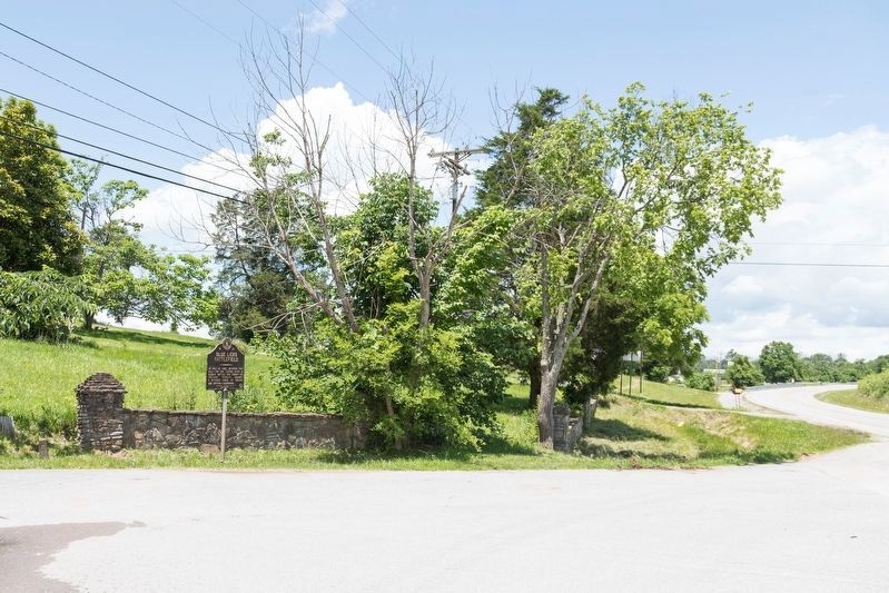
On Maysville Road (U.S. 68) at Main Park Road, on the left when traveling north on Maysville Road.
On Aug. 19, 1782, between this hill-top and Licking River a bloody battle was fought by Kentucky pioneers against a superior force of Indians and British-Canadians. — — Map (db m136359) HM
On West Maple Street at Baughman Street, on the right when traveling west on West Maple Street.
Side 1:
Two hundred feet west John Boyle built log cabin, 1798, that is still part of home. He and three others, who later set up housekeeping in that cabin, were state legislators and represented the district in Congress 28 years.
. . . — — Map (db m67848) HM
On U.S. 41 east of Keysburg Road (County Route 1884), on the right when traveling west.
The Edgefield and Kentucky Railroad was vitally important for transporting soldiers and supplies. Confederate forces constructed Fort Redmond to protect and defend the railroad bridge a mile northwest of here, near the confluence of the Red River . . . — — Map (db m82327) WM
On Tennessee Route 49 0.5 miles south of State Line Road, on the right when traveling south.
★ Tennessee ★
Robertson County
Established 1796: named in honor of
James Robertson
Leader in establishment of the Watauga Settlement in East Tennessee. In 1778, explored the Cumberland country; in 1779 led an . . . — — Map (db m123302) HM
Near Minuteman Parkway at West Frankfort Connector.
The Kentucky National Guard finds its roots among the oldest military organizations in the United States. On October 10, 1774, when Kentucky was a county of colonial Virginia, James Harrod, the founder of Harrodsburg, led a group of frontiersmen . . . — — Map (db m161767) HM
On West 6th Avenue at Locust Street, on the left when traveling west on West 6th Avenue.
For most residents, Robertson County was a difficult place to live during the war. After the fall of Confederate Forts Henry and Donelson in 1862, Union forces occupied the county and made the town of Springfield a military base, where they guarded . . . — — Map (db m82328) HM
On South Brown Street south of 6th Avenue, on the left when traveling south.
Early in the war, townswomen met at the Henry H. Kirk house, just north of here, to sew uniforms and blankets for Confederate soldiers after Kirk bought sewing machines and patterns in St. Louis, Missouri. When the 9th Pennsylvania Cavalry hoisted . . . — — Map (db m82330) HM
On Woodhead Street at Harold Street, on the left when traveling north on Woodhead Street.
Obedience Smith was a pioneer of three American frontiers: Kentucky, Mississippi, and Texas. Newly widowed, she arrived in the Mexican state of Coahuila y Texas from Jackson, Mississippi just weeks before the Texas Declaration of Independence on . . . — — Map (db m269167) HM
On 7th Avenue North north of Union Street, on the left when traveling north.
The tallest office building in Nashville was purchased from American General Life and Accident Insurance Company by the State of Tennessee on January 3, 1994.
It was originally built in 1970 as the National Life Center, home of the National Life . . . — — Map (db m166570) HM
On Interstate 30 Frontage Road 0.2 miles west of Division Street, on the right when traveling west.
"Gone to Texas" was the popular slogan for settlers during the 1830s who immigrated from numerous countries and states to the newly formed Republic of Texas (1836-1846). Although the Republic of Texas struggled, the desire for vast amounts of cheap . . . — — Map (db m285487) HM
Near Boonville Road 0.1 miles east of Austins Colony Parkway.
Eli Seale 1793-1857
Elias (Eli) Seale was born in North Carolina in 1793. He served as a fifer in the War of 1812 in Mississippi, and in 1835 moved with his three brothers and his family from Alabama to Texas. He received his Mexican . . . — — Map (db m170484) HM
Thin black lines indicate changes in relevance. Between each pair of lines entries are ordered geographically but all have the same relevance.
* Inflectional forms of words are their plurals, singulars, and possessives as well as gramatical tenses and similar variations.