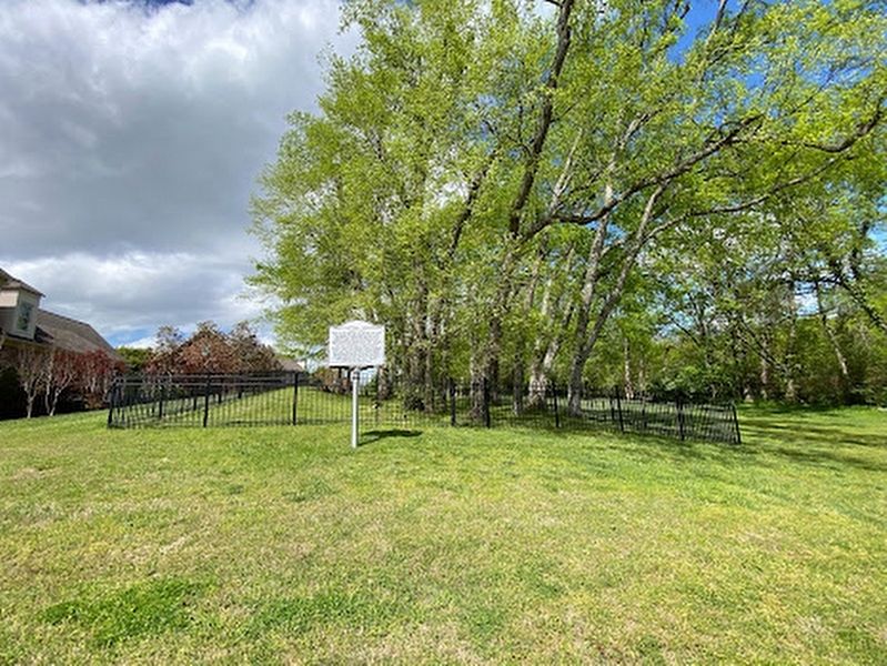
On Coronet Lane, on the right when traveling west.
Buried in this cemetery are Gersham Hunt (1765-1818) and his wife Sarah Orton Hunt and their descendants. Gersham Hunt was the son of Jonathan Hunt, one of the founders of the Jersey Colony of North Carolina. He was a member of the North Carolina . . . — — Map (db m220685) HM
On State Highway 152 0.1 miles east of Meredith Lane, on the right when traveling east.
Introduced bill, 1885, for industrial school, now N.C. State University. Speaker of House, 1889: prison reformer. Taught at academy here. — — Map (db m237131) HM
On N Main Street (U.S. 29) at W Council Street, on the left when traveling north on N Main Street.
The Old Rowan County Courthouse, a visible reminder of Salisbury’s antebellum prosperity, was erected in 1855 and is one of North Carolina’s finest Greek Revival-style public buildings. It served as Rowan’s third courthouse until 1914. Salisbury . . . — — Map (db m34278) HM
On East Kerr Street at Depot Street, on the right when traveling south on East Kerr Street.
In 1856 Nathaniel Boyden and other investors established the North Carolina Foundry and Agricultural Machine Works. It was located on East Kerr Street on an acre lot lying between the railroad and Long Street. The property, with its three large . . . — — Map (db m238692) HM
On East Main Street 0.1 miles east of Western Avenue, on the right when traveling east.
Born in Cecil County, Maryland, William Alexander entered the Revolutionary War from Rowan County, North Carolina in 1775. Wounded in 1776, he later joined a South Carolina unit and fought at Cowpens, Fort Motte, Granby, Biggers Church, and . . . — — Map (db m248916) HM
On East Innes Street just east of South Main Street (U.S. 29/70), on the right when traveling east.
John Willis Ellis was born November 20, 1820, in the area of Rowan County which later became a part of the new county of Davidson. In 1842 he opened his law office at No. 2 Cowan's Row, located in this block. Early in his career he won a seat in . . . — — Map (db m175778) HM
On North Main Street (U.S. 276) at Depot Street, on the right when traveling south on North Main Street.
This monument is dedicated to the memory of the First American Veterans
These patriots, believing in the noble cause of liberty, gallantly fought for home and country during the American Revolution so that their descendants might enjoy civil . . . — — Map (db m261749) HM WM
On Third Creek Church Road 0.2 miles east of Chenault Road, on the left when traveling east.
In memory of
Peter Stewart Ney
A native of France
and
Soldier of the French Revolution
under
Napoleon Bonaparte
Who departed this life
November 15, 1846
Aged 77 years — — Map (db m291242) HM WM
On South Tryon Street at East Brooklyn Village Avenue, on the right when traveling north on South Tryon Street.
At least 5,000 African-Americans, both free and enslaved, served in the Continental Army, state troops, navies, and militias. A substantial number of these African-American patriots came from North Carolina, South Carolina and Virginia. Some served . . . — — Map (db m249010) HM
On North Church Street at West Liberty Street, on the right when traveling south on North Church Street.
Lynching in America Racial terror lynching claimed the lives of thousands of African Americans and created a legacy of injustice that can still be felt today. After slavery ended, many white people remained committed to racial hierarchy and used . . . — — Map (db m238719) HM
On River Highway (North Carolina Route 150) at Mariner Pointe Lane, on the right when traveling west on River Highway.
Among the original pioneers from Pennsylvania, New Jersey, and Maryland who settled on the east side of the Catawba River were George Davidson (1-home destroyed), Reverend John Thomson, Moses White, Hugh Lawson, John Oliphant, John Brevard, . . . — — Map (db m283194) HM
Near Old Mulkey Park Road 0.2 miles west of Old Mulkey Road.
Hannah Boone was the youngest child born to Squire Boone and Sarah Morgan Boone.
The Boones were members of the Friends Society (Quakers) and Squire served as first a trustee and then an overseer of the Oley Meeting. The Boones moved to the Yadkin . . . — — Map (db m184060) HM
On Greenlee Ford Road 0.3 miles north of Carbon City Road (U.S. 70), on the right when traveling north.
During the America n Revolution, at this ford of the Catawba River, around 1390 men from Western North Carolina and Southwestern Virginia crossed here on their way to the Battle Of Kings Mountain. The men who crossed the river here were all . . . — — Map (db m285957) HM WM
On Jeb Seagle Drive at Linwood Drive, on the left when traveling west on Jeb Seagle Drive.
After two hours, fighting ceased. As the fog lifted, the scene revealed the dead and wounded scattered on the ridge and flanks. About 100 men on each side were wounded and 50 Tories were taken prisoner. Casualties were heavy among officers. By . . . — — Map (db m231959) HM
On Jeb Seagle Drive at Linwood Drive, on the left when traveling west on Jeb Seagle Drive.
After several years of war and a military stalemate in the northern colonies, the British took the war to the South. After capturing Charleston, South Carolina, on May 12, 1780, Lieutenant-General Charles, 2nd Earl Cornwallis eyed North Carolina as . . . — — Map (db m231949) HM
Near Gilead Road 0.1 miles west of Old Store Road, on the right when traveling west.
Hugh Torance House and Store, originally a simple log cabin dating to 1779, is the oldest standing store in North Carolina, and one of the few remaining 18th-century structures in Mecklenburg County.
Who was Hugh Torence
In 1763, Hugh . . . — — Map (db m307354) HM
On North Church Street north of West Kerr Street, on the right when traveling north.
This property
Mount Zion
Baptist Church
has been placed on the
National Register
of Historic Places
by the United States
Department of the Interior
December 30, 1985 — — Map (db m238713) HM