THE HISTORICAL
MARKER DATABASE
“Bite-Size Bits of Local, National, and Global History”


20 entries match your criteria.  


Related Historical Markers

To better understand the relationship, study each marker in the order shown.
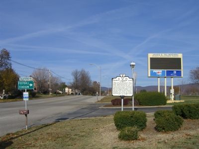
 
By Kevin W., November 24, 2007
General Andrew Lewis Marker
SHOWN IN SOURCE-SPECIFIED ORDER
1 ► Virginia, Salem — K-75 — General Andrew Lewis —
On Roanoke Blvd at Taliaferro Way, on the right when traveling north on Roanoke Blvd.
2 ► Virginia, Salem — General Andrew Lewis — 1716 - 1781 — Pioneer Patriot —
Near East Northern Street.
3 ► Virginia, Salem — K-77 — Andrew Lewis’ Grave —
On E. Main Street (U.S. 460) at Park Avenue, on the right when traveling east on E. Main Street.
4 ► West Virginia, McDowell County, Iaeger — Lewis’ Camp —
On West Virginia Route 80 0 miles south of U.S. 52, on the left when traveling north.
5 ► West Virginia, Greenbrier County, Lewisburg — Lewisburg —
On Courtney Drive at Washington Street (U.S. 60) on Courtney Drive.
6 ► West Virginia, Putnam County, Hometown — Andrew & Charles Lewis March —
On Charleston Road (West Virginia Route 62) south of A Street (Local Road 35/11).
7 ► West Virginia, Mason County, Point Pleasant — The Battle of Point Pleasant — The Chief Event of Lord Dunmore's War —
On Main Street 0 miles 1st Street, on the right when traveling south.
8 ► West Virginia, Mason County, Point Pleasant — Colonel Andrew Lewis — 1720 - 1781 —
On Main Street 0 miles west of 1st Street, on the right when traveling south.
9 ► West Virginia, Mason County, Point Pleasant — The Magazine —
On Main Street 0.1 miles 1st Street, on the right when traveling south.
10 ► West Virginia, Mason County, Point Pleasant — Chief Cornstalk — 1727–1777 —
On Main Street 0 miles west of 1st Street, on the right when traveling south.
11 ► Ohio, Gallia County, Gallipolis — 7-27 — The Dunmore War 1774 —
On Locust Street at 1st Avenue, on the right when traveling north on Locust Street.
12 ► Ohio, Athens County, Nelsonville — Camp Site of Lord Dunmore — 1774
On Canal Street (U.S. 33) at Pine Grove Drive, on the right when traveling east on Canal Street. Reported permanently removed.
13 ► Ohio, Pickaway County, Leistville — 6-65 — Treaty of Camp Charlotte —
On Ohio Route 56 0.5 miles north of Route 159, on the right when traveling north.
14 ► Ohio, Pickaway County, Leistville — Camp Charlotte —
Near Ohio Route 56 0.5 miles north of Route 159, on the right when traveling north.
15 ► Ohio, Pickaway County, Circleville — Cornstalk —
Near Ohio 361.
Paid Advertisement
16 ► Ohio, Pickaway County, Circleville — Grenadier Squaw (Non-hel-e-ma) —
Near Ohio 361.
17 ► Ohio, Pickaway County, Circleville — 10-65 — Chief Logan / Logan Elm —
On Ohio Route 361 at Wolfe Road on Ohio Route 361.
18 ► Ohio, Pickaway County, Circleville — Site of Logan Elm —
Near Ohio 361.
19 ► Ohio, Pickaway County, Circleville — Capt. Michael Cresap — In Memoriam —
Near Ohio 361.
20 ► Ohio, Pickaway County, Circleville, Pickaway Township — 7-65 — Grenadier Squaw Village / Cornstalk Town —
On Emerson Road (Local Highway 48) 0.4 miles east of U.S. 23, on the right when traveling east.
 
 
CeraNet Cloud Computing sponsors the Historical Marker Database.
This website earns income from purchases you make after using our links to Amazon.com. We appreciate your support.
Paid Advertisement
Nov. 11, 2026
