19 entries match your criteria.
Related Historical Markers
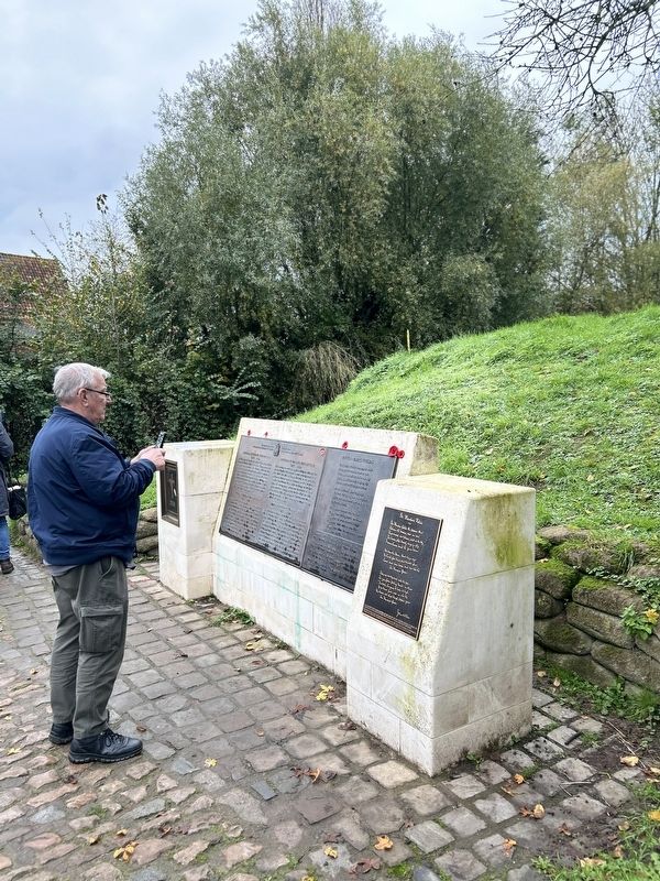
By Steve Stoessel, November 12, 2024
Lieutenant-Colonel John McCrae Marker
SHOWN IN SOURCE-SPECIFIED ORDER
1 ► Belgium, Vlaanderen, West-Vlaanderen, Ieper — Lieutenant-Colonel John McCrae — 1872-1918 —  |
| Near Diksmuidseweg (National Route 313) at Nordorring. | |||
| 2 ► Belgium, Vlaanderen, West-Vlaanderen, Ieper — Medische hulppost John McCrae / Medical Aid Post John McCrae — 2024-18 — 100 jaar Groote Oorlog — |
| Near Diksmuidseweg (National Route 369) at Noorderring. | |||
| 3 ► Belgium, Vlaanderen, West-Vlaanderen, Ypres — McCrae Site, the Canal Bank 1914-1918 / Site McCrae de Canadijk 1914-1918 — 2014-18 — 100 Years of the Great War/ 100 Jaar Groote Oorlog — |
| On National Route 369 at Noorderring (National Route 38), on the right when traveling north on National Route 369. | |||
| 4 ► West Virginia, Preston County, Terra Alta — In Flander's Field by John McCrae / Buddy Poppy — |
| On East State Avenue (Route 7) 0.1 miles west of East High Street, on the right when traveling east. | |||
| 5 ► Virginia, Washington County, Abingdon — Poppies — |
| Near Lieutenant Billy Webb Avenue 0.2 miles north of Cook Street. | |||
| 6 ► Belgium, Vlaanderen, West-Vlaanderen, Langemark-Poelkapelle, St. Juliaan — The Second Battle of Ypres — (22 April - 25 May 1915) — |
| On Brugseweg (National Route 313) at Zonnebekestraat, on the left when traveling south on Brugseweg. | |||
| 7 ► Belgium, Vlaanderen, West-Vlaanderen, Ieper — In Flanders Fields — |
| Near Diksmuidseweg (National Route 369) north of Noorderring. | |||
| 8 ► Texas, Gonzales County, Gonzales — "We Shall Not Forget" — World War I - 1914-1918 — |
| On North Fair Street at St. Lawrence Street on North Fair Street. | |||
| 9 ► Kansas, Woodson County, Yates Center — World War Memorial — |
| On State Street at Rutledge Street, on the right when traveling north on State Street. | |||
| 10 ► Pennsylvania, Philadelphia County, Philadelphia, Logan/ Ogontz/ Fern Rock — American War Mothers Memorial |
| On Belfield Avenue south of North 20th Street, on the right when traveling south. Reported damaged. | |||
| 11 ► Georgia, Walton County, Good Hope — 147-7 — The Poppy Lady — ← 1½ mi. — |
| On Georgia Route 83 at Moina Michael Road, on the right when traveling west on Georgia Route 83. | |||
| 12 ► Ontario, Leeds and Grenville United Counties, Gananoque — Legion Riders Memorial Park — Lest We Forget — Support Our Troops — |
| On King Street West (County Highway 2) at Main Street, on the left when traveling east on King Street West. | |||
| 13 ► Missouri, Cole County, Jefferson City — World War I Memorial — |
| On Chestnut Street 0.1 miles north of Dawson Drive when traveling north. | |||
| 14 ► Georgia, Oconee County, Watkinsville — World War I Killed in Action Memorial — |
| On Hog Mountain Road, on the right when traveling west. | |||
| 15 ► Ohio, Madison County, South Vienna — Ohio World War I Red Poppy — Remembrance Garden — |
| Near Interstate 70 1.7 miles west of Ohio Route 56, on the right when traveling east. | |||
| 16 ► Nova Scotia, Cumberland County, Amherst — World Wars Memorial — |
| On Victoria Street East (Nova Scotia Route 6) just south of Havelock Street ( Route 2), on the right when traveling south. | |||
| 17 ► Ohio, Allen County, Delphos — Delphos World War I Memorial — |
| On Lincoln Highway (Ohio Route 66) at North Main Street ( Route 66), on the right when traveling east on Lincoln Highway. | |||
| 18 ► Pennsylvania, Pike County, Matamoras — The Great War - WWI — The War To End All Wars — |
| Near Avenue S. | |||
| 19 ► Ontario, Ottawa, Barrhaven — War Memorial — |
| On Malvern Drive 1 kilometer west of Greenbank Road (County Highway 13), on the left when traveling west. | |||