17 entries match your criteria.
Related Historical Markers
This is a list of markers that relate to Frank Lloyd Wright.
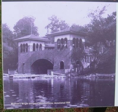
By William J. Toman, July 4, 2010
Closeup of Boathouse Photo on Marker
SHOWN IN SOURCE-SPECIFIED ORDER
| On North Carroll Street at Langdon Street, on the right when traveling north on North Carroll Street. |
| Near North Butler Street 0.1 miles north of East Washington Avenue, on the left when traveling north. |
| On University Bay Drive 0.2 miles north of University Avenue, on the left when traveling north. |
| On North Prospect Avenue at Ely Place, on the right when traveling west on North Prospect Avenue. |
| On U.S. 14 0.2 miles east of Helena Road, on the right when traveling east. |
| On Johnson Avenue at McDonald Street, on the right when traveling north on Johnson Avenue. |
| On South 4th Street at 4th Street, on the left when traveling east on South 4th Street. |
| Near Toepfer Avenue at Birch Avenue, on the left when traveling south. |
| On Shawn Trail 0.1 miles south of Old Sauk Road, on the left when traveling south. |
| On South Main Street at Fourteenth Street, on the right when traveling north on South Main Street. |
| On Nakoma Road at Monroe Street, on the right when traveling south on Nakoma Road. |
| On North Park Street at Langdon Street, on the left when traveling north on North Park Street. |
| On South Michigan Avenue at East Congress Parkway, on the right when traveling south on South Michigan Avenue. |
| Near North Scottsdale Road. |
| Near East Frank Lloyd Wright Boulevard. |
| On Mill Run Road (Pennsylvania Route 381) 1.5 miles north of Maple Summit Road ( Route 2017), on the right when traveling north. |
Nov. 11, 2026
