THE HISTORICAL
MARKER DATABASE
“Bite-Size Bits of Local, National, and Global History”


7 entries match your criteria.  


Related Historical Markers
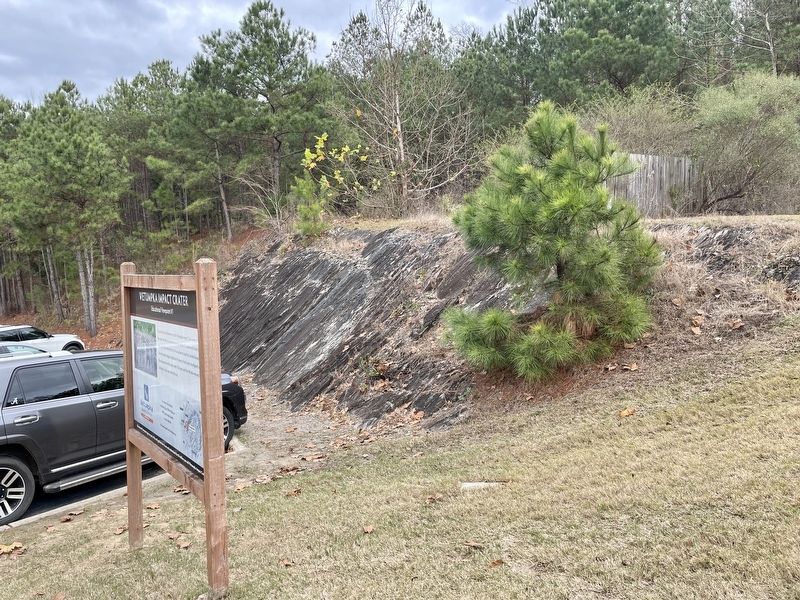
 
By Mark Hilton, December 27, 2021
Wetumpka Impact Crater metamorphic bedrock.
SHOWN IN SOURCE-SPECIFIED ORDER
1 ► Alabama, Elmore County, Wetumpka — 1 — Wetumpka Impact Crater — Educational Viewpoint #1 —
Near Wilson Street 0.2 miles north of Emerson Street, on the right when traveling north.
2 ► Alabama, Elmore County, Wetumpka — 2 — Wetumpka Impact Crater — Educational Viewpoint #2 —
On Bald Knob Road 0.6 miles north of Enslen Drive, on the right when traveling north.
3 ► Alabama, Elmore County, Wetumpka — 3 — Wetumpka Impact Crater — Educational Viewpoint #3 —
On Harrogate Springs Road 1.3 miles east of Jasmine Hill Road, on the left when traveling east.
4 ► Alabama, Elmore County, Wetumpka — 4 — Wetumpka Impact Crater — Educational Viewpoint #4 —
On Buck Ridge Road 0.3 miles south of Harrogate Springs Road, on the right when traveling south.
5 ► Alabama, Elmore County, Wetumpka — 5 — Wetumpka Impact Crater — Educational Viewpoint #5 —
On Trotters Trail 0.2 miles south of Fairliewood Drive, on the left when traveling south.
6 ► Alabama, Elmore County, Wetumpka — 6 — Wetumpka Impact Crater — Educational Viewpoint #6 —
Near Coosa River Parkway, on the left when traveling north.
7 ► Alabama, Elmore County, Wetumpka — 7 — Wetumpka Impact Crater — Educational Viewpoint #7 —
On Orline Street west of Hill Street, on the right when traveling south.
 
 
CeraNet Cloud Computing sponsors the Historical Marker Database.
This website earns income from purchases you make after using our links to Amazon.com. We appreciate your support.
Paid Advertisement
Nov. 10, 2026
