25 entries match your criteria.
Entries Containing All of the Phrases «douglas county» AND «nebraska»
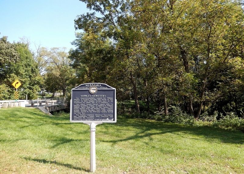
By Cosmos Mariner, September 16, 2025
Shipley Cemetery Marker
RANKED BY RELEVANCE
1 ► Nebraska, Douglas County, Omaha — 187 — Shipley Cemetery —  |
| On Ponca Road at North 47th Street, on the right when traveling east on Ponca Road. | |||
| 2 ► Nebraska, Douglas County, Omaha, North Omaha — 211 — Crook House — |
| On Metro Tech College Road (West Road) at Metro Tech College Road (North Road), on the left when traveling north on Metro Tech College Road (West Road). | |||
| 3 ► Nebraska, Douglas County, Omaha, North Omaha — 4 — Fort Omaha Balloon School — Fort Omaha Walking Tour — |
| On North Road, on the left when traveling west. | |||
| 4 ► Nebraska, Douglas County, Omaha, North Omaha — 10 — Fort Omaha Fire Station — Fort Omaha Walking Tour — |
| On East Road at South Road, on the right when traveling north on East Road. | |||
| 5 ► Nebraska, Douglas County, Omaha, North Omaha — 8 — Fort Omaha Guardhouse — Fort Omaha Walking Tour — |
| On East Road, on the right when traveling north. | |||
| 6 ► Nebraska, Douglas County, Omaha, North Omaha — 14 — Fort Omaha Headquarters Building — Fort Omaha Walking Tour — |
| On South Road, on the left when traveling west. | |||
| 7 ► Nebraska, Douglas County, Omaha, North Omaha — 13 — Fort Omaha Hospital — Fort Omaha Walking Tour — |
| On West Road, on the right when traveling south. | |||
| 8 ► Nebraska, Douglas County, Omaha, North Omaha — 6 — Fort Omaha Knights of Columbus Assembly Hall — Fort Omaha Walking Tour — |
| On East Road, on the right when traveling north. | |||
| 9 ► Nebraska, Douglas County, Omaha, North Omaha — 3 — Fort Omaha Officers Row — Fort Omaha Walking Tour — |
| On West Road at Middle Road, on the left when traveling north on West Road. | |||
| 10 ► Nebraska, Douglas County, Omaha, North Omaha — 9 — Fort Omaha Post Exchange and Gymnasium — Fort Omaha Walking Tour — |
| On East Road, on the right when traveling north. | |||
| 11 ► Nebraska, Douglas County, Omaha, North Omaha — 12 — Fort Omaha Quartermaster Depot — Fort Omaha Walking Tour — |
| On West Road, on the right when traveling south. | |||
| 12 ► Nebraska, Douglas County, Omaha, North Omaha — 2 — General Crook's Headquarters at Fort Omaha — Fort Omaha Walking Tour — |
| On Middle Road, on the right when traveling west. | |||
| 13 ► Nebraska, Douglas County, Omaha, North Omaha — 1 — History of Fort Omaha — Fort Omaha Walking Tour — |
| On Middle Street, on the left when traveling west. | |||
| 14 ► Nebraska, Douglas County, Omaha, North Omaha — 5 — Observation Balloon Training at Fort Omaha — Fort Omaha Walking Tour — |
| On North Road, on the right when traveling west. | |||
| 15 ► Nebraska, Douglas County, Omaha, North Omaha — 11 — Ordnance Magazine — Fort Omaha Walking Tour — |
| On the Alley between 2nd and 1st Roads, on the left when traveling north. | |||
| 16 ► Nebraska, Douglas County, Omaha, North Omaha — 7 — Quartermaster's Office and Commissary — Fort Omaha Walking Tour — |
| On East Road, on the right when traveling north. | |||
| 17 ► Nebraska, Douglas County, Omaha, Downtown — Lynching in America / The Lynching of Will Brown — Community Remembrance Project — |
| On Farnam Street west of 17th Street, on the left when traveling west. | |||
| 18 ► Nebraska, Douglas County, Omaha — 280 — Boettger Farm — |
| Near Bennington Road (State Highway 36) 0.4 miles east of North 96th Street, on the right when traveling east. | |||
| 19 ► Nebraska, Douglas County, Omaha, Central Omaha — Douglas County World War II Memorial Shrine — |
| On Robert H. Storz Drive south of Underwood Avenue. | |||
| 20 ► Nebraska, Douglas County, Omaha, Central Omaha — The Dodge Street Overpass — Combining Form and Function in a "Structure of Beauty" — |
| On Dodge Street west of Farnam Street, on the right when traveling west. | |||
| 21 ► Nebraska, Douglas County, Omaha, North Omaha — James G. Megeath — 1824 - 1906 — |
| Near Parker Street. | |||
| 22 ► Nebraska, Douglas County, Omaha, North Omaha — Johan and Sophia Ahmanson — (1827 - 1891) and (18? - 1894) — |
| Near Parker Street. | |||
| 23 ► Kansas, Douglas County, Lawrence, Lawrence Cultural District — Indigenous Lands — |
| On U.S. 59 at East 6th Street, on the left when traveling east on U.S. 59. | |||
| 24 ► Nebraska, Douglas County, Omaha, Downtown — Union Walk — |
| On Riverfront Drive, on the left when traveling south. | |||
| 25 ► Nebraska, Douglas County, Omaha, Central Omaha — Memorial Park — |
| On Robert H Storz Drive 0.2 miles south of Underwood Avenue, on the right when traveling south. | |||
Thin black lines indicate changes in relevance. Between each pair of lines entries are ordered geographically but all have the same relevance.
* Inflectional forms of words are their plurals, singulars, and possessives as well as gramatical tenses and similar variations.
Nov. 13, 2026